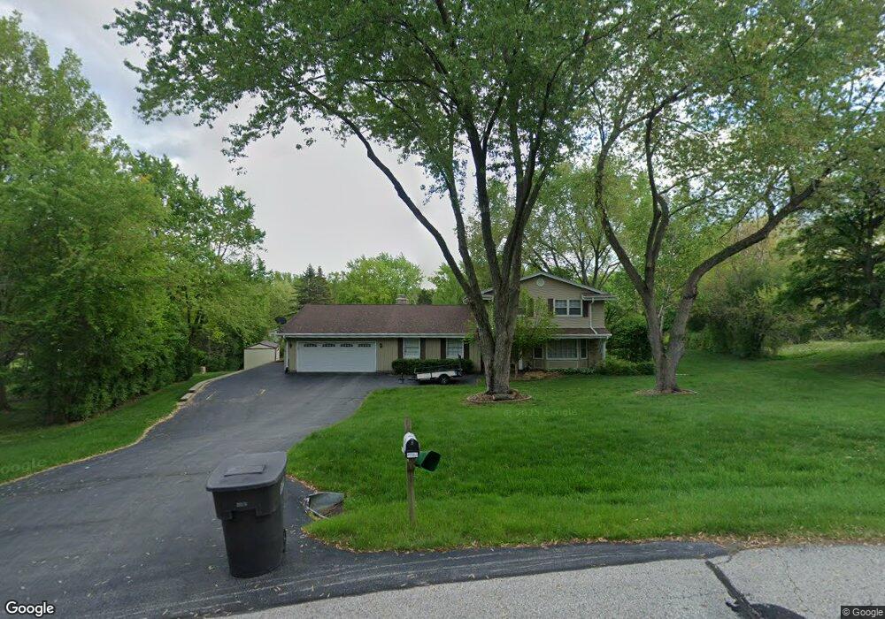
S28W29521 Pamela Cir Waukesha, WI 53188
Estimated Value: $421,211 - $503,000
--
Bed
--
Bath
--
Sq Ft
1
Acres
About This Home
This home is located at S28W29521 Pamela Cir, Waukesha, WI 53188 and is currently estimated at $476,803. S28W29521 Pamela Cir is a home located in Waukesha County with nearby schools including Summit View Elementary School, Butler Middle School, and West High School.
Ownership History
Date
Name
Owned For
Owner Type
Purchase Details
Closed on
Aug 24, 2015
Sold by
Pfau Richard O and Pfau Judith M
Bought by
The Richard O Pfau And Judith M Pfau Rev and Pfau Judith M
Current Estimated Value
Home Financials for this Owner
Home Financials are based on the most recent Mortgage that was taken out on this home.
Original Mortgage
$159,000
Interest Rate
3.5%
Mortgage Type
Adjustable Rate Mortgage/ARM
Purchase Details
Closed on
Nov 13, 2000
Sold by
Pfau Richard O and Pfau Judith M
Bought by
Richard O & Judith M Pfau Revocable Tr
Create a Home Valuation Report for This Property
The Home Valuation Report is an in-depth analysis detailing your home's value as well as a comparison with similar homes in the area
Home Values in the Area
Average Home Value in this Area
Purchase History
| Date | Buyer | Sale Price | Title Company |
|---|---|---|---|
| The Richard O Pfau And Judith M Pfau Rev | -- | Title Source | |
| Richard O & Judith M Pfau Revocable Tr | -- | -- |
Source: Public Records
Mortgage History
| Date | Status | Borrower | Loan Amount |
|---|---|---|---|
| Closed | The Richard O Pfau And Judith M Pfau Rev | $159,000 |
Source: Public Records
Tax History Compared to Growth
Tax History
| Year | Tax Paid | Tax Assessment Tax Assessment Total Assessment is a certain percentage of the fair market value that is determined by local assessors to be the total taxable value of land and additions on the property. | Land | Improvement |
|---|---|---|---|---|
| 2024 | $3,185 | $388,000 | $145,000 | $243,000 |
| 2023 | $2,950 | $378,000 | $135,000 | $243,000 |
| 2022 | $3,045 | $333,500 | $105,000 | $228,500 |
| 2021 | $3,182 | $258,000 | $55,000 | $203,000 |
| 2020 | $3,285 | $258,000 | $55,000 | $203,000 |
| 2019 | $3,089 | $258,000 | $55,000 | $203,000 |
| 2018 | $2,962 | $258,000 | $55,000 | $203,000 |
| 2017 | $2,933 | $256,000 | $55,000 | $201,000 |
| 2016 | $3,068 | $256,000 | $55,000 | $201,000 |
| 2015 | $3,153 | $256,000 | $55,000 | $201,000 |
| 2014 | $3,064 | $256,000 | $55,000 | $201,000 |
| 2013 | $3,064 | $256,000 | $55,000 | $201,000 |
Source: Public Records
Map
Nearby Homes
- S25W29201 Cambrian Ridge
- S27W30015 N Bethesda Cir
- S23W30709 Brecon Way
- 105 Legend Way
- S17W28902 Price Ct
- W304S1779 Pinehurst Ct
- 447 Dugan Rd
- 715 Lochtyn Ridge
- Lt14 Merrimac Trail
- 205 Kummrow Ct
- 329 Breck Rd
- 224 N Elias St
- 440 S Brandybrook Rd
- W275S3617 Payne Stewart Ct
- 3741 Howell Oaks Dr
- S36W27290 Legend at Merrill Hills Ct
- 3645 Olde Howell Rd
- 3637 Olde Howell Rd
- 116 W Main St
- 156 Olde Howell Ct
- S28W29541 Pamela Cir
- S28W29465 Pamela Cir
- S28W29433 Pamela Cir
- S28W29545 Pamela Cir
- S29W29512 Ancestral Dr
- S29W29540 Ancestral Dr
- W296S2850 Molly Ln N
- W294S2899 Wills Barry Dr
- S27W29508 Pamela Cir
- S28W29400 Pamela Cir
- S28W29430 Pamela Cir
- S28W29470 Pamela Cir
- W296S2864 Molly Ln N
- w262s3044 Ancestral Dr
- S27W29615 Jarmon Rd
- W296S2846 Molly Ln N
- W294S2860 Wills Barry Dr
- W294S2894 Wills Barry Dr
- W296S2886 Molly Ln N
- S29W29513 Ancestral Dr