
Estimated payment $3,133/month
About This Lot
''Southwest Well Pad Cove'' - 75 acres Water rights are deeded to the city of Rifle as part of development approvals. Mineral rights to be excluded from property sale. Broken up parcels subject to filing an processing preliminary and final plat.
Listing Agent
Leverich and Carr Real Estate Brokerage Phone: (970) 925-5400 License #ER212181 Listed on: 01/25/2024
Property Details
Property Type
- Land
Lot Details
- 17 Acre Lot
- Property is zoned Agricultural
Location
- Mineral Rights Excluded
Community Details
- No Home Owners Association
Listing and Financial Details
- Assessor Parcel Number 217724300398
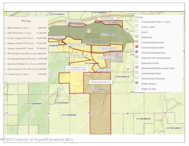
Map
Home Values in the Area
Average Home Value in this Area
Property History
| Date | Event | Price | List to Sale | Price per Sq Ft |
|---|---|---|---|---|
| 01/25/2024 01/25/24 | For Sale | $500,000 | -- | -- |
Source: Aspen Glenwood MLS
MLS Number: 182311
Disclaimer: Certain information contained herein is derived from information provided by parties other than Homes.com. All information provided is deemed reliable, but is not guaranteed to be accurate and should be independently verified.
![]() IDX information is provided exclusively for personal, non-commercial use, and may not be used for any purpose other than to identify prospective properties consumers may be interested in purchasing. Information is deemed reliable but not guaranteed.
IDX information is provided exclusively for personal, non-commercial use, and may not be used for any purpose other than to identify prospective properties consumers may be interested in purchasing. Information is deemed reliable but not guaranteed.
- TBD Hunter Mesa ''Bottom South''
- TBD Cty Rd 333''Dvlpng Resources''
- TBD Cty Rd 333 ''Old Water Tank''
- TBD Cty Rd 352 ''County Cmplexse''
- 545 County Road 352
- TBD Cty Rd 352''Adj Airport Ne''
- TBD Cty Rd 352 ''Adj Airport Nw''
- TBD Mamm Crk Rd ''Mamm Crk Exit''
- TBD Cty Rd 319 ''Cmc West Parcel''
- TBD Cty Rd 346 ''Moose Pasture''
- 2135 Airport Rd
- 1797 County Road 346
- Tbd Blacktail Dr
- 30412 U S 6
- 756 Airport Rd
- 756 Airport Rd Unit 9 AC
- 27653 Highway 6 Unit 310
- 449 County Road 223
- 83 Native Springs Dr
- 203 Native Springs Dr
