Estimated payment $40,142/month
Total Views
14,619
75
Acres
$100,000
Price per Acre
3,267,000
Sq Ft Lot
About This Lot
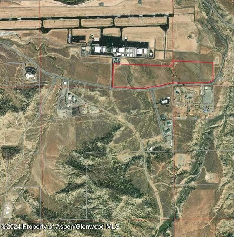
''Adjacent Airport NE'' - 75 acres Water rights are deeded to the city of Rifle as part of development approvals. Mineral rights to be excluded from property sale. Broken up parcels subject to filing and processing preliminary and final plat.
Listing Agent
Leverich and Carr Real Estate Brokerage Phone: (970) 925-5400 License #ER212181 Listed on: 01/31/2024
Property Details
Property Type
- Land
Est. Annual Taxes
- $7,821
Lot Details
- 75 Acre Lot
- Property is zoned Agricultural
Location
- Mineral Rights Excluded
Community Details
- No Home Owners Association
Listing and Financial Details
- Assessor Parcel Number 217724300398
Map
Create a Home Valuation Report for This Property
The Home Valuation Report is an in-depth analysis detailing your home's value as well as a comparison with similar homes in the area
Home Values in the Area
Average Home Value in this Area
Tax History
| Year | Tax Paid | Tax Assessment Tax Assessment Total Assessment is a certain percentage of the fair market value that is determined by local assessors to be the total taxable value of land and additions on the property. | Land | Improvement |
|---|---|---|---|---|
| 2024 | $8,945 | $118,550 | $115,210 | $3,340 |
| 2023 | $8,945 | $118,550 | $115,210 | $3,340 |
| 2022 | $2,314 | $32,690 | $29,940 | $2,750 |
| 2021 | $2,827 | $35,720 | $32,890 | $2,830 |
| 2020 | $1,795 | $24,810 | $20,930 | $3,880 |
| 2019 | $1,698 | $24,810 | $20,930 | $3,880 |
| 2018 | $1,225 | $17,500 | $14,530 | $2,970 |
| 2017 | $1,106 | $17,500 | $14,530 | $2,970 |
| 2016 | $954 | $17,120 | $13,760 | $3,360 |
| 2015 | $935 | $18,930 | $15,570 | $3,360 |
| 2014 | $563 | $10,880 | $8,900 | $1,980 |
Source: Public Records
Property History
| Date | Event | Price | List to Sale | Price per Sq Ft |
|---|---|---|---|---|
| 01/31/2024 01/31/24 | For Sale | $7,500,000 | -- | -- |
Source: Aspen Glenwood MLS
Purchase History
| Date | Type | Sale Price | Title Company |
|---|---|---|---|
| Deed | $2,000,000 | -- |
Source: Public Records
Source: Aspen Glenwood MLS
MLS Number: 182382
APN: R247253
Nearby Homes
- 545 County Road 352
- TBD Cty Rd 352 ''County Cmplexse''
- TBD Cty Rd 333 ''Old Water Tank''
- TBD Cty Rd 352 ''Adj Airport Nw''
- TBD Cty Rd 333''Sw Well Pad Cove''
- TBD Mamm Crk Rd ''Mamm Crk Exit''
- TBD Cty Rd 346 ''Moose Pasture''
- TBD Hunter Mesa ''Bottom South''
- TBD Cty Rd 333''Dvlpng Resources''
- TBD Cty Rd 319 ''Cmc West Parcel''
- 2135 Airport Rd
- 1797 County Road 346
- 30412 U S 6
- Tbd Blacktail Dr
- 449 County Road 223
- 83 Native Springs Dr
- 27653 Highway 6 Unit 310
- 1840 County Road 210
- 203 Native Springs Dr
- 756 Airport Rd


