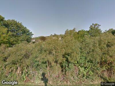
W281S3641 Pheasant Run Waukesha, WI 53189
Estimated Value: $388,000 - $529,000
--
Bed
--
Bath
--
Sq Ft
1.1
Acres
About This Home
This home is located at W281S3641 Pheasant Run, Waukesha, WI 53189 and is currently estimated at $453,785. W281S3641 Pheasant Run is a home located in Waukesha County with nearby schools including Rose Glen Elementary School, Les Paul Middle School - Central Campus, and West High School.
Ownership History
Date
Name
Owned For
Owner Type
Purchase Details
Closed on
Jul 26, 2018
Sold by
Noesen John P and Noesen Brenda
Bought by
Buck Andrew J and Buck Jennifer A R
Current Estimated Value
Home Financials for this Owner
Home Financials are based on the most recent Mortgage that was taken out on this home.
Original Mortgage
$273,600
Interest Rate
4.5%
Mortgage Type
New Conventional
Create a Home Valuation Report for This Property
The Home Valuation Report is an in-depth analysis detailing your home's value as well as a comparison with similar homes in the area
Home Values in the Area
Average Home Value in this Area
Purchase History
| Date | Buyer | Sale Price | Title Company |
|---|---|---|---|
| Buck Andrew J | $288,000 | None Available |
Source: Public Records
Mortgage History
| Date | Status | Borrower | Loan Amount |
|---|---|---|---|
| Open | Buck Jennifer Ar | $40,000 | |
| Open | Buck Jennifer Ar | $281,975 | |
| Closed | Buck Jennifer A R | $17,000 | |
| Closed | Buck Andrew J | $272,000 | |
| Closed | Buck Andrew J | $273,600 | |
| Previous Owner | Noesen John P | $178,162 | |
| Previous Owner | Noesen John P | $5,000 | |
| Previous Owner | Noesen John P | $208,000 | |
| Previous Owner | Noesen John P | $88,900 |
Source: Public Records
Tax History Compared to Growth
Tax History
| Year | Tax Paid | Tax Assessment Tax Assessment Total Assessment is a certain percentage of the fair market value that is determined by local assessors to be the total taxable value of land and additions on the property. | Land | Improvement |
|---|---|---|---|---|
| 2024 | $3,318 | $404,500 | $146,000 | $258,500 |
| 2023 | $2,962 | $379,500 | $136,000 | $243,500 |
| 2022 | $3,113 | $341,000 | $121,000 | $220,000 |
| 2021 | $3,194 | $259,000 | $55,000 | $204,000 |
| 2020 | $3,298 | $259,000 | $55,000 | $204,000 |
| 2019 | $3,101 | $259,000 | $55,000 | $204,000 |
| 2018 | $2,974 | $259,000 | $55,000 | $204,000 |
| 2017 | $3,406 | $259,000 | $55,000 | $204,000 |
| 2016 | $3,104 | $259,000 | $55,000 | $204,000 |
| 2015 | $3,190 | $259,000 | $55,000 | $204,000 |
| 2014 | $3,102 | $259,000 | $55,000 | $204,000 |
| 2013 | $3,102 | $259,000 | $55,000 | $204,000 |
Source: Public Records
Map
Nearby Homes
- Lt14 Merrimac Trail
- W275S3580 Payne Stewart Ct
- W275S3761 Legend Clubs Ct
- S36W27290 Legend at Merrill Hills Ct
- S32W27650 Dale View Dr
- S41W27403 Timber Trail
- S30W27399 Green Ln
- S41W27053 Oak Grove Ln
- W255S5377 Primrose Ln
- W254S5317 Primrose Ln
- Lt1 Saylesville Rd
- S41W26912 Oak Grove Ln
- S29W29485 Ancestral Dr
- 3629 Applewood Dr
- 2708 Kingfisher Ct
- 3828 Stillwater Cir
- 3804 Oxbow Dr
- 1019 S Comanche Ln
- 2516 Fox River Cir
- S51W29202 Ridgefield Rd
- W281S3641 Pheasant Run
- W281S3599 Redtail Ct
- W281S3665 Pheasant Run
- W281S3583 Redtail Ct
- S36W28238 Quail Run
- W281S3565 Redtail Ct
- W281S3582 Redtail Ct
- W282S3594 Ringneck Ct
- W282S3608 Ringneck Ct
- W281S3553 Redtail Ct
- S36W28256 Quail Run
- W281S3606 Pheasant Run
- W281S3688 Woodcock Ct
- W283S3630 Ringneck Ct
- W281S3547 Redtail Ct
- W282S3580 Ringneck Ct
- W281S3550 Redtail Ct
- W281S3563 Pheasant Run
- W281S3632 Pheasant Run
- W280S3560 Pheasant Run
