$233,041Average Value$203Average Price per Sq Ft29Homes For Sale
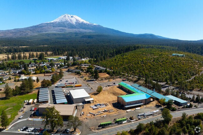
Weed and College of the Siskiyous at the base of Mount Shasta
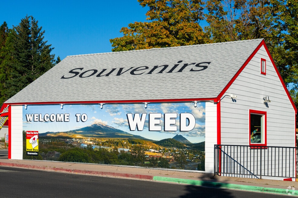
Situated at the base of Mount Shasta, Weed is a small Northern California town of almost 3,000 residents. “It’s a typical, older, small town. Everyone’s in your business, and families have been there for generations,” says Donna Kalayjian, a broker and the owner of Hearthstone Realty, who grew up in the area and went to Weed High School.
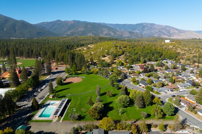
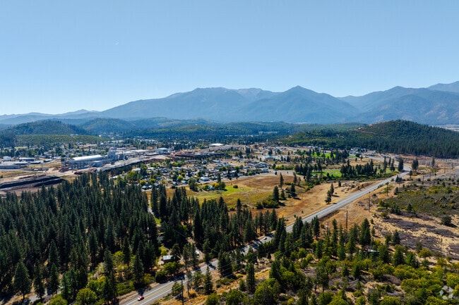
Green spaces and open land surround Weed, California.
Weed, California sits at the base of Mount Shasta and is home to nearly 3,000 residents.
1/2
Nearby Mount Shasta, Black Butte, Lake Shastina and several city parks
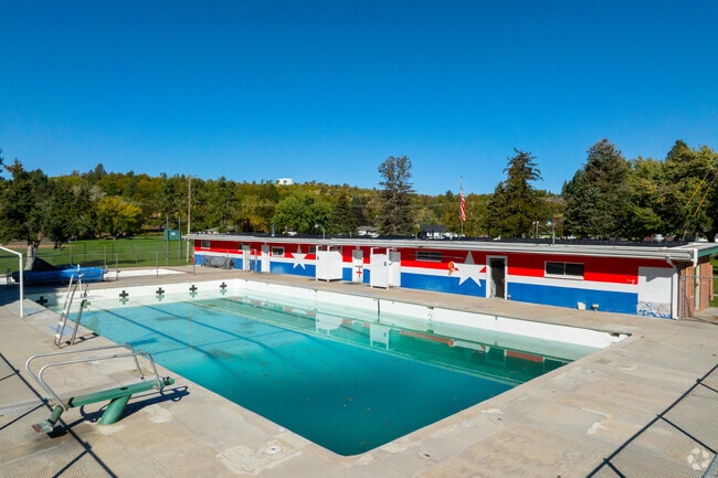
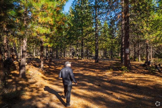
Diverse outdoor recreation surrounds Weed; during the summer, inner tubes, jet skis and fishing boats dot Lake Shastina, which is less than 10 miles to the north, while the infamous Mount Shasta and its ski resorts are roughly 22 miles away. Hikers can admire the snow-capped mountain from the peak of Black Butte, which is about 7 miles from Weed. In addition to the natural attractions around Weed, the city also has several green spaces. Bel Air Park’s playground, baseball field, bocce ball courts and horseshoe pits are next to the community pool, which is open for night swim on Tuesday and Thursday evenings. “That’s where all the stuff in Weed happens,” Kalayjian says, referring to events like the Weed Carnevale & Parade in Bel Air Park. The nearby Bear Trail meanders through the ponderosa pine forest that surrounds the College of the Siskiyous for about 2 miles. “It’s more than a strolling walkway, but less than a hike,” Kalayjian says.
Bel Air Park features a baseball field and community pool.
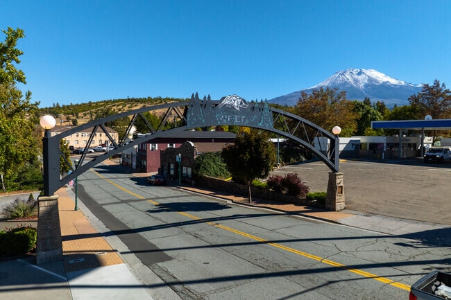
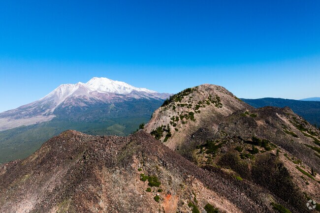
Mount Shasta rises above the landscape near Weed.
1/2
Weed’s Annual Carnevale
The city’s longest-running event is the annual Carnevale, which began as the “Italian Carnival” in 1952. The four-day event in July includes amusement rides, bocce ball and horseshoe tournaments, live music, craft vendors and a food court in Bel Air Park.
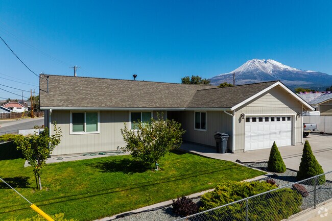
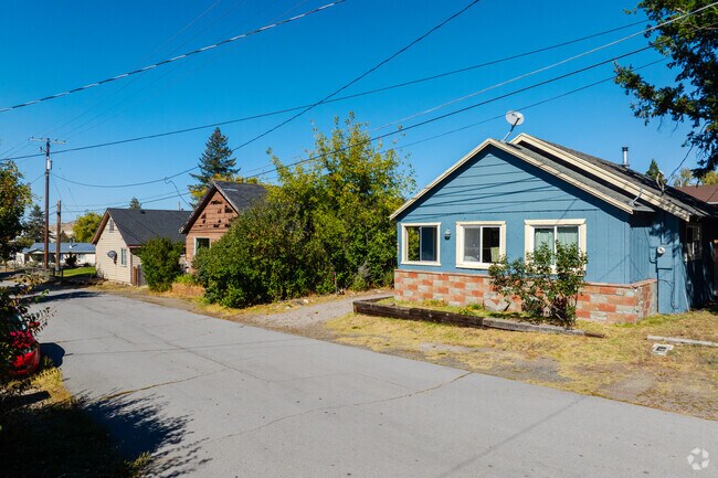
20th-century cottages and ranch-style homes with views of Mount Shasta
Cheerful flower bushes stretch toward the sun in front of homes that tend to sit close to each other, especially near downtown Weed, where sidewalks are sparse. Cottages largely built between 1900 and 1970 cost between $125,000 and $315,000, and ranch-style homes constructed from the 1960s through the 1980s are mostly concentrated near the community college campus. Lots go up to an acre in size, and many feature views of Mount Shasta.
A ranch-style home offers views of Mount Shasta.
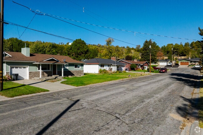
Homes line a quiet street near downtown Weed.
1/2
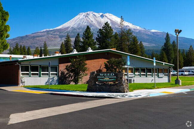
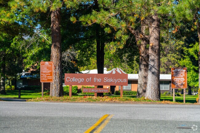
Career education at Weed High School and College of the Siskiyous
Children may start their schooling with grades K-8 at Weed Elementary School, which earns a C-minus grade from Niche. They may then move forward to Weed High School, which receives a B-plus and has 13 athletic programs, including skiing, snowboarding, swimming and golf. Students may pursue certificates in career pathways from residential and commercial construction to graphic design or business management, among others. The College of the Siskiyous’ 250-acre campus is in the southwestern portion of Weed, and it’s one of 11 community colleges with on-campus housing in the state. The campus includes an emergency services training center, a science complex, a tactical training center, a 562-seat theater and a gymnasium, among other amenities. “A lot of people move there for the college,” Kalayjian says.
Weed High School sits below Mount Shasta.
College of the Siskiyous welcomes students to its campus.
1/2
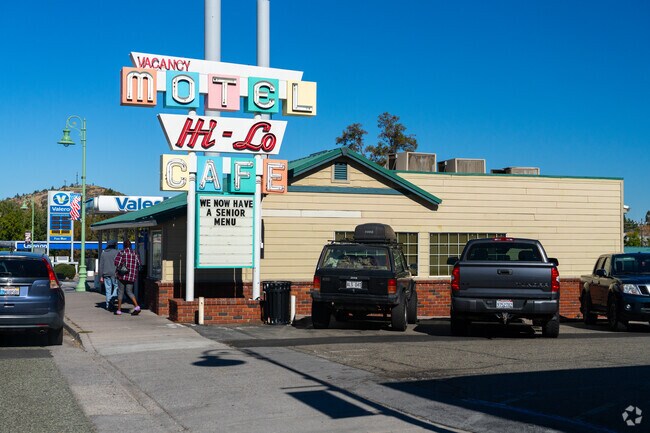
Longstanding Hi-Lo Café and breakfast at Ellie’s Espresso & Bakery
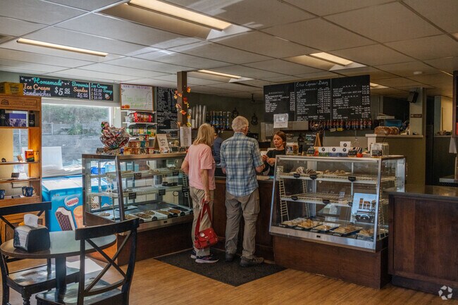
United States Route 97, also known as Volcanic Legacy Scenic Byway, traces the southern edge of Weed’s historic downtown and passes some of the city’s go-to eateries. The Hi-Lo Cafe has been around since 1951, and its legacy is evident in details like the retro swivel barstools that face its counter. Breakfast is served all day, and the dinner menu includes home-style meals like pot roast, old-fashioned meatloaf and freshly roasted turkey. Milkshakes, malts and freshly baked pies round out the Hi-Lo Cafe experience. Across the street, Ellie’s Espresso & Bakery offers espresso drinks, freshly baked pastries and morning bites like the Shasta Bagel Melt or a ham-and-cheese croissant. Ray’s Food Place is farther northwest along the highway for groceries.
Hi-Lo Cafe has served homestyle meals since 1951.
Locals grab coffee and pastries at Ellie’s Espresso & Bakery.
1/2
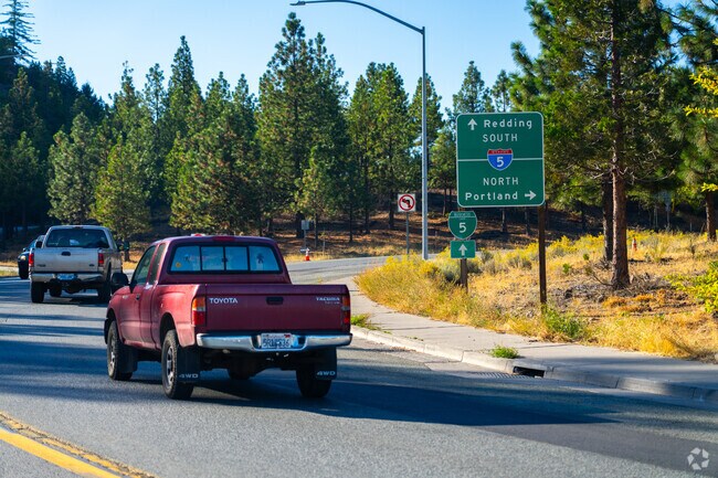
Interstate 5 travels north to Medford and its international airport
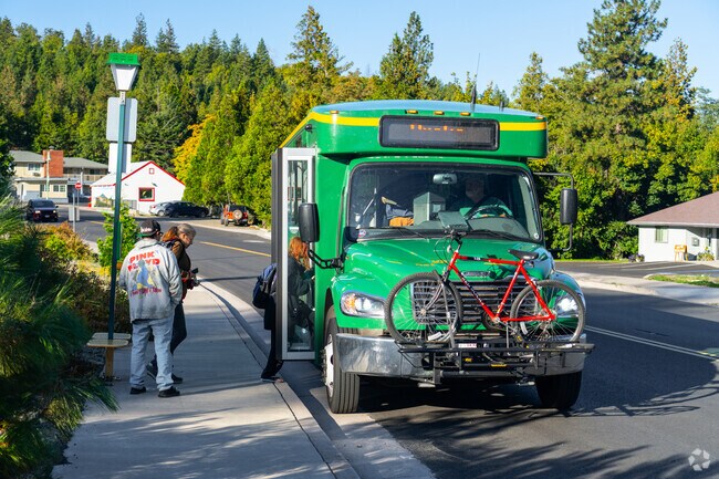
Interstate 5 runs through Weed and continues north to Edgewood, Yreka and eventually Medford, which is about 80 miles away. To the south, it passes the community of Mt. Shasta on its way to Redding, roughly 72 miles away. United States Route 97 branches off the interstate, leading past natural sites like Lake Shastina and Pluto’s Cave. Three routes of the Siskiyou Transit and General Express transit system stop in Weed, connecting it to Dunsmuir, Yreka and Mt. Shasta. The Rogue Valley International-Medford Airport is about 82 miles away and offers direct flights to 11 cities across the West.
Vehicles enter Interstate 5 near Weed’s city center.
Passengers board Siskiyou Transit in Weed.
1/2
Environmental Factors
Weed is at an increased risk of wildfire, and burn permits are required in the city. The entire region is at a moderate risk of earthquakes, according to the Federal Emergency Management Agency.
Written By
Julia Straka
Photography Contributed By
Maurice Boone
Video By
Daniel Quattro
Interested in learning more about homes in this area?
Reach out to
Michelle Williams,
an experienced agent in this area.
On average, homes in Weed, CA sell after 125 days on the market compared to the national average of 54 days. The median sale price for homes in Weed, CA over the last 12 months is $318,000, up 9% from the median home sale price over the previous 12 months.
Neat as pin and ready for new owners! This home is situated near the Lake Shastina Championship Golf Course and lake. Nearby recreational opportunities abound from Golf to Skiing. 10 Minutes to I5 less than 30 minutes to the quaint towns of Weed, City of Mt Shasta, McCloud, Dunsmuir just to list few local hot spots. Lakes, hiking trials, water sports and gourmet fooderies are all nearby. View of
BEAUTIFUL LOT - Escape to the captivating beauty of Rancho Hills, where an extraordinary opportunity awaits. This exquisite lot, is .27 of an acre, With open building areas, diverse trees, & stunning views of Little Shasta Valley, this property is a true gem. Imagine having a boat dock & picnic area just blocks away, providing easy access to boating & memorable gatherings by the water. This lot
AMZING VIEWS OF MT. SHASTA AND GOLF COURSE – Discover this stunning lot with incredible and breath taking views of Mt. Shasta. Situated right alongside the 6th hole of the golf course. Don't miss the opportunity to step out of your car and explore this lot firsthand, experiencing the incredible views and envisioning its potential. Enjoy the serenity of peaceful surroundings, starlit nights, and a
Spectacular 5-Acre Parcel with Beautiful Views of Mt. Shasta This stunning, level 5-acre lot offers breathtaking views of Mt. Shasta. A rare opportunity to build your dream home in a peaceful, upscale neighborhood just minutes from all the best of Northern California living. The property features several ideal building areas, giving you the freedom to design & position your home just the way you
SCENIC GOLF COURSE LOT with MT. SHASTA VIEW ~ Build Your Dream Home ~ This beautiful .25-acre lot is tucked away at the end of a quiet cul-de-sac, offering stunning views of Mt. Shasta and direct frontage on the Scottish Course at Lake Shastina Golf Resort. It’s the ideal location to build your dream home, perfectly positioned to capture both mountain and golf course views. Take a moment to walk
Do not miss out on a chance to own your own piece of paradise in the beautiful Lake Shastina Community. Minutes away from sparkling Lake Shastina, this property is also in close proximity to Lake Shastina Golf Resort and Mount Shasta. Enjoy a gorgeous view of Mount Shasta while being in the comfort of a friendly community, a golden opportunity to build your dream home awaits.
BEAUTIFUL MT. SHASTA VIEW -Desirable Area of Lake Shastina. Very nice neighborhood. This lot has a view of Mount Shasta and land is ready to build upon. Underground Utilities and community water. Location is easy in and out of subdivision. Lake Shastina offers a 27 hole Golf Course, Lake, camping and Mercy Lake Shastina Community Clinic, Police and Fire Department. Close to Hoy park that provides
GOLF COURSE VIEW – Discover this stunning building lot tucked away at the end of a tranquil cul-de-sac, situated right alongside the 3rd hole of the golf course. Don't miss the opportunity to step out of your car and explore this lot firsthand, experiencing the incredible views and envisioning its potential. Enjoy the serenity of peaceful surroundings, starlit nights, and a plethora of outdoor
Escape to the serenity of the mountains with this captivating Craftsman-style house, nestled at the base of the picturesque snow-capped peaks of Mt. Shasta on one side and tranquil Lake Shastina on the other. This meticulously maintained home offers the best in both indoor and outdoor living. Complete with a spacious deck for outdoor entertaining and a wonderfully functional floor plan with high
Live where every sunrise and sunset frames Mt. Shasta and the Eddy Mountain Range! This custom-built home blends refined design with warm, mountain-inspired charm. The heart of the home is a show-stopping kitchen featuring granite countertops, hickory cabinets, Italian gas range, double ovens, a massive island perfect for gathering, and an effortless flow into the main living area anchored by a
Have you been dreaming of a home in the mountains of majestic Northern California, but still want to be within easy access to modern conveniences? This custom home is designed with Lindal’s signature craftsmanship and timeless architectural style, blending warm natural wood accents with soaring ceilings and an abundance of windows that frame the breathtaking scenery beyond. The open-concept floor
Walk Score® measures the walkability of any address. Transit Score® measures access to public transit. Bike Score® measures the bikeability of any address. CAP Index provides objective, accurate, and consistent data to help measure, compare, and mitigate crime risks.
Disclaimer: Certain information contained herein is derived from information provided by parties other than Homes.com. Our sources include: Accuweather, Public Records and Neustar. All information provided is deemed reliable, but is not guaranteed to be accurate and should be independently verified.