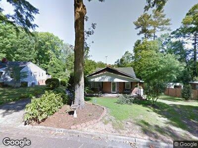
1024 Redbird Rd Augusta, GA 30904
Lakemont NeighborhoodEstimated Value: $249,000 - $277,667
3
Beds
2
Baths
2,099
Sq Ft
$127/Sq Ft
Est. Value
About This Home
This home is located at 1024 Redbird Rd, Augusta, GA 30904 and is currently estimated at $266,417, approximately $126 per square foot. 1024 Redbird Rd is a home located in Richmond County with nearby schools including Garrett Elementary School, Tutt Middle School, and Johnson Magnet.
Ownership History
Date
Name
Owned For
Owner Type
Purchase Details
Closed on
Apr 1, 2024
Sold by
Cunningham Glora Elizabeth Rofs
Bought by
Cunningham Gloria Elizabeth and Cunningham Larry Joe
Current Estimated Value
Purchase Details
Closed on
Jun 19, 2017
Sold by
Cunningham Shane D
Bought by
Cunningham Gloria Elizabeth and Cunningham Larry Joe
Purchase Details
Closed on
Dec 6, 2013
Sold by
Cunningham Gloria Elizabet
Bought by
Cunningham Shane D and Cunningham Gloria Elizabeth Et
Purchase Details
Closed on
Sep 28, 2009
Sold by
Cunningham Gloria E
Bought by
Cunningham Larry J and Cunningham Gloria E
Purchase Details
Closed on
Sep 23, 2009
Sold by
Haskell Katherine M
Bought by
Cunningham Gloria E
Create a Home Valuation Report for This Property
The Home Valuation Report is an in-depth analysis detailing your home's value as well as a comparison with similar homes in the area
Home Values in the Area
Average Home Value in this Area
Purchase History
| Date | Buyer | Sale Price | Title Company |
|---|---|---|---|
| Cunningham Gloria Elizabeth | -- | -- | |
| Cunningham Gloria Elizabeth | -- | -- | |
| Cunningham Shane D | -- | -- | |
| Cunningham Larry J | -- | -- | |
| Cunningham Gloria E | $25,000 | -- | |
| Cunningham Gloria E | $25,000 | -- | |
| Cunningham Gloria E | $25,000 | -- | |
| Cunningham Gloria E | -- | -- |
Source: Public Records
Mortgage History
| Date | Status | Borrower | Loan Amount |
|---|---|---|---|
| Previous Owner | Cunningham Gloria Elizabeth | $56,270 |
Source: Public Records
Tax History Compared to Growth
Tax History
| Year | Tax Paid | Tax Assessment Tax Assessment Total Assessment is a certain percentage of the fair market value that is determined by local assessors to be the total taxable value of land and additions on the property. | Land | Improvement |
|---|---|---|---|---|
| 2024 | $3,502 | $115,928 | $8,400 | $107,528 |
| 2023 | $3,502 | $105,208 | $8,400 | $96,808 |
| 2022 | $2,882 | $88,774 | $8,400 | $80,374 |
| 2021 | $2,324 | $62,733 | $8,400 | $54,333 |
| 2020 | $2,192 | $59,595 | $7,200 | $52,395 |
| 2019 | $2,324 | $59,595 | $7,200 | $52,395 |
| 2018 | $1,933 | $59,595 | $7,200 | $52,395 |
| 2017 | $2,128 | $59,595 | $7,200 | $52,395 |
| 2016 | $2,128 | $59,595 | $7,200 | $52,395 |
| 2015 | $2,143 | $59,595 | $7,200 | $52,395 |
Source: Public Records
Map
Nearby Homes
- 1020 Stewart Ave
- 1002 Oleander Dr
- 2319 Woodbine Rd
- 1015 Oleander Dr
- 843 Lake Terrace Dr
- 2417 Wilkshire Dr
- 2403 Ponderosa Dr
- 301 White Ash Ct
- 2327 Redwood Dr
- 227 Water Oak Dr
- 912 Eisenhower Dr
- 243 Water Oak Dr
- 241 Water Oak Dr
- 2433 Forest Park Rd
- 2406 Mohican Rd
- 2314 Redwood Dr
- 2511 Castlewood Dr
- 1115 Glenwood Dr
- 102 Morningside Ct
- 2220 Edgewood Dr
- 1024 Redbird Rd
- 1026 Redbird Rd
- 1022 Redbird Rd
- 911 Flythe Dr
- 909 Flythe Dr
- 1028 Redbird Rd
- 1020 Redbird Rd
- 907 Flythe Dr
- 913 Flythe Dr
- 1021 Redbird Rd
- 1019 Redbird Rd
- 1023 Redbird Rd
- 1018 Redbird Rd
- 915 Flythe Dr
- 903 Flythe Dr
- 1025 Redbird Rd
- 905 Flythe Dr
- 917 Flythe Dr
- 1017 Redbird Rd
- 1036 Redbird Rd