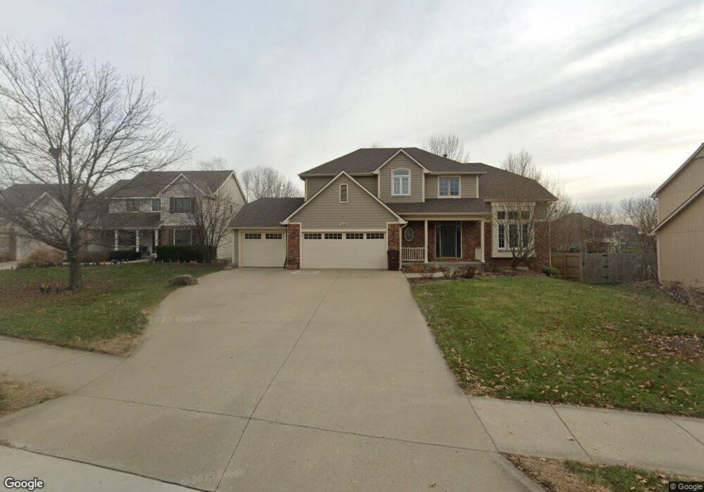
1028 Summerfield Way Lawrence, KS 66049
West Lawrence NeighborhoodEstimated Value: $537,000 - $558,000
4
Beds
4
Baths
2,535
Sq Ft
$216/Sq Ft
Est. Value
About This Home
This home is located at 1028 Summerfield Way, Lawrence, KS 66049 and is currently estimated at $548,184, approximately $216 per square foot. 1028 Summerfield Way is a home located in Douglas County with nearby schools including Langston Hughes Elementary School, Southwest Middle School, and Lawrence Free State High School.
Ownership History
Date
Name
Owned For
Owner Type
Purchase Details
Closed on
Sep 6, 2024
Sold by
Hutfles Michael T and Hutfles Lori Majure
Bought by
Michael Todd Hutfles And Lori Majure Hutfles and Hutfles
Current Estimated Value
Create a Home Valuation Report for This Property
The Home Valuation Report is an in-depth analysis detailing your home's value as well as a comparison with similar homes in the area
Home Values in the Area
Average Home Value in this Area
Purchase History
| Date | Buyer | Sale Price | Title Company |
|---|---|---|---|
| Michael Todd Hutfles And Lori Majure Hutfles | -- | None Listed On Document |
Source: Public Records
Tax History Compared to Growth
Tax History
| Year | Tax Paid | Tax Assessment Tax Assessment Total Assessment is a certain percentage of the fair market value that is determined by local assessors to be the total taxable value of land and additions on the property. | Land | Improvement |
|---|---|---|---|---|
| 2025 | $7,391 | $58,984 | $9,200 | $49,784 |
| 2024 | $7,007 | $55,959 | $7,475 | $48,484 |
| 2023 | $6,881 | $53,211 | $7,475 | $45,736 |
| 2022 | $6,453 | $49,588 | $7,475 | $42,113 |
| 2021 | $5,593 | $41,754 | $6,334 | $35,420 |
| 2020 | $5,401 | $40,537 | $6,334 | $34,203 |
| 2019 | $4,480 | $33,718 | $6,334 | $27,384 |
| 2018 | $4,451 | $33,258 | $6,334 | $26,924 |
| 2017 | $4,483 | $33,120 | $6,334 | $26,786 |
| 2016 | $4,292 | $33,120 | $5,753 | $27,367 |
| 2015 | $4,249 | $32,786 | $5,753 | $27,033 |
| 2014 | $4,208 | $32,786 | $5,753 | $27,033 |
Source: Public Records
Map
Nearby Homes
- 5117 Harvard Rd
- 5024 Cedar Grove Way
- 5204 Foxchase Dr
- 5204 Fox Chase Dr
- 1202 Little Knife
- 1040 Stonecreek Dr
- 1017 Stoneridge Dr
- 1033 Stonecreek Dr
- 1300 Research Park Dr
- 1315 Research Park Dr
- 904 Moundridge Dr
- 5245 Overland Dr Unit A15
- 5245 Overland Dr Unit C12
- 5245 Overland Dr Unit D4
- 1347 Kanza Dr
- 5614 Chimney Rocks Cir
- 5710 Goff Ct
- 1601 Research Park Dr
- 6204 Berando Ct
- 1564 Fountain Dr
- 1032 Summerfield Way
- 1024 Summerfield Way
- 1020 Summerfield Way
- 1100 Summerfield Way
- 5224 Cedar Grove Way
- 5220 Cedar Grove Way
- 1013 Summerfield Way
- 1104 Summerfield Way
- 1017 Summerfield Way
- 5208 Cedar Grove Way
- 1009 Summerfield Way
- 1021 Summerfield Way
- 1016 Summerfield Way
- 5216 Cedar Grove Way
- 1101 Summerfield Way
- 1108 Summerfield Way
- 1005 Summerfield Way
- 1105 Juniper Ln
- 1012 Summerfield Way
- 1105 Summerfield Way