Estimated Value: $80,000 - $147,000
Studio
1
Bath
725
Sq Ft
$159/Sq Ft
Est. Value
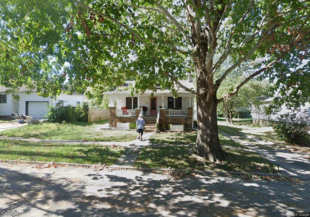
About This Home
This home is located at 103 S Locust St, Eldon, MI 65026 and is currently estimated at $115,534, approximately $159 per square foot. 103 S Locust St is a home located in Miller County with nearby schools including South Elementary School, Eldon Upper Elementary School, and Eldon Middle School.
Ownership History
Date
Name
Owned For
Owner Type
Purchase Details
Closed on
Jan 25, 2022
Sold by
Burlingame John E
Bought by
Hilltop Home Holdings Llc
Current Estimated Value
Purchase Details
Closed on
Nov 5, 2013
Sold by
Hilse William J and Hilse Dorothy A
Bought by
Burlingame John E
Home Financials for this Owner
Home Financials are based on the most recent Mortgage that was taken out on this home.
Original Mortgage
$20,000
Interest Rate
4.5%
Mortgage Type
Adjustable Rate Mortgage/ARM
Create a Home Valuation Report for This Property
The Home Valuation Report is an in-depth analysis detailing your home's value as well as a comparison with similar homes in the area
Home Values in the Area
Average Home Value in this Area
Purchase History
| Date | Buyer | Sale Price | Title Company |
|---|---|---|---|
| Hilltop Home Holdings Llc | -- | New Title Company Name | |
| Burlingame John E | -- | None Available |
Source: Public Records
Mortgage History
| Date | Status | Borrower | Loan Amount |
|---|---|---|---|
| Previous Owner | Burlingame John E | $20,000 |
Source: Public Records
Tax History
| Year | Tax Paid | Tax Assessment Tax Assessment Total Assessment is a certain percentage of the fair market value that is determined by local assessors to be the total taxable value of land and additions on the property. | Land | Improvement |
|---|---|---|---|---|
| 2025 | $409 | $9,440 | $1,160 | $8,280 |
| 2024 | $375 | $8,250 | $1,050 | $7,200 |
| 2023 | $375 | $8,250 | $1,050 | $7,200 |
| 2022 | $375 | $8,250 | $1,050 | $7,200 |
| 2021 | $375 | $8,250 | $1,050 | $7,200 |
| 2020 | $358 | $7,790 | $1,050 | $6,740 |
| 2019 | $358 | $7,790 | $1,050 | $6,740 |
| 2018 | $361 | $7,790 | $1,050 | $6,740 |
| 2017 | $352 | $7,980 | $990 | $6,990 |
| 2016 | $355 | $7,980 | $0 | $0 |
| 2015 | -- | $7,980 | $0 | $0 |
| 2012 | -- | $7,540 | $0 | $0 |
Source: Public Records
Map
Nearby Homes
- 130 S Grand Ave
- 414 W 6th St
- 406 S Godfrey Ave
- 502 W 6th St
- 110 W Autry St
- 134 W 8th St
- 502 N Vernon Dr
- 904 Larkin Dr
- 405 S Dunstan Dr
- 509 Sunset Strip
- 207 Franklin Ave
- 406 N Mill St
- Lot 5 W Bourbon St
- Lot 7 W Bourbon St
- Lot 9 W Bourbon St
- Lot 6 W Bourbon St
- Lot 10 W Bourbon St
- 612 E High St
- 508 E Harrison St
- 807 Rollotrend Ln
- 103 S Locust St
- 302 W 1st St
- 107 S Locust St
- 111 S Locust St
- 113 S Locust St
- 122 S Locust St
- 102 S Locust St
- 104 S Grand Ave
- 304 W 1st St
- 123 S Locust St
- 110 S Grand Ave
- 110 S Grand Ave
- 124 S Locust St
- 303 W 2nd St
- 101 S Grand Ave
- 5 S Grand Ave
- 5 S Grand Ave
- 1 S Grand Ave
- 5 S Grand Ave
- 125 S Grand Ave
Your Personal Tour Guide
Ask me questions while you tour the home.