Estimated Value: $313,000 - $336,000
3
Beds
1
Bath
1,076
Sq Ft
$304/Sq Ft
Est. Value
About This Home
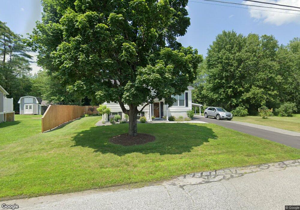
This home is located at 104 Butternut Dr, Keene, NH 03431 and is currently estimated at $327,094, approximately $303 per square foot. 104 Butternut Dr is a home with nearby schools including Greenlee Primary School, Keene Middle School, and Mayland Early College High School.
Ownership History
Date
Name
Owned For
Owner Type
Purchase Details
Closed on
Jul 1, 2002
Sold by
Oneil Kenneth L
Bought by
Hartwell Paul V and Hartwell Denise E
Current Estimated Value
Home Financials for this Owner
Home Financials are based on the most recent Mortgage that was taken out on this home.
Original Mortgage
$65,000
Interest Rate
6.92%
Purchase Details
Closed on
Jul 18, 1996
Sold by
Boice William D and Boice Mildred R
Bought by
Oneil Kenneth L
Home Financials for this Owner
Home Financials are based on the most recent Mortgage that was taken out on this home.
Original Mortgage
$82,400
Interest Rate
8.28%
Create a Home Valuation Report for This Property
The Home Valuation Report is an in-depth analysis detailing your home's value as well as a comparison with similar homes in the area
Home Values in the Area
Average Home Value in this Area
Purchase History
| Date | Buyer | Sale Price | Title Company |
|---|---|---|---|
| Hartwell Paul V | $119,500 | -- | |
| Oneil Kenneth L | $80,500 | -- |
Source: Public Records
Mortgage History
| Date | Status | Borrower | Loan Amount |
|---|---|---|---|
| Open | Oneil Kenneth L | $42,000 | |
| Closed | Oneil Kenneth L | $65,000 | |
| Previous Owner | Oneil Kenneth L | $82,400 |
Source: Public Records
Tax History Compared to Growth
Tax History
| Year | Tax Paid | Tax Assessment Tax Assessment Total Assessment is a certain percentage of the fair market value that is determined by local assessors to be the total taxable value of land and additions on the property. | Land | Improvement |
|---|---|---|---|---|
| 2024 | $6,340 | $191,700 | $47,600 | $144,100 |
| 2023 | $6,014 | $188,600 | $47,600 | $141,000 |
| 2022 | $5,852 | $188,600 | $47,600 | $141,000 |
| 2021 | $5,899 | $188,600 | $47,600 | $141,000 |
| 2020 | $5,726 | $153,600 | $55,700 | $97,900 |
| 2019 | $5,775 | $153,600 | $55,700 | $97,900 |
| 2018 | $5,702 | $153,600 | $55,700 | $97,900 |
| 2017 | $5,706 | $153,300 | $55,400 | $97,900 |
| 2016 | $5,579 | $153,300 | $55,400 | $97,900 |
| 2015 | $5,974 | $173,600 | $62,600 | $111,000 |
Source: Public Records
Map
Nearby Homes
- 115 Liberty Ln
- 184 Kennedy Dr
- 64 Old Walpole Rd
- 224 Darling Rd
- 106 Pako Ave
- 31 Darling Ct
- 798 Court St Unit G
- 792 Court St Unit A
- 11 Nut Hatch Ln
- 0 Rd Unit 5039440
- 17 Blue Jay Ct
- 28 Stonehouse Ln
- 38 Stonehouse Ln Unit A
- 39 Windsor Ct Unit B
- Lot 27-1 Old Walpole Rd
- 89 Kendall Rd
- 220 Hurricane Rd
- Rt Highway 12
- 257 Park Ave
- 0 Stevens St Unit 1
- 100 Butternut Dr
- 108 Butternut Dr
- 107 Butternut Dr
- 96 Butternut Dr
- 97 Butternut Dr
- 115 Butternut Dr
- 114 Butternut Dr
- 91 Butternut Dr
- 92 Butternut Dr
- 119 Butternut Dr
- 81 Butternut Dr
- 118 Butternut Dr
- 88 Butternut Dr
- 123 Butternut Dr
- 77 Butternut Dr
- 122 Butternut Dr
- 84 Butternut Dr
- 127 Butternut Dr
- 126 Butternut Dr
- 80 Butternut Dr