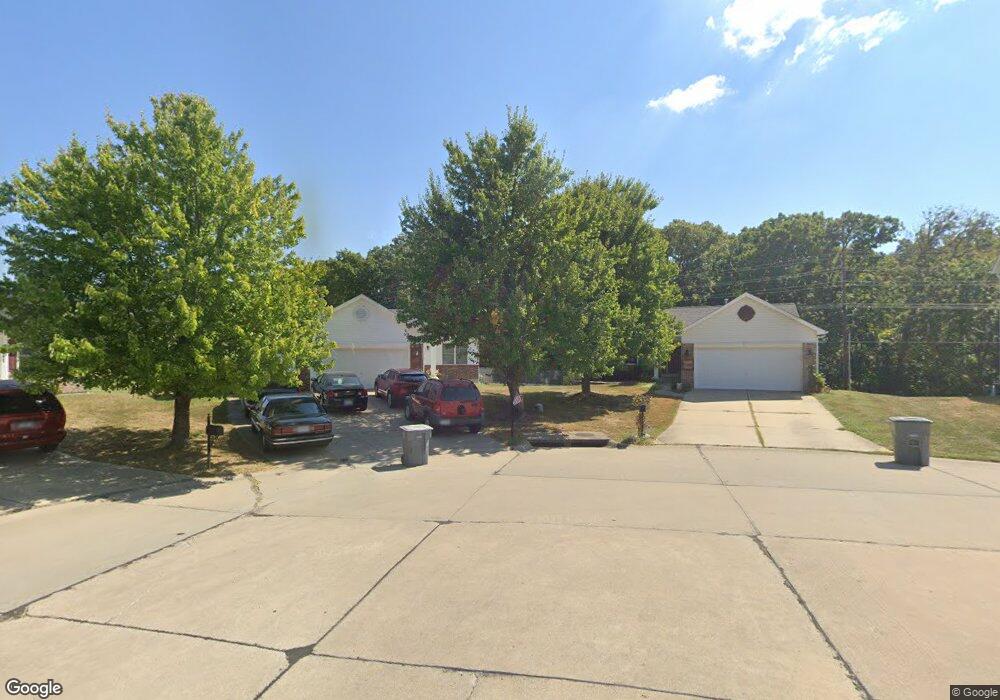
1041 Batters Box Ct O Fallon, MO 63366
Estimated Value: $332,000 - $358,000
3
Beds
2
Baths
1,360
Sq Ft
$251/Sq Ft
Est. Value
About This Home
This home is located at 1041 Batters Box Ct, O Fallon, MO 63366 and is currently estimated at $341,849, approximately $251 per square foot. 1041 Batters Box Ct is a home located in St. Charles County with nearby schools including Westhoff Elementary School, Fort Zumwalt North Middle School, and Fort Zumwalt North High School.
Ownership History
Date
Name
Owned For
Owner Type
Purchase Details
Closed on
Dec 3, 2004
Sold by
Tr Hughes Inc
Bought by
Keller Jodi
Current Estimated Value
Home Financials for this Owner
Home Financials are based on the most recent Mortgage that was taken out on this home.
Original Mortgage
$167,050
Outstanding Balance
$83,045
Interest Rate
5.62%
Mortgage Type
Purchase Money Mortgage
Estimated Equity
$258,804
Purchase Details
Closed on
Oct 22, 2004
Sold by
Summit Pointe Lc
Bought by
Tr Hughes Inc
Home Financials for this Owner
Home Financials are based on the most recent Mortgage that was taken out on this home.
Original Mortgage
$167,050
Outstanding Balance
$83,045
Interest Rate
5.62%
Mortgage Type
Purchase Money Mortgage
Estimated Equity
$258,804
Create a Home Valuation Report for This Property
The Home Valuation Report is an in-depth analysis detailing your home's value as well as a comparison with similar homes in the area
Home Values in the Area
Average Home Value in this Area
Purchase History
| Date | Buyer | Sale Price | Title Company |
|---|---|---|---|
| Keller Jodi | $175,890 | Atc | |
| Tr Hughes Inc | -- | Atc |
Source: Public Records
Mortgage History
| Date | Status | Borrower | Loan Amount |
|---|---|---|---|
| Open | Keller Jodi | $167,050 | |
| Previous Owner | Tr Hughes Inc | $139,000 |
Source: Public Records
Tax History Compared to Growth
Tax History
| Year | Tax Paid | Tax Assessment Tax Assessment Total Assessment is a certain percentage of the fair market value that is determined by local assessors to be the total taxable value of land and additions on the property. | Land | Improvement |
|---|---|---|---|---|
| 2025 | $3,405 | $57,568 | -- | -- |
| 2023 | $3,407 | $51,397 | $0 | $0 |
| 2022 | $2,937 | $41,174 | $0 | $0 |
| 2021 | $2,940 | $41,174 | $0 | $0 |
| 2020 | $2,923 | $39,692 | $0 | $0 |
| 2019 | $2,929 | $39,692 | $0 | $0 |
| 2018 | $2,871 | $37,149 | $0 | $0 |
| 2017 | $2,833 | $37,149 | $0 | $0 |
| 2016 | $2,498 | $32,627 | $0 | $0 |
| 2015 | $2,323 | $32,627 | $0 | $0 |
| 2014 | $2,233 | $30,844 | $0 | $0 |
Source: Public Records
Map
Nearby Homes
- 2024 Homefield Ridge Dr
- 1612 Homefield Meadows Dr
- 117.76 Acres Missouri 79
- 18 W Homefield Point Ct
- 18 Homefield Gardens Dr Unit 21N
- 628 Homerun Dr Unit 11N
- Lot 2 Homefield Blvd
- 8 Dugout Ct
- 0 Tom Ginnever Ave
- 6 Green Park Ln
- 1113 Renfrew Ln S
- 72 Green Park Ln Unit 28B
- 239 Crystal Ridge Dr
- 57 Green Park Ln
- 1401 Noyack Dr
- 1384 Deerfield Estates Dr
- 1103 Piepers Glen Ln Unit 1B
- 5 Queen Victoria C Ct
- 1129 Danielle Elizabeth Ct
- 805 Saint Joseph Ave
- 1037 Batters Box Ct
- 1045 Batters Box Ct
- 1033 Batters Box Ct
- 1047 Batters Box Ct
- 1029 Batters Box Ct
- 2219 Homefield Grove Dr
- 1046 Batters Box Ct
- 2221 Homefield Grove Dr
- 1038 Batters Box Ct
- 1042 Batters Box Ct
- 1025 Batters Box Ct
- 1034 Batters Box Ct
- 2217 Homefield Grove Dr
- 1030 Batters Box Ct
- 1021 Batters Box Ct
- 1026 Batters Box Ct
- 1918 Homefield Prairie Ct
- 2215 Homefield Grove Dr
- 2222 Homefield Grove Dr
- 1017 Batters Box Ct