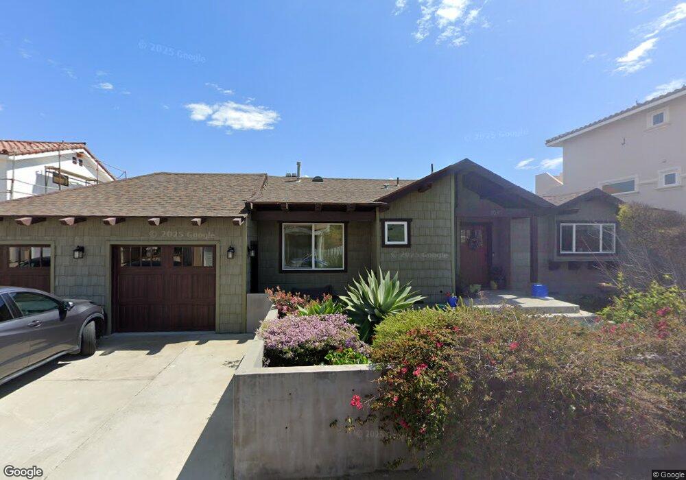
1042 Brockton Ln Ventura, CA 93001
Pierpont NeighborhoodEstimated Value: $1,479,000 - $2,109,000
3
Beds
3
Baths
1,847
Sq Ft
$996/Sq Ft
Est. Value
About This Home
This home is located at 1042 Brockton Ln, Ventura, CA 93001 and is currently estimated at $1,839,833, approximately $996 per square foot. 1042 Brockton Ln is a home located in Ventura County with nearby schools including Pierpont Elementary School, Cabrillo Middle School, and Ventura High School.
Ownership History
Date
Name
Owned For
Owner Type
Purchase Details
Closed on
May 8, 2019
Sold by
Moreau Michael M and Yau Florence W
Bought by
Moreau Michael M and Yau Florence W
Current Estimated Value
Purchase Details
Closed on
Mar 5, 2013
Sold by
Moreau Michael M
Bought by
Moreau Michael M and Yau Florence W
Home Financials for this Owner
Home Financials are based on the most recent Mortgage that was taken out on this home.
Original Mortgage
$160,000
Interest Rate
3.53%
Mortgage Type
New Conventional
Purchase Details
Closed on
Apr 2, 2010
Sold by
Moreau Michael M and Hubinger Richard L
Bought by
Moreau Michael M
Purchase Details
Closed on
May 16, 1996
Sold by
Hubinger Eileen B and Moreau Eileen E
Bought by
Hubinger Walter J and Hubinger Eileen B
Create a Home Valuation Report for This Property
The Home Valuation Report is an in-depth analysis detailing your home's value as well as a comparison with similar homes in the area
Home Values in the Area
Average Home Value in this Area
Purchase History
| Date | Buyer | Sale Price | Title Company |
|---|---|---|---|
| Moreau Michael M | -- | None Available | |
| Moreau Michael M | -- | Pacific Coast Title Company | |
| Moreau Michael M | -- | None Available | |
| Hubinger Walter J | -- | -- |
Source: Public Records
Mortgage History
| Date | Status | Borrower | Loan Amount |
|---|---|---|---|
| Closed | Moreau Michael M | $160,000 |
Source: Public Records
Tax History Compared to Growth
Tax History
| Year | Tax Paid | Tax Assessment Tax Assessment Total Assessment is a certain percentage of the fair market value that is determined by local assessors to be the total taxable value of land and additions on the property. | Land | Improvement |
|---|---|---|---|---|
| 2025 | $3,886 | $353,548 | $58,787 | $294,761 |
| 2024 | $3,886 | $346,616 | $57,634 | $288,982 |
| 2023 | $3,839 | $339,820 | $56,504 | $283,316 |
| 2022 | $3,579 | $333,157 | $55,396 | $277,761 |
| 2021 | $3,511 | $326,625 | $54,310 | $272,315 |
| 2020 | $3,478 | $323,278 | $53,754 | $269,524 |
| 2019 | $3,414 | $316,940 | $52,700 | $264,240 |
| 2018 | $3,345 | $310,726 | $51,667 | $259,059 |
| 2017 | $3,276 | $304,634 | $50,654 | $253,980 |
| 2016 | $1,493 | $133,785 | $49,661 | $84,124 |
| 2015 | $920 | $78,435 | $48,916 | $29,519 |
| 2014 | $906 | $76,900 | $47,958 | $28,942 |
Source: Public Records
Map
Nearby Homes
- 999 Waterbury Ln
- 2036 Pierpont Blvd
- 2149 Monmouth Dr
- 934 Sharon Ln
- 1090 Bangor Ln
- 1111 Dover Ln
- 2001 Alessandro Dr
- 1132 Pittsfield Ln
- 1158 Shelburn Ln
- 0 Alessandro Dr Unit V1-27834
- 1884 Channel Dr
- 1153 Cornwall Ln
- Plan 1898 Modeled at Seaview at Midtown
- Plan 2392 Modeled at Seaview at Midtown
- Plan 1376 Modeled at Seaview at Midtown
- Plan 1424 Interior Modeled at Seaview at Midtown
- Plan 1424 End at Seaview at Midtown
- 2364 Haley Point Dr Unit 103
- 2364 Haley Point Dr Unit 101
- 2380 Haley Point Dr Unit 104
- 1020 Brockton Ln
- 1050 Brockton Ln
- 1051 Driftwood Ln
- 1047 Driftwood Ln
- 1012 Brockton Ln
- 1055 Driftwood Ln
- 1070 Brockton Ln
- 1025 Brockton Ln
- 1043 Driftwood Ln
- 1027 Brockton Ln
- 1023 Brockton Ln Unit 1
- 1043 Brockton Ln
- 1067 Driftwood Ln
- 1019 Driftwood Ln
- 1009 Brockton Ln
- 978 Brockton Ln
- 1067 Brockton Ln
- 1081 Driftwood Ln
- 1005 Driftwood Ln
- 981 Brockton Ln