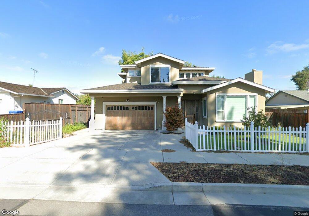
1047 Hazel Ave Campbell, CA 95008
San Tomas NeighborhoodEstimated Value: $2,383,000 - $2,773,000
4
Beds
4
Baths
2,525
Sq Ft
$1,029/Sq Ft
Est. Value
About This Home
This home is located at 1047 Hazel Ave, Campbell, CA 95008 and is currently estimated at $2,597,615, approximately $1,028 per square foot. 1047 Hazel Ave is a home located in Santa Clara County with nearby schools including Westmont High School, Capri Elementary, and Forest Hill Elementary School.
Ownership History
Date
Name
Owned For
Owner Type
Purchase Details
Closed on
Nov 11, 2025
Sold by
Hwang Shwi-Long Jimmy and Hwang Julie Lee
Bought by
Hwang Family Trust and Hwang
Current Estimated Value
Purchase Details
Closed on
Dec 15, 2010
Sold by
Call Daniel D and Call Marnie M
Bought by
Hwang Shwi Long Jimmy and Hwang Julie L
Home Financials for this Owner
Home Financials are based on the most recent Mortgage that was taken out on this home.
Original Mortgage
$360,000
Interest Rate
4.21%
Mortgage Type
New Conventional
Create a Home Valuation Report for This Property
The Home Valuation Report is an in-depth analysis detailing your home's value as well as a comparison with similar homes in the area
Home Values in the Area
Average Home Value in this Area
Purchase History
| Date | Buyer | Sale Price | Title Company |
|---|---|---|---|
| Hwang Family Trust | -- | None Listed On Document | |
| Hwang Shwi Long Jimmy | $975,000 | Stewart Title Of California |
Source: Public Records
Mortgage History
| Date | Status | Borrower | Loan Amount |
|---|---|---|---|
| Previous Owner | Hwang Shwi Long Jimmy | $360,000 |
Source: Public Records
Tax History
| Year | Tax Paid | Tax Assessment Tax Assessment Total Assessment is a certain percentage of the fair market value that is determined by local assessors to be the total taxable value of land and additions on the property. | Land | Improvement |
|---|---|---|---|---|
| 2025 | $15,685 | $1,249,136 | $936,791 | $312,345 |
| 2024 | $15,685 | $1,224,644 | $918,423 | $306,221 |
| 2023 | $15,466 | $1,200,632 | $900,415 | $300,217 |
| 2022 | $15,362 | $1,177,091 | $882,760 | $294,331 |
| 2021 | $15,086 | $1,154,011 | $865,451 | $288,560 |
| 2020 | $14,696 | $1,142,179 | $856,577 | $285,602 |
| 2019 | $14,490 | $1,119,784 | $839,782 | $280,002 |
| 2018 | $14,039 | $1,097,828 | $823,316 | $274,512 |
| 2017 | $13,841 | $1,076,303 | $807,173 | $269,130 |
| 2016 | $13,016 | $1,055,200 | $791,347 | $263,853 |
| 2015 | $12,803 | $1,039,351 | $779,461 | $259,890 |
| 2014 | $12,379 | $1,018,993 | $764,193 | $254,800 |
Source: Public Records
Map
Nearby Homes
- 734 Pecan Way
- 832 Mary Ct
- 963 Connie Dr
- 2310 Montezuma Dr
- 786 Sharmon Palms Ln
- 803 W Sunnyoaks Ave
- 648 W Sunnyoaks Ave
- 1500 W San Tomas Aquino Rd
- 1430 Westmont Ave
- 3887 Via Milano
- 810 Virginia Ct
- 2245 S San Tomas Aquino Rd
- 2329 Dorval Dr
- 1434 Capri Dr
- 123 Dot Ave
- 90 Victor Ave
- 576 W Parr Ave Unit 9
- 576 W Parr Ave Unit 3
- 576 W Parr Ave Unit 1
- 1375 Colleen Way
Your Personal Tour Guide
Ask me questions while you tour the home.