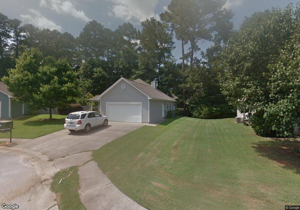
106 Cambridge Pointe Cir Alabaster, AL 35007
Estimated Value: $241,960 - $259,000
3
Beds
2
Baths
1,394
Sq Ft
$178/Sq Ft
Est. Value
About This Home
This home is located at 106 Cambridge Pointe Cir, Alabaster, AL 35007 and is currently estimated at $248,490, approximately $178 per square foot. 106 Cambridge Pointe Cir is a home located in Shelby County with nearby schools including Thompson Intermediate School, Thompson Middle School, and Thompson High School.
Ownership History
Date
Name
Owned For
Owner Type
Purchase Details
Closed on
Oct 21, 2008
Sold by
Wallace Brian D
Bought by
Burrow Phillip M and Burrow Cynthia
Current Estimated Value
Purchase Details
Closed on
Jul 27, 2007
Sold by
Boohaker George J and Boohaker Lori R
Bought by
Wallace Brian D
Home Financials for this Owner
Home Financials are based on the most recent Mortgage that was taken out on this home.
Original Mortgage
$139,900
Outstanding Balance
$88,804
Interest Rate
6.71%
Mortgage Type
Unknown
Estimated Equity
$159,686
Purchase Details
Closed on
Mar 20, 1998
Sold by
Hendrix Margaret and Hendrix Robert A
Bought by
Boohaker George J and Boohaker Lori R
Home Financials for this Owner
Home Financials are based on the most recent Mortgage that was taken out on this home.
Original Mortgage
$94,500
Interest Rate
6.99%
Create a Home Valuation Report for This Property
The Home Valuation Report is an in-depth analysis detailing your home's value as well as a comparison with similar homes in the area
Home Values in the Area
Average Home Value in this Area
Purchase History
| Date | Buyer | Sale Price | Title Company |
|---|---|---|---|
| Burrow Phillip M | $131,500 | None Available | |
| Wallace Brian D | $139,900 | None Available | |
| Boohaker George J | $99,500 | -- |
Source: Public Records
Mortgage History
| Date | Status | Borrower | Loan Amount |
|---|---|---|---|
| Open | Wallace Brian D | $139,900 | |
| Previous Owner | Boohaker George J | $94,500 |
Source: Public Records
Tax History Compared to Growth
Tax History
| Year | Tax Paid | Tax Assessment Tax Assessment Total Assessment is a certain percentage of the fair market value that is determined by local assessors to be the total taxable value of land and additions on the property. | Land | Improvement |
|---|---|---|---|---|
| 2024 | $1,058 | $19,600 | $0 | $0 |
| 2023 | $1,003 | $19,340 | $0 | $0 |
| 2022 | $888 | $17,200 | $0 | $0 |
| 2021 | $806 | $15,680 | $0 | $0 |
| 2020 | $740 | $14,460 | $0 | $0 |
| 2019 | $732 | $14,320 | $0 | $0 |
| 2017 | $707 | $13,100 | $0 | $0 |
| 2015 | $672 | $12,440 | $0 | $0 |
| 2014 | $666 | $12,340 | $0 | $0 |
Source: Public Records
Map
Nearby Homes
- 201 Shalimar Cir
- 144 Palm Dr
- 1520 Tropical Cir
- 104 Camden Cir
- 117 Kensington Ln
- 217 Kensington Ln
- 10589 Highway 119
- 240 Jasmine Dr
- 521 13th St SW
- 280 Cedar Grove Pkwy
- 902 6th Ave SW
- 104 Kentwood Trail Cir
- 732 4th St SW
- 412 10th St SW
- 309 Cedar Grove Ct
- 549 Ramsgate Dr
- 545 Ramsgate Dr
- 1307 3rd Ave SW
- 0000 Highway 26
- 537 Ramsgate Dr
- 108 Cambridge Pointe Cir
- 109 Summer Brook Ln
- 110 Cambridge Pointe Cir
- 105 Summer Brook Ln
- 113 Summer Brook Ln
- 105 Cambridge Pointe Cir
- 1300 Applegate Dr
- 1304 Applegate Dr
- 1306 Applegate Dr
- 1302 Applegate Dr
- 112 Cambridge Pointe Cir
- 100 Cambridge Pointe Cir
- 1308 Applegate Dr
- 117 Summer Brook Ln
- 1310 Applegate Dr
- 101 Summer Brook Ln
- 1402 Applegate Dr
- 109 Cambridge Pointe Cir
- 101 Cambridge Pointe Cir
- 1404 Applegate Dr