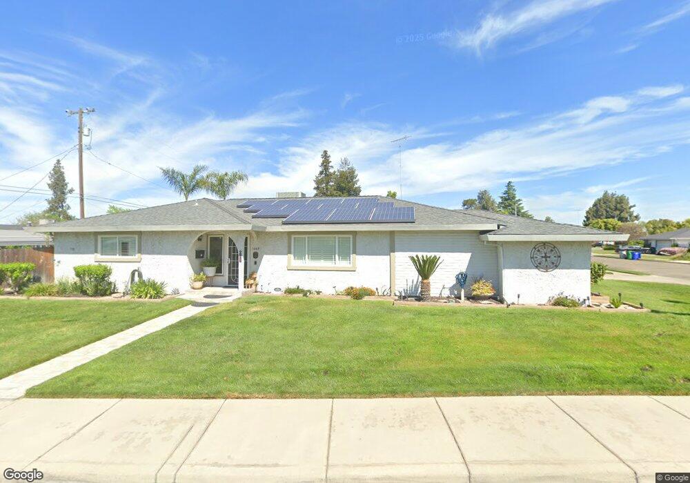
1069 Palm Ave Atwater, CA 95301
Estimated Value: $377,000 - $467,000
3
Beds
2
Baths
2,059
Sq Ft
$210/Sq Ft
Est. Value
About This Home
This home is located at 1069 Palm Ave, Atwater, CA 95301 and is currently estimated at $432,531, approximately $210 per square foot. 1069 Palm Ave is a home located in Merced County with nearby schools including Elmer Wood Elementary School, Mitchell Intermediate School, and Atwater High School.
Ownership History
Date
Name
Owned For
Owner Type
Purchase Details
Closed on
Aug 18, 2025
Sold by
Norton Timothy W and Norton Laurie M
Bought by
Norton Family Living Trust and Norton
Current Estimated Value
Purchase Details
Closed on
Apr 21, 2000
Sold by
Millar Charles M and Millar Phyllis B
Bought by
Norton Timothy W and Norton Laurie M
Home Financials for this Owner
Home Financials are based on the most recent Mortgage that was taken out on this home.
Original Mortgage
$95,500
Interest Rate
8.24%
Mortgage Type
Purchase Money Mortgage
Create a Home Valuation Report for This Property
The Home Valuation Report is an in-depth analysis detailing your home's value as well as a comparison with similar homes in the area
Home Values in the Area
Average Home Value in this Area
Purchase History
| Date | Buyer | Sale Price | Title Company |
|---|---|---|---|
| Norton Family Living Trust | -- | None Listed On Document | |
| Norton Timothy W | $155,500 | Fidelity National Title Co |
Source: Public Records
Mortgage History
| Date | Status | Borrower | Loan Amount |
|---|---|---|---|
| Previous Owner | Norton Timothy W | $95,500 |
Source: Public Records
Tax History Compared to Growth
Tax History
| Year | Tax Paid | Tax Assessment Tax Assessment Total Assessment is a certain percentage of the fair market value that is determined by local assessors to be the total taxable value of land and additions on the property. | Land | Improvement |
|---|---|---|---|---|
| 2025 | $2,458 | $238,978 | $38,415 | $200,563 |
| 2024 | $2,458 | $234,293 | $37,662 | $196,631 |
| 2023 | $2,393 | $229,700 | $36,924 | $192,776 |
| 2022 | $2,365 | $225,197 | $36,200 | $188,997 |
| 2021 | $2,367 | $220,783 | $35,491 | $185,292 |
| 2020 | $2,340 | $218,521 | $35,128 | $183,393 |
| 2019 | $2,239 | $214,238 | $34,440 | $179,798 |
| 2018 | $2,182 | $210,038 | $33,765 | $176,273 |
| 2017 | $2,153 | $205,920 | $33,103 | $172,817 |
| 2016 | $2,117 | $201,883 | $32,454 | $169,429 |
| 2015 | $2,091 | $198,852 | $31,967 | $166,885 |
| 2014 | $2,030 | $194,000 | $30,000 | $164,000 |
Source: Public Records
Map
Nearby Homes
- 1105 Oak Ave
- 0 Alabama St Unit MC25081690
- 0 Alabama St Unit MC25081689
- 0 Alabama St Unit MC25081688
- 2198 5th St
- 1220 Bellevue Rd
- 639 Mulberry Ave
- 1505 Redwood Ave
- 1585 Redwood Ave
- 190 Tammy Dr
- 1586 Underwood Ave
- 3005 Laura Ln
- 223 Kadota Ave
- 352 Terri Dr
- 2709 Hillcrest St
- 1360 Grove Ave
- 1510 High St
- 1943 Pollitt Ct
- 3216 Heather Glen Ln
- 207 Waterfront Ct
- 2335 Village Circle Dr
- 1079 Palm Ave
- 2336 Linden St
- 2333 Village Circle Dr
- 2342 Linden St
- 2339 Village Circle Dr
- 2334 Village Circle Dr
- 2326 Linden St
- 2350 Linden St
- 2332 Village Circle Dr
- 2327 Village Circle Dr
- 2336 Village Circle Dr
- 2322 Linden St
- 2360 Linden St
- 2335 Palm Ave
- 2326 Village Circle Dr
- 2321 Village Circle Dr
- 2304 Palm Ave
- 2318 Linden St
- 2320 Village Circle Dr