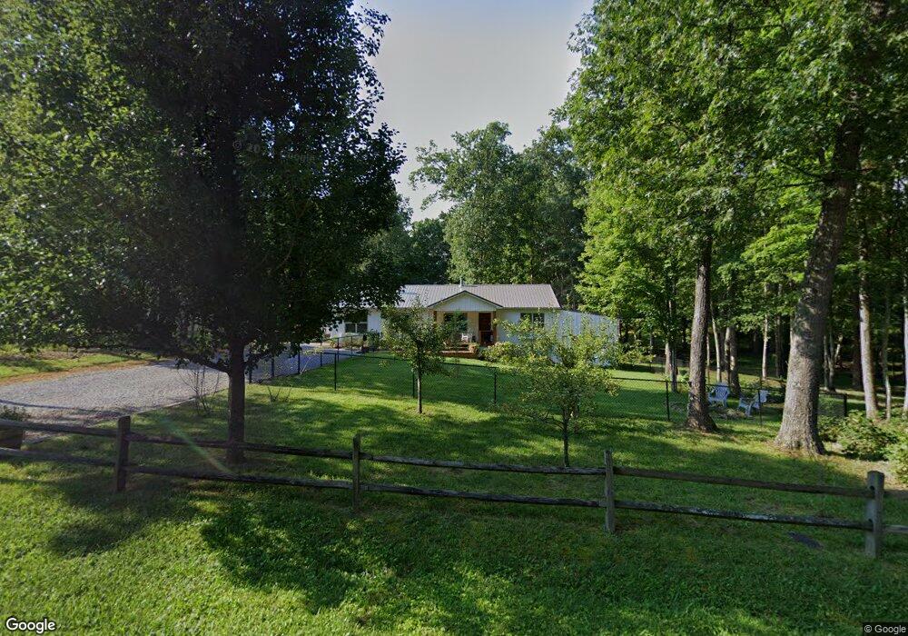
1075 N Shady Lane Loop Clarkrange, TN 38553
Estimated Value: $261,000 - $289,000
Studio
2
Baths
1,512
Sq Ft
$178/Sq Ft
Est. Value
About This Home
This home is located at 1075 N Shady Lane Loop, Clarkrange, TN 38553 and is currently estimated at $269,370, approximately $178 per square foot. 1075 N Shady Lane Loop is a home located in Fentress County.
Ownership History
Date
Name
Owned For
Owner Type
Purchase Details
Closed on
Feb 19, 2021
Sold by
Mitchell Ruth
Bought by
Calhoun Robert O and Calhoun Fay I
Current Estimated Value
Purchase Details
Closed on
Sep 23, 2005
Sold by
Not Provided
Bought by
Calhoun Robert O
Home Financials for this Owner
Home Financials are based on the most recent Mortgage that was taken out on this home.
Original Mortgage
$67,900
Interest Rate
5.72%
Mortgage Type
Cash
Purchase Details
Closed on
Apr 12, 2005
Sold by
Not Provided
Bought by
Calhoun Robert O
Create a Home Valuation Report for This Property
The Home Valuation Report is an in-depth analysis detailing your home's value as well as a comparison with similar homes in the area
Purchase History
| Date | Buyer | Sale Price | Title Company |
|---|---|---|---|
| Calhoun Robert O | $7,800 | None Available | |
| Calhoun Robert O | $87,900 | -- | |
| Calhoun Robert O | $6,500 | -- |
Source: Public Records
Mortgage History
| Date | Status | Borrower | Loan Amount |
|---|---|---|---|
| Previous Owner | Calhoun Robert O | $67,900 | |
| Previous Owner | Calhoun Robert O | $20,000 |
Source: Public Records
Tax History
| Year | Tax Paid | Tax Assessment Tax Assessment Total Assessment is a certain percentage of the fair market value that is determined by local assessors to be the total taxable value of land and additions on the property. | Land | Improvement |
|---|---|---|---|---|
| 2025 | $616 | $45,600 | $0 | $0 |
| 2024 | $616 | $45,600 | $4,475 | $41,125 |
| 2023 | $616 | $45,600 | $4,475 | $41,125 |
| 2022 | $537 | $28,125 | $3,200 | $24,925 |
| 2021 | $537 | $28,125 | $3,200 | $24,925 |
| 2020 | $511 | $26,750 | $1,825 | $24,925 |
| 2019 | $492 | $25,775 | $1,825 | $23,950 |
| 2018 | $492 | $25,775 | $1,825 | $23,950 |
| 2017 | $487 | $24,525 | $1,825 | $22,700 |
| 2016 | $487 | $24,525 | $1,825 | $22,700 |
| 2015 | $487 | $24,530 | $0 | $0 |
| 2014 | $450 | $22,688 | $0 | $0 |
Source: Public Records
Map
Nearby Homes
- 1070 N Shady Lane Loop
- 6006 S York Hwy
- 145 Rhum Rd
- 6105 S York Hwy
- 6105 S South York Hwy
- 5740 S York Hwy
- 1011 Fox Ridge Dr
- 106 MacA Ridge Cir
- 634 Robs Rd
- 338 Swallows Crossing
- 1383 Old Bean Shed Rd
- 1255 Franklin Loop
- 164 Green Acres
- 5550 S York Hwy
- 1174 Hargis Rd
- 5534 S York Hwy
- 2019 Martha Washington Rd
- 2570 Martha Washington Rd
- 5424 Wilder Rd
- 1068 Hargis Rd
- 1071 N Shady Lane Loop
- 0 N Shady Ln Unit 144433
- 0 N Shady Ln Unit 682369
- 0 N Shady Ln Unit 744285
- 0 N Shady Ln Unit 766115
- 1065 N Shady Lane Loop
- 107 Stults Short Cut Rd
- 1080 N Shady Lane Loop
- 1066 N Shady Lane Loop
- 1086 N Shady Lane Loop
- 1057 N Shady Lane Loop
- 49 N Shady Lane Loop
- Lot 45 N Shady Lane Loop
- Lot 36 N Shady Lane Loop
- Lot 32 N Shady Lane Loop
- 102 Stults Short Cut Rd N
- n/a Shady Lane Loop
- 0 Shady Lane Loop
- 1058 N Shady Lane Loop
- 1055 N Shady Lane Loop