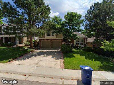
10921 Main Range Trail Littleton, CO 80127
Ken Caryl NeighborhoodEstimated Value: $782,316 - $893,000
4
Beds
5
Baths
2,931
Sq Ft
$280/Sq Ft
Est. Value
About This Home
This home is located at 10921 Main Range Trail, Littleton, CO 80127 and is currently estimated at $820,329, approximately $279 per square foot. 10921 Main Range Trail is a home located in Jefferson County with nearby schools including Shaffer Elementary School, Falcon Bluffs Middle School, and Chatfield High School.
Ownership History
Date
Name
Owned For
Owner Type
Purchase Details
Closed on
Mar 23, 2023
Sold by
Langley James P
Bought by
Langley Family Trust
Current Estimated Value
Purchase Details
Closed on
Jun 15, 1998
Sold by
Conkling Paul S and Demoss Yvonne R
Bought by
Langley James P and Langley Laurie A
Home Financials for this Owner
Home Financials are based on the most recent Mortgage that was taken out on this home.
Original Mortgage
$127,500
Interest Rate
7.17%
Create a Home Valuation Report for This Property
The Home Valuation Report is an in-depth analysis detailing your home's value as well as a comparison with similar homes in the area
Home Values in the Area
Average Home Value in this Area
Purchase History
| Date | Buyer | Sale Price | Title Company |
|---|---|---|---|
| Langley Family Trust | -- | -- | |
| Langley James P | $232,500 | First American Heritage Titl |
Source: Public Records
Mortgage History
| Date | Status | Borrower | Loan Amount |
|---|---|---|---|
| Previous Owner | Langley James P | $100,000 | |
| Previous Owner | Langley James P | $127,500 |
Source: Public Records
Tax History Compared to Growth
Tax History
| Year | Tax Paid | Tax Assessment Tax Assessment Total Assessment is a certain percentage of the fair market value that is determined by local assessors to be the total taxable value of land and additions on the property. | Land | Improvement |
|---|---|---|---|---|
| 2024 | $3,894 | $43,075 | $10,126 | $32,949 |
| 2023 | $3,894 | $43,075 | $10,126 | $32,949 |
| 2022 | $3,951 | $36,093 | $8,244 | $27,849 |
| 2021 | $4,012 | $37,132 | $8,481 | $28,651 |
| 2020 | $3,517 | $32,663 | $6,609 | $26,054 |
| 2019 | $3,476 | $32,663 | $6,609 | $26,054 |
| 2018 | $3,166 | $28,736 | $6,867 | $21,869 |
| 2017 | $2,944 | $28,736 | $6,867 | $21,869 |
| 2016 | $3,209 | $29,642 | $8,429 | $21,213 |
| 2015 | $2,891 | $29,642 | $8,429 | $21,213 |
| 2014 | $2,891 | $25,160 | $6,685 | $18,475 |
Source: Public Records
Map
Nearby Homes
- 10961 Main Range Trail
- 10743 W Turtle Mountain
- 11245 San Joaquin Ridge
- 8140 S Storm King Peak
- 11404 W Sharkstooth Peak
- 10966 W Half Moon Pass
- 10627 W Chautauga Mountain
- 8101 S San Juan Range Rd
- 7567 Parkview Mountain
- 10895 W Half Moon Pass
- 10587 W Chautauga Mountain
- 10866 W Half Moon Pass
- 10802 W Indore Dr
- 8040 S Culebra Peak
- 10685 W Apishapa Pass
- 8008 W Spanish Peak
- 10433 Red Mountain W
- 7433 S Quail Cir Unit 1924
- 10588 Park Mountain E
- 7489 S Quail Cir Unit 814
- 10921 Main Range Trail
- 10931 Main Range Trail
- 10911 Main Range Trail
- 10941 Main Range Trail
- 10901 Main Range Trail
- 10951 Main Range Trail
- 10932 Main Range Trail
- 10922 Main Range Trail
- 10942 Main Range Trail
- 10912 Main Range Trail
- 10706 W Devils Head
- 10952 Main Range Trail
- 10902 Main Range Trail
- 10741 W Dakan Mountain
- 10971 Main Range Trail
- 7708 Gunsight Pass
- 7760 Crystal Peak
- 7816 Cathedral Peak
- 10962 Main Range Trail
- 10686 W Devils Head