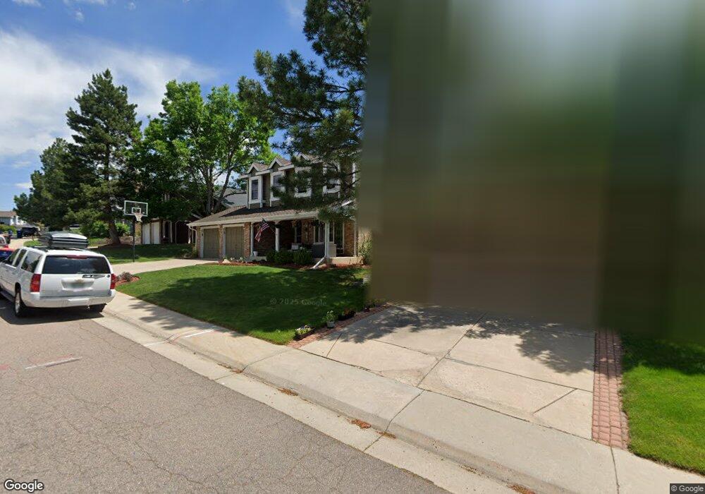
10931 Main Range Trail Littleton, CO 80127
Ken Caryl Ranch NeighborhoodEstimated Value: $835,000 - $896,000
5
Beds
4
Baths
3,688
Sq Ft
$235/Sq Ft
Est. Value
About This Home
This home is located at 10931 Main Range Trail, Littleton, CO 80127 and is currently estimated at $867,953, approximately $235 per square foot. 10931 Main Range Trail is a home located in Jefferson County with nearby schools including Shaffer Elementary School, Falcon Bluffs Middle School, and Chatfield High School.
Ownership History
Date
Name
Owned For
Owner Type
Purchase Details
Closed on
Aug 2, 2019
Sold by
Petty Julie
Bought by
Sprague Julia and Sprague Micah C
Current Estimated Value
Home Financials for this Owner
Home Financials are based on the most recent Mortgage that was taken out on this home.
Original Mortgage
$480,000
Outstanding Balance
$421,252
Interest Rate
3.8%
Mortgage Type
New Conventional
Estimated Equity
$446,701
Purchase Details
Closed on
Jul 6, 2017
Sold by
Hood Steve
Bought by
Petty Julie
Purchase Details
Closed on
Sep 5, 2013
Sold by
Hood Janice
Bought by
Hood Steve
Purchase Details
Closed on
Jul 27, 2010
Sold by
Hood Steven
Bought by
Hood Steve and Hood Janice
Home Financials for this Owner
Home Financials are based on the most recent Mortgage that was taken out on this home.
Original Mortgage
$242,499
Interest Rate
4.25%
Mortgage Type
New Conventional
Purchase Details
Closed on
Jun 6, 2003
Sold by
Miller Jay A and Miller Robyn W
Bought by
Hood Steven
Home Financials for this Owner
Home Financials are based on the most recent Mortgage that was taken out on this home.
Original Mortgage
$240,000
Interest Rate
4.5%
Mortgage Type
New Conventional
Purchase Details
Closed on
Jul 21, 1994
Sold by
Coy Don E and Coy Linda
Bought by
Miller Jay A and Miller Robyn W
Home Financials for this Owner
Home Financials are based on the most recent Mortgage that was taken out on this home.
Original Mortgage
$132,500
Interest Rate
8.3%
Create a Home Valuation Report for This Property
The Home Valuation Report is an in-depth analysis detailing your home's value as well as a comparison with similar homes in the area
Home Values in the Area
Average Home Value in this Area
Purchase History
| Date | Buyer | Sale Price | Title Company |
|---|---|---|---|
| Sprague Julia | $600,000 | Land Title Guarantee Co | |
| Petty Julie | $530,500 | Stewrt Title | |
| Hood Steve | -- | None Available | |
| Hood Steve | -- | Land Title Guarantee Company | |
| Hood Steven | $300,000 | -- | |
| Miller Jay A | $182,500 | Commonwealth Land Title Ins |
Source: Public Records
Mortgage History
| Date | Status | Borrower | Loan Amount |
|---|---|---|---|
| Open | Sprague Julia | $480,000 | |
| Previous Owner | Hood Steve | $242,499 | |
| Previous Owner | Hood Steven | $240,000 | |
| Previous Owner | Miller Jay A | $132,500 |
Source: Public Records
Tax History Compared to Growth
Tax History
| Year | Tax Paid | Tax Assessment Tax Assessment Total Assessment is a certain percentage of the fair market value that is determined by local assessors to be the total taxable value of land and additions on the property. | Land | Improvement |
|---|---|---|---|---|
| 2024 | $5,539 | $51,739 | $10,126 | $41,613 |
| 2023 | $5,539 | $51,739 | $10,126 | $41,613 |
| 2022 | $4,665 | $42,613 | $8,244 | $34,369 |
| 2021 | $4,736 | $43,839 | $8,481 | $35,358 |
| 2020 | $4,190 | $38,912 | $6,609 | $32,303 |
| 2019 | $4,140 | $38,912 | $6,609 | $32,303 |
| 2018 | $3,203 | $29,068 | $6,867 | $22,201 |
| 2017 | $2,978 | $29,068 | $6,867 | $22,201 |
| 2016 | $3,174 | $29,006 | $8,429 | $20,577 |
| 2015 | $2,846 | $29,006 | $8,429 | $20,577 |
| 2014 | $2,846 | $24,770 | $6,685 | $18,085 |
Source: Public Records
Map
Nearby Homes
- 7825 Sand Mountain
- 7747 Gunsight Pass
- 10791 Trailrider Pass
- 10494 W Turtle Mountain
- 10567 W Chautauga Mountain
- 10866 W Half Moon Pass
- 10550 W Raspberry Mountain
- 11104 W San Juan Range Rd
- 11617 Elk Head Range Rd
- 10606 Park Mountain W
- 11703 Elk Head Range Rd
- 7413 S Quail Cir Unit 1417
- 10355 Red Mountain E
- 10351 Red Mountain E
- 7418 S Quail Cir Unit 1315
- 11804 Elk Head Range Rd
- 11781 Elk Head Range Rd
- Willow Plan at Ken-Caryl Ranch - Deer Creek
- Ponderosa Plan at Ken-Caryl Ranch - Deer Creek
- 11341 W Alder Dr
- 10921 Main Range Trail
- 10941 Main Range Trail
- 10911 Main Range Trail
- 10951 Main Range Trail
- 10901 Main Range Trail
- 10942 Main Range Trail
- 10932 Main Range Trail
- 10952 Main Range Trail
- 10922 Main Range Trail
- 10706 W Devils Head
- 10912 Main Range Trail
- 10971 Main Range Trail
- 10962 Main Range Trail
- 7708 Gunsight Pass
- 10902 Main Range Trail
- 10695 W Devils Head
- 10741 W Dakan Mountain
- 10972 Main Range Trail
- 10981 Main Range Trail
- 7760 Crystal Peak