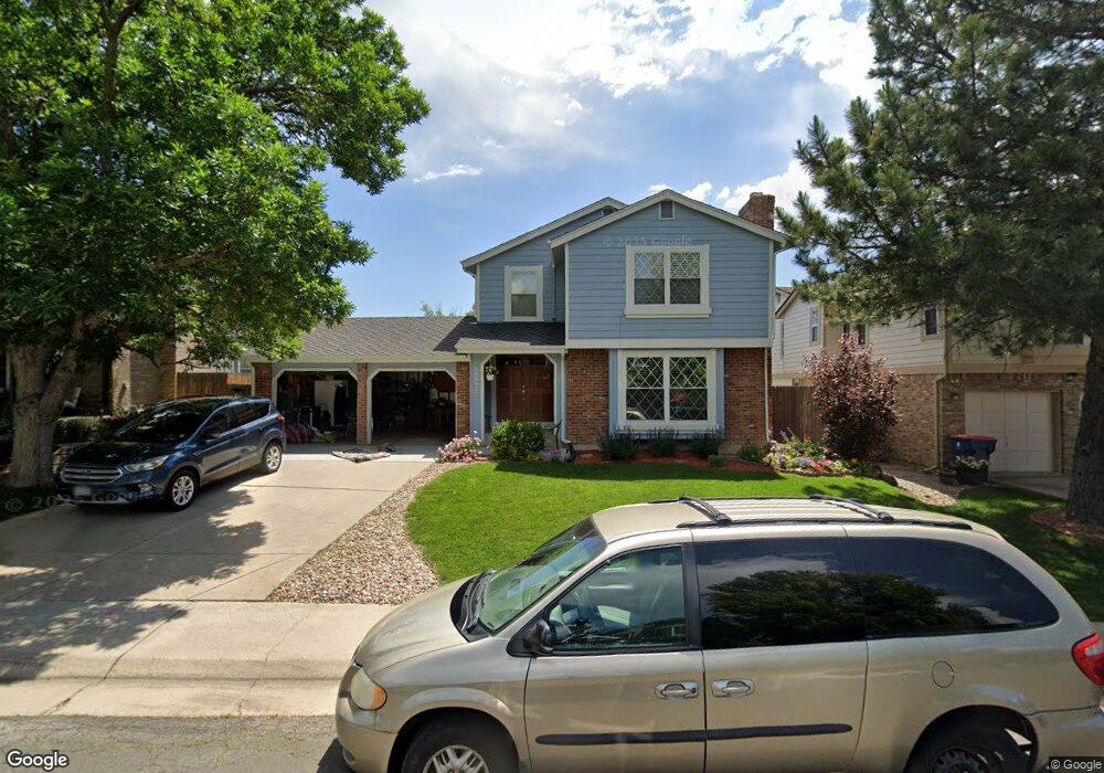
10971 Main Range Trail Littleton, CO 80127
Ken Caryl Ranch NeighborhoodEstimated Value: $675,595 - $724,000
3
Beds
5
Baths
2,115
Sq Ft
$331/Sq Ft
Est. Value
About This Home
This home is located at 10971 Main Range Trail, Littleton, CO 80127 and is currently estimated at $700,649, approximately $331 per square foot. 10971 Main Range Trail is a home located in Jefferson County with nearby schools including Shaffer Elementary School, Falcon Bluffs Middle School, and Chatfield High School.
Ownership History
Date
Name
Owned For
Owner Type
Purchase Details
Closed on
Mar 16, 2007
Sold by
Wooley Timothy A and Wooley Juanita M
Bought by
Veres Russell W and Veres Fedelina A Giron
Current Estimated Value
Home Financials for this Owner
Home Financials are based on the most recent Mortgage that was taken out on this home.
Original Mortgage
$56,600
Interest Rate
6.05%
Mortgage Type
Unknown
Purchase Details
Closed on
Feb 1, 2000
Sold by
Wooley Timothy A Woodcock Juanita M and Wooley Juanita B
Bought by
Wooley Timothy A and Wooley Juanita M
Purchase Details
Closed on
Jan 7, 1998
Sold by
Schilling Christopher D and Schilling Debra L
Bought by
Wooley Timothy A and Woodcock Juanita M
Home Financials for this Owner
Home Financials are based on the most recent Mortgage that was taken out on this home.
Original Mortgage
$147,900
Interest Rate
7.14%
Create a Home Valuation Report for This Property
The Home Valuation Report is an in-depth analysis detailing your home's value as well as a comparison with similar homes in the area
Home Values in the Area
Average Home Value in this Area
Purchase History
| Date | Buyer | Sale Price | Title Company |
|---|---|---|---|
| Veres Russell W | $283,000 | Land Title Guarantee Company | |
| Wooley Timothy A | -- | -- | |
| Wooley Timothy A | $184,900 | First American |
Source: Public Records
Mortgage History
| Date | Status | Borrower | Loan Amount |
|---|---|---|---|
| Closed | Veres Russell W | $56,600 | |
| Open | Veres Russell W | $226,400 | |
| Previous Owner | Wooley Timothy A | $147,900 |
Source: Public Records
Tax History
| Year | Tax Paid | Tax Assessment Tax Assessment Total Assessment is a certain percentage of the fair market value that is determined by local assessors to be the total taxable value of land and additions on the property. | Land | Improvement |
|---|---|---|---|---|
| 2024 | $4,190 | $39,135 | $10,330 | $28,805 |
| 2023 | $4,190 | $39,135 | $10,330 | $28,805 |
| 2022 | $3,741 | $34,174 | $8,377 | $25,797 |
| 2021 | $3,798 | $35,158 | $8,618 | $26,540 |
| 2020 | $3,358 | $31,186 | $6,902 | $24,284 |
| 2019 | $3,318 | $31,186 | $6,902 | $24,284 |
| 2018 | $2,964 | $26,901 | $6,750 | $20,151 |
| 2017 | $2,756 | $26,901 | $6,750 | $20,151 |
| 2016 | $2,900 | $26,785 | $8,429 | $18,356 |
| 2015 | $2,587 | $26,785 | $8,429 | $18,356 |
| 2014 | $2,587 | $22,517 | $6,685 | $15,832 |
Source: Public Records
Map
Nearby Homes
- 10791 Trailrider Pass
- 8140 S Storm King Peak
- 7580 S Lost Ranger Peak
- 10463 W Turtle Mountain
- 11446 San Joaquin Ridge
- 7448 S Quail Cir Unit 2214
- 10866 W Half Moon Pass
- 11369 W Park Range Rd
- 8221 S San Juan Range Rd
- 10550 W Raspberry Mountain
- 7433 S Quail Cir Unit 1913
- 7776 S Crestone Peak
- 7463 S Quail Cir Unit 312
- 7423 S Quail Cir Unit 1535
- 7473 S Quail Cir Unit 521
- 11104 W San Juan Range Rd
- 8077 S Vermejo Peak
- 7422 S Quail Cir Unit 1615
- 7831 Sangre de Cristo Rd
- 11804 Elk Head Range Rd
- 10981 Main Range Trail
- 10951 Main Range Trail
- 10972 Main Range Trail
- 10941 Main Range Trail
- 7658 Snowmass Mountain
- 10962 Main Range Trail
- 10982 Main Range Trail
- 10695 W Devils Head
- 10931 Main Range Trail
- 7648 Snowmass Mountain
- 7657 Snowmass Mountain
- 10952 Main Range Trail
- 10992 Main Range Trail
- 7707 Gunsight Pass
- 10921 Main Range Trail
- 7638 Snowmass Mountain
- 7647 Snowmass Mountain
- 10675 W Devils Head
- 10942 Main Range Trail
- 10706 W Devils Head
Your Personal Tour Guide
Ask me questions while you tour the home.