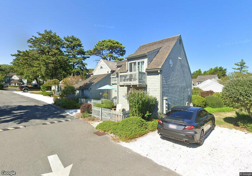
11 Hyannis Point Rd Mashpee, MA 02649
New Seabury-Popponesset Island NeighborhoodEstimated Value: $773,000 - $990,000
2
Beds
2
Baths
840
Sq Ft
$1,003/Sq Ft
Est. Value
About This Home
This home is located at 11 Hyannis Point Rd, Mashpee, MA 02649 and is currently estimated at $842,188, approximately $1,002 per square foot. 11 Hyannis Point Rd is a home located in Barnstable County with nearby schools including Kenneth C. Coombs School, Quashnet School, and Mashpee Middle School.
Ownership History
Date
Name
Owned For
Owner Type
Purchase Details
Closed on
Mar 13, 1998
Sold by
Courneen James J and Courneen Carol M
Bought by
Theroux Richard M
Current Estimated Value
Purchase Details
Closed on
Nov 1, 1996
Sold by
Rollie Rt
Bought by
Courneen James J
Home Financials for this Owner
Home Financials are based on the most recent Mortgage that was taken out on this home.
Original Mortgage
$103,600
Interest Rate
8.07%
Mortgage Type
Purchase Money Mortgage
Create a Home Valuation Report for This Property
The Home Valuation Report is an in-depth analysis detailing your home's value as well as a comparison with similar homes in the area
Home Values in the Area
Average Home Value in this Area
Purchase History
| Date | Buyer | Sale Price | Title Company |
|---|---|---|---|
| Theroux Richard M | $146,500 | -- | |
| Courneen James J | $129,500 | -- |
Source: Public Records
Mortgage History
| Date | Status | Borrower | Loan Amount |
|---|---|---|---|
| Previous Owner | Courneen James J | $103,600 |
Source: Public Records
Tax History
| Year | Tax Paid | Tax Assessment Tax Assessment Total Assessment is a certain percentage of the fair market value that is determined by local assessors to be the total taxable value of land and additions on the property. | Land | Improvement |
|---|---|---|---|---|
| 2025 | $4,474 | $675,900 | $0 | $675,900 |
| 2024 | $4,141 | $644,000 | $0 | $644,000 |
| 2023 | $3,858 | $550,300 | $0 | $550,300 |
| 2022 | $3,483 | $426,300 | $0 | $426,300 |
| 2021 | $3,561 | $392,600 | $0 | $392,600 |
| 2020 | $3,663 | $403,000 | $0 | $403,000 |
| 2019 | $3,547 | $391,900 | $0 | $391,900 |
| 2018 | $3,397 | $380,800 | $0 | $380,800 |
| 2017 | $3,437 | $374,000 | $0 | $374,000 |
| 2016 | $3,326 | $360,000 | $0 | $360,000 |
| 2015 | $3,158 | $346,700 | $0 | $346,700 |
| 2014 | $3,217 | $342,600 | $0 | $342,600 |
Source: Public Records
Map
Nearby Homes
- 15 Brant Rock Rd Unit 765
- 6 Hammock Pond Rd
- 6 Hammock Pond Rd Unit 6
- 3 Hyannis Point Rd Unit 790
- 3 Hyannis Point Rd
- 21 Milestone Way Unit 620
- 33 Landmark Ave
- 11 Milestone Way Unit 624
- 25 Milestone Way Unit 25
- 25 Milestone Way
- 46 Greensward Cir
- 101 Greensward Rd
- 251 Shore Dr Unit D2
- 251 Shore Dr Unit D2
- 16 Slice Way
- 7 Blue Fin
- 42 Fells Pond Rd
- 128 Uncle Percys Rd
- 37 The Hunt Cir
- 22 Mid Iron Way Unit 7511
- 17 Hyannis Point Rd
- 17 Hyannis Point Rd Unit 17
- 17 Hyannis Point Rd Unit 775
- 19 Hyannis Point Rd
- 15 Hyannis Point Rd Unit 774
- 15 Hyannis Point Rd
- 9 Hydrangea Ln
- 9 Hyannis Point Rd
- 7 Hyannis Point Rd
- 9 Hyannis Point Rd Unit 772
- 7 Hyannis Point Rd Unit 771
- 7 Wharf Ave
- 5 Wharf Ave
- 3 Hydrangea Ln
- 3 Folgers Way
- 7 Folgers Way
- 3 Folgers Way Unit 3
- 3 Folgers Way Unit 752
- 6 Hyannis Point Rd
- 6 Hyannis Point Rd Unit 6
Your Personal Tour Guide
Ask me questions while you tour the home.