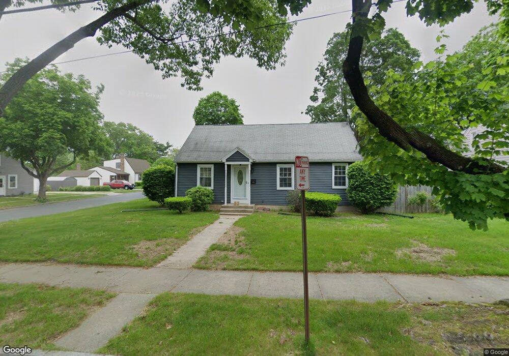
111 Lancaster St Springfield, MA 01118
East Forest Park NeighborhoodEstimated Value: $302,000 - $317,000
3
Beds
1
Bath
1,242
Sq Ft
$249/Sq Ft
Est. Value
About This Home
This home is located at 111 Lancaster St, Springfield, MA 01118 and is currently estimated at $309,741, approximately $249 per square foot. 111 Lancaster St is a home located in Hampden County with nearby schools including Mary A. Dryden Veterans Memorial School, M Marcus Kiley Middle, and Springfield High School of Science and Technology.
Ownership History
Date
Name
Owned For
Owner Type
Purchase Details
Closed on
Aug 20, 2003
Sold by
Maloney Ruth S
Bought by
Anderson Robert J
Current Estimated Value
Home Financials for this Owner
Home Financials are based on the most recent Mortgage that was taken out on this home.
Original Mortgage
$131,100
Outstanding Balance
$57,311
Interest Rate
5.52%
Mortgage Type
Purchase Money Mortgage
Estimated Equity
$252,431
Purchase Details
Closed on
Jun 12, 2003
Sold by
Maloney Joseph P and Bowman Judith A
Bought by
Maloney Ruth S
Create a Home Valuation Report for This Property
The Home Valuation Report is an in-depth analysis detailing your home's value as well as a comparison with similar homes in the area
Home Values in the Area
Average Home Value in this Area
Purchase History
| Date | Buyer | Sale Price | Title Company |
|---|---|---|---|
| Anderson Robert J | $138,000 | -- | |
| Maloney Ruth S | -- | -- |
Source: Public Records
Mortgage History
| Date | Status | Borrower | Loan Amount |
|---|---|---|---|
| Open | Anderson Robert J | $131,100 |
Source: Public Records
Tax History
| Year | Tax Paid | Tax Assessment Tax Assessment Total Assessment is a certain percentage of the fair market value that is determined by local assessors to be the total taxable value of land and additions on the property. | Land | Improvement |
|---|---|---|---|---|
| 2025 | $4,444 | $283,400 | $47,200 | $236,200 |
| 2024 | $4,076 | $253,800 | $47,200 | $206,600 |
| 2023 | $4,372 | $256,400 | $45,000 | $211,400 |
| 2022 | $3,826 | $203,300 | $45,000 | $158,300 |
| 2021 | $3,357 | $177,600 | $40,800 | $136,800 |
| 2020 | $3,318 | $169,900 | $40,800 | $129,100 |
| 2019 | $3,135 | $159,300 | $40,800 | $118,500 |
| 2018 | $3,147 | $159,900 | $40,800 | $119,100 |
| 2017 | $3,039 | $154,600 | $40,800 | $113,800 |
| 2016 | $2,931 | $149,100 | $40,800 | $108,300 |
| 2015 | $2,939 | $149,400 | $40,800 | $108,600 |
Source: Public Records
Map
Nearby Homes
- 118 Pilgrim Rd
- 170 Plumtree Rd
- 7 Ashbrook St
- 75 Gillette Cir
- 134 Eddywood St
- 79 Arvilla St
- 384 Abbott St
- 44 Amanda St
- 79 Roosevelt Ave
- 22 Amanda St
- 54 S Shore Dr
- 47 Hartford Terrace
- 55 Mandalay Rd
- 236 Pondview Dr
- 509 Plumtree Rd
- 37 Chesterfield Ave
- 1088 Sumner Ave
- 410 Allen St
- 13 Bither St
- 59 Daviston St
- 105 Lancaster St
- 108 Grandview St
- 104 Grandview St Unit 1
- 123 Lancaster St
- 98 Grandview St
- 112 Lancaster St
- 142 Cambria St
- 106 Lancaster St
- 120 Lancaster St
- 94 Grandview St
- 100 Lancaster St
- 287 Surrey Rd
- 293 Surrey Rd
- 279 Surrey Rd
- 88 Grandview St
- 150 Cambria St
- 299 Surrey Rd
- 273 Surrey Rd
- 94 Lancaster St
- 107 Grandview St
Your Personal Tour Guide
Ask me questions while you tour the home.