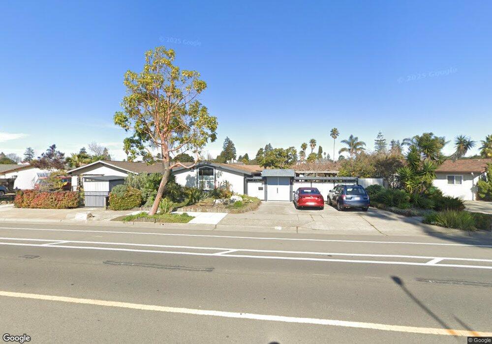
1113 Otis Dr Alameda, CA 94501
South Shore NeighborhoodEstimated Value: $1,418,000 - $1,494,000
4
Beds
2
Baths
1,911
Sq Ft
$759/Sq Ft
Est. Value
About This Home
This home is located at 1113 Otis Dr, Alameda, CA 94501 and is currently estimated at $1,449,928, approximately $758 per square foot. 1113 Otis Dr is a home located in Alameda County with nearby schools including Franklin Elementary, Will C. Wood Middle School, and Encinal Junior/Senior High.
Ownership History
Date
Name
Owned For
Owner Type
Purchase Details
Closed on
Aug 5, 2020
Sold by
Wilson Harvey and Beary Monica
Bought by
Beary Monica L and Wilson Harvey
Current Estimated Value
Home Financials for this Owner
Home Financials are based on the most recent Mortgage that was taken out on this home.
Original Mortgage
$211,000
Outstanding Balance
$187,172
Interest Rate
3%
Mortgage Type
New Conventional
Estimated Equity
$1,262,756
Purchase Details
Closed on
Jul 22, 2019
Sold by
Wilson Harvey and Beary Monica L
Bought by
Wilson Harvey and Beary Monica L
Purchase Details
Closed on
Aug 20, 2018
Sold by
Wilson Harvey and Beary Monica L
Bought by
Wilson Harvey and Beary Monica L
Purchase Details
Closed on
Oct 23, 1997
Sold by
Kestler James M
Bought by
Wilson Harvey and Beary Monica L
Home Financials for this Owner
Home Financials are based on the most recent Mortgage that was taken out on this home.
Original Mortgage
$304,000
Interest Rate
7.49%
Create a Home Valuation Report for This Property
The Home Valuation Report is an in-depth analysis detailing your home's value as well as a comparison with similar homes in the area
Home Values in the Area
Average Home Value in this Area
Purchase History
| Date | Buyer | Sale Price | Title Company |
|---|---|---|---|
| Beary Monica L | -- | Old Republic Title Company | |
| Wilson Harvey | -- | None Available | |
| Wilson Harvey | -- | None Available | |
| Wilson Harvey | $380,000 | Commonwealth Land Title Co |
Source: Public Records
Mortgage History
| Date | Status | Borrower | Loan Amount |
|---|---|---|---|
| Open | Beary Monica L | $211,000 | |
| Closed | Wilson Harvey | $304,000 |
Source: Public Records
Tax History
| Year | Tax Paid | Tax Assessment Tax Assessment Total Assessment is a certain percentage of the fair market value that is determined by local assessors to be the total taxable value of land and additions on the property. | Land | Improvement |
|---|---|---|---|---|
| 2025 | $8,398 | $599,734 | $182,020 | $424,714 |
| 2024 | $8,398 | $587,840 | $178,452 | $416,388 |
| 2023 | $8,051 | $583,177 | $174,953 | $408,224 |
| 2022 | $7,851 | $564,743 | $171,523 | $400,220 |
| 2021 | $7,641 | $553,533 | $168,160 | $392,373 |
| 2020 | $7,537 | $554,788 | $166,436 | $388,352 |
| 2019 | $7,424 | $543,912 | $163,173 | $380,739 |
| 2018 | $7,226 | $533,250 | $159,975 | $373,275 |
| 2017 | $6,882 | $522,795 | $156,838 | $365,957 |
| 2016 | $7,494 | $512,547 | $153,764 | $358,783 |
| 2015 | $7,466 | $504,848 | $151,454 | $353,394 |
| 2014 | $7,092 | $494,960 | $148,488 | $346,472 |
Source: Public Records
Map
Nearby Homes
- 955 Shorepoint Ct Unit 110
- 955 Shorepoint Ct Unit 216
- 1246 Otis Dr
- 400 Harbor Light Rd
- 960 Shorepoint Ct Unit 215
- 1259 Hawthorne St
- 1220 9th St
- 1000 Central Ave
- 1203 Benton St
- 1301 9th St
- 1814 Clinton Ave
- 325 Kitty Hawk Rd Unit 207
- 325 Kitty Hawk Rd Unit 304
- 1211 Paru St
- 1500 Alameda Ave Unit G
- 1427 Bay St
- 610 Grand St
- 911 Taylor Ave
- 1822 San Antonio Ave
- 1401 Cottage St Unit D
- 1109 Otis Dr
- 1121 Otis Dr
- 609 Windemere Isle
- 600 Larchmont Isle
- 615 Windemere Isle
- 612 Larchmont Isle
- 1118 Otis Dr
- 1112 Otis Dr
- 1124 Otis Dr
- 618 Larchmont Isle
- 621 Windemere Isle
- 1106 Otis Dr
- 1130 Otis Dr
- 1100 Otis Dr
- 624 Larchmont Isle
- 600 Windemere Isle
- 627 Windemere Isle
- 612 Windemere Isle
- 1136 Otis Dr
- 1121 Rosewood Way
Your Personal Tour Guide
Ask me questions while you tour the home.