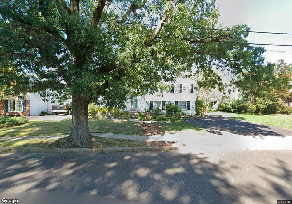
1127 Emerald Ave Lansdale, PA 19446
Estimated Value: $342,000 - $479,000
3
Beds
2
Baths
1,827
Sq Ft
$222/Sq Ft
Est. Value
About This Home
This home is located at 1127 Emerald Ave, Lansdale, PA 19446 and is currently estimated at $405,357, approximately $221 per square foot. 1127 Emerald Ave is a home located in Montgomery County with nearby schools including Oak Park El School, Penndale Middle School, and North Penn Senior High School.
Ownership History
Date
Name
Owned For
Owner Type
Purchase Details
Closed on
Jul 31, 2025
Sold by
Maier Nancy R
Bought by
Rossi Michael Patrick and Pardoski Joseph
Current Estimated Value
Home Financials for this Owner
Home Financials are based on the most recent Mortgage that was taken out on this home.
Original Mortgage
$324,900
Outstanding Balance
$324,621
Interest Rate
6.77%
Mortgage Type
New Conventional
Estimated Equity
$80,736
Purchase Details
Closed on
Jan 1, 1962
Bought by
Maier Rudolph and Maier Nancy R
Create a Home Valuation Report for This Property
The Home Valuation Report is an in-depth analysis detailing your home's value as well as a comparison with similar homes in the area
Home Values in the Area
Average Home Value in this Area
Purchase History
| Date | Buyer | Sale Price | Title Company |
|---|---|---|---|
| Rossi Michael Patrick | $342,000 | Rocket Close Llc-Residential | |
| Maier Rudolph | -- | -- |
Source: Public Records
Mortgage History
| Date | Status | Borrower | Loan Amount |
|---|---|---|---|
| Open | Rossi Michael Patrick | $324,900 |
Source: Public Records
Tax History Compared to Growth
Tax History
| Year | Tax Paid | Tax Assessment Tax Assessment Total Assessment is a certain percentage of the fair market value that is determined by local assessors to be the total taxable value of land and additions on the property. | Land | Improvement |
|---|---|---|---|---|
| 2025 | $4,604 | $114,980 | $38,950 | $76,030 |
| 2024 | $4,604 | $114,980 | $38,950 | $76,030 |
| 2023 | $4,406 | $114,980 | $38,950 | $76,030 |
| 2022 | $4,262 | $114,980 | $38,950 | $76,030 |
| 2021 | $4,141 | $114,980 | $38,950 | $76,030 |
| 2020 | $4,043 | $114,980 | $38,950 | $76,030 |
| 2019 | $3,976 | $114,980 | $38,950 | $76,030 |
| 2018 | $3,976 | $114,980 | $38,950 | $76,030 |
| 2017 | $3,824 | $114,980 | $38,950 | $76,030 |
| 2016 | $3,779 | $114,980 | $38,950 | $76,030 |
| 2015 | $3,627 | $114,980 | $38,950 | $76,030 |
| 2014 | $3,627 | $114,980 | $38,950 | $76,030 |
Source: Public Records
Map
Nearby Homes
- 1035 Forest Ave
- 1028 Poplar St Unit 75
- 833 W 4th St
- 204 N Valley Forge Rd Unit 7B
- 13 W End Dr
- 1315 Deer Run Rd
- 108 Allison Ct Unit 8
- 831 W Main St
- 21 S Valley Forge Rd Unit 213
- 217 Cherry Ln
- 1061 York Ave
- 816 Kenilworth Ave
- 920 Columbia Ave
- 302 W 8th St Unit 21
- 1226 Cabin Rd
- 245 Cherry Ln
- 1306 W Orvilla Rd
- 340 Central Dr
- 129 W Fifth St
- 1165 Mason Rd
- 1119 Emerald Ave
- 1135 Emerald Ave
- 1113 Emerald Ave
- 1143 Emerald Ave
- 545 Oak Park Rd
- 1151 Emerald Ave
- 1105 Emerald Ave
- 1126 Emerald Ave
- 1118 Emerald Ave
- 1134 Emerald Ave
- 1142 Emerald Ave
- 1112 Emerald Ave
- 1045 Emerald Ave
- 1159 Emerald Ave
- 541 Oak Park Rd
- 1104 Emerald Ave
- 1150 Emerald Ave
- 1050 Peaceful Ln
- 1034 Peaceful Ln
- 1038 Landis Ln