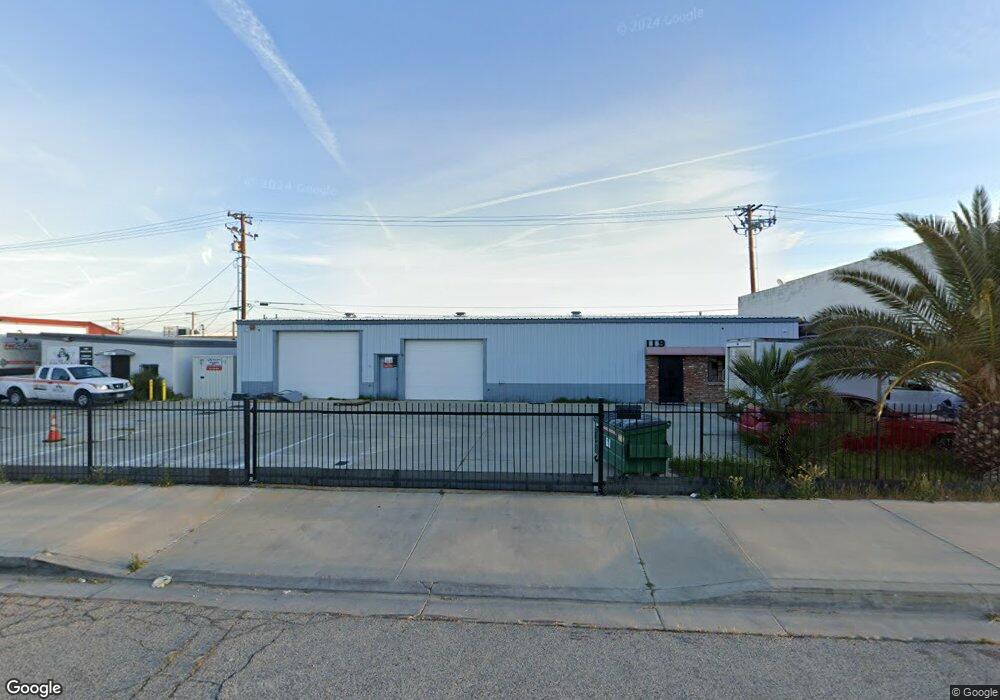
119 W Nugent St Lancaster, CA 93534
Central Lancaster NeighborhoodEstimated Value: $515,330
--
Bed
--
Bath
3,200
Sq Ft
$161/Sq Ft
Est. Value
About This Home
This home is located at 119 W Nugent St, Lancaster, CA 93534 and is currently estimated at $515,330, approximately $161 per square foot. 119 W Nugent St is a home located in Los Angeles County with nearby schools including El Dorado Elementary School, Piute Middle School, and Antelope Valley High School.
Ownership History
Date
Name
Owned For
Owner Type
Purchase Details
Closed on
May 27, 2021
Sold by
Martinez Marlon A and Martinez Jeanette
Bought by
Martinez Trust and Martinez
Current Estimated Value
Purchase Details
Closed on
Sep 19, 2012
Sold by
Chase Willis Edmund
Bought by
Martinez Marlon A and Martinez Jeanette
Home Financials for this Owner
Home Financials are based on the most recent Mortgage that was taken out on this home.
Original Mortgage
$150,000
Interest Rate
3.5%
Mortgage Type
Commercial
Create a Home Valuation Report for This Property
The Home Valuation Report is an in-depth analysis detailing your home's value as well as a comparison with similar homes in the area
Home Values in the Area
Average Home Value in this Area
Purchase History
| Date | Buyer | Sale Price | Title Company |
|---|---|---|---|
| Martinez Trust | -- | None Listed On Document | |
| Martinez Marlon A | $200,000 | Chicago Title Company |
Source: Public Records
Mortgage History
| Date | Status | Borrower | Loan Amount |
|---|---|---|---|
| Previous Owner | Martinez Marlon A | $150,000 |
Source: Public Records
Tax History Compared to Growth
Tax History
| Year | Tax Paid | Tax Assessment Tax Assessment Total Assessment is a certain percentage of the fair market value that is determined by local assessors to be the total taxable value of land and additions on the property. | Land | Improvement |
|---|---|---|---|---|
| 2025 | $3,953 | $246,276 | $123,138 | $123,138 |
| 2024 | $3,953 | $241,448 | $120,724 | $120,724 |
| 2023 | $3,882 | $236,714 | $118,357 | $118,357 |
| 2022 | $3,818 | $232,074 | $116,037 | $116,037 |
| 2021 | $3,751 | $227,524 | $113,762 | $113,762 |
| 2020 | $3,709 | $225,192 | $112,596 | $112,596 |
| 2019 | $3,643 | $220,778 | $110,389 | $110,389 |
| 2018 | $3,593 | $216,450 | $108,225 | $108,225 |
| 2016 | $3,389 | $208,046 | $104,023 | $104,023 |
| 2015 | $3,349 | $204,922 | $102,461 | $102,461 |
| 2014 | $3,307 | $200,908 | $100,454 | $100,454 |
Source: Public Records
Map
Nearby Homes
- 126 Nicobar St
- 119 W Pondera St Vic Division
- 44557 2nd St E
- 105 E Avenue J
- 44544 2nd St E
- 44502 2nd St E
- 44551 Stanridge Ave
- 125 E Avenue J
- 127 E Avenue J
- 0 0 Unit CV25218952
- 0 E Lancaster Blvd Unit PW25117467
- 0 E Lancaster Blvd Unit 22010684
- 1 Sierra Hwy
- 44441 Sierra Hwy
- 44442 Beech Ave
- 14 SR Sierra Hwy Unit K8
- 44817 Redwood Ave
- 44708 3rd St E
- 44739 3rd St E
- 44347 Stanridge Ave
- 0 Vac Nugent I12 Vic 138
- 0 Cor Norberry St Division Unit 17001438
- 0 Cor Norberry St Division Unit 18001865
- 118 W Nugent St
- 108/110 W Nugent St
- 108 W Nugent St
- 44571 Division St
- 44633 Division St
- 127 W Oldfield St
- 203 W Oldfield St
- 222 W Norberry St
- 116 Nicobar St
- 44645 Division St
- 128 Nicobar St
- 134 Nicobar St
- 44545 Division St
- 44618 Trevor Ave Unit 44618
- 44632 Trevor Ave
- 202 Nicobar St
- 0 Vic Nicobar and Division Unit 19004942