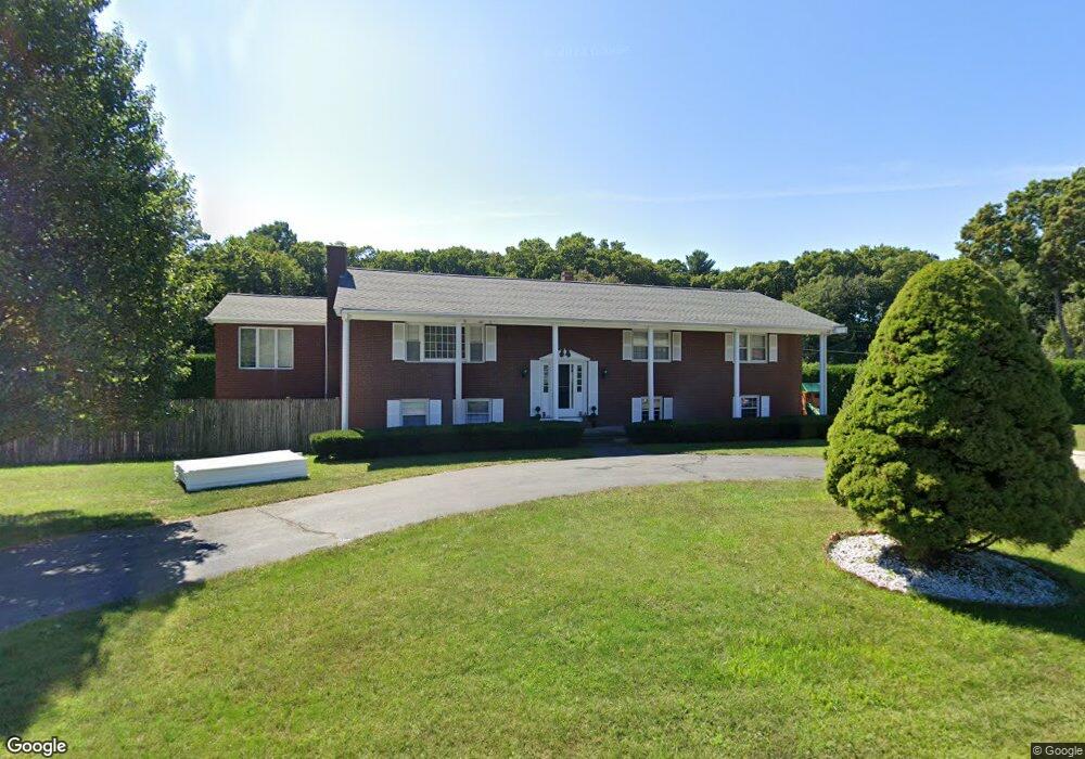
12 Crestwood Dr Andover, MA 01810
West Andover NeighborhoodEstimated Value: $1,099,000 - $1,396,000
4
Beds
3
Baths
3,404
Sq Ft
$353/Sq Ft
Est. Value
About This Home
This home is located at 12 Crestwood Dr, Andover, MA 01810 and is currently estimated at $1,202,744, approximately $353 per square foot. 12 Crestwood Dr is a home located in Essex County with nearby schools including Henry C. Sanborn Elementary School, Andover West Middle School, and Andover High School.
Ownership History
Date
Name
Owned For
Owner Type
Purchase Details
Closed on
Jul 8, 2015
Sold by
Alexandris Gregory
Bought by
Dhamsania Jay R and Dhamsania Shavinee J
Current Estimated Value
Home Financials for this Owner
Home Financials are based on the most recent Mortgage that was taken out on this home.
Original Mortgage
$404,925
Outstanding Balance
$314,075
Interest Rate
3.87%
Mortgage Type
New Conventional
Estimated Equity
$888,669
Purchase Details
Closed on
Mar 28, 2011
Sold by
Alexandris Peter
Bought by
Alexandris Gregory
Create a Home Valuation Report for This Property
The Home Valuation Report is an in-depth analysis detailing your home's value as well as a comparison with similar homes in the area
Home Values in the Area
Average Home Value in this Area
Purchase History
| Date | Buyer | Sale Price | Title Company |
|---|---|---|---|
| Dhamsania Jay R | $540,000 | -- | |
| Alexandris Gregory | -- | -- | |
| Alexandris Peter | -- | -- | |
| Alexandris Peter | -- | -- |
Source: Public Records
Mortgage History
| Date | Status | Borrower | Loan Amount |
|---|---|---|---|
| Open | Dhamsania Jay R | $404,925 | |
| Closed | Alexandris Peter | $404,925 | |
| Previous Owner | Alexandris Peter | $323,000 | |
| Previous Owner | Alexandris Peter | $200,000 |
Source: Public Records
Tax History Compared to Growth
Tax History
| Year | Tax Paid | Tax Assessment Tax Assessment Total Assessment is a certain percentage of the fair market value that is determined by local assessors to be the total taxable value of land and additions on the property. | Land | Improvement |
|---|---|---|---|---|
| 2024 | $10,081 | $782,700 | $446,300 | $336,400 |
| 2023 | $9,746 | $713,500 | $401,900 | $311,600 |
| 2022 | $8,951 | $613,100 | $349,500 | $263,600 |
| 2021 | $8,590 | $561,800 | $317,800 | $244,000 |
| 2020 | $8,272 | $551,100 | $310,200 | $240,900 |
| 2019 | $8,173 | $535,200 | $301,000 | $234,200 |
| 2018 | $7,931 | $507,100 | $289,500 | $217,600 |
| 2017 | $7,611 | $501,400 | $283,800 | $217,600 |
| 2016 | $7,457 | $503,200 | $283,800 | $219,400 |
| 2015 | $7,208 | $481,500 | $272,700 | $208,800 |
Source: Public Records
Map
Nearby Homes
- 4 Hazelwood Cir
- 18 Dale St Unit 4G
- 18 Bryan Ln Unit 18
- 105 Central St
- 103 Central St
- 58 Blanchard St
- 14 Geneva Rd
- 15 Geneva Rd
- 3 West Hollow
- 69 Blanchard St
- 47 Abbot St
- 14 Regis Rd
- 25 Timothy Dr
- 31 Porter Rd
- 22 Haggetts Pond Rd
- 4 Hammond Way
- 56 Sunset Rock Rd
- 37 Crenshaw Ln Unit 37
- 101 Bellevue Rd
- 5 Kensington Way Unit 5
- 14 Crestwood Dr
- 1 Russett Ln
- 13 Crestwood Dr
- 15 Crestwood Dr
- 10 Crestwood Dr
- 6 Russett Ln
- 8 Russett Ln
- 2 Russett Ln
- 4 Russett Ln
- 11 Crestwood Dr
- 11 Russett Ln
- 10 Russett Ln
- 8 Crestwood Dr Unit 195
- 8 Crestwood Dr
- 9 Crestwood Dr Unit 187
- 9 Crestwood Dr
- 12 Russett Ln
- 13 Russett Ln
- 14 Durham Dr
- 12 Durham Dr