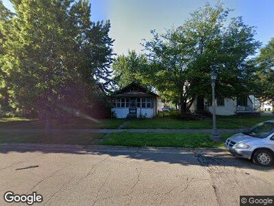
1212 Minnehaha Ave W Saint Paul, MN 55104
Hamline-Midway NeighborhoodEstimated Value: $232,000 - $254,000
2
Beds
1
Bath
875
Sq Ft
$278/Sq Ft
Est. Value
About This Home
This home is located at 1212 Minnehaha Ave W, Saint Paul, MN 55104 and is currently estimated at $243,484, approximately $278 per square foot. 1212 Minnehaha Ave W is a home located in Ramsey County with nearby schools including Galtier Magnet Elementary School, Murray Middle School, and Como Park Senior High School.
Ownership History
Date
Name
Owned For
Owner Type
Purchase Details
Closed on
Dec 24, 2003
Sold by
Abdel Hadi and Abdel Kifah Hadi
Bought by
Diana L and Todd D
Current Estimated Value
Purchase Details
Closed on
Sep 18, 2001
Sold by
Cisse Aliou B
Bought by
Ibrahim Abdel Hadi
Purchase Details
Closed on
Aug 28, 1998
Sold by
Taylor Carol Ann and Taylor Robert C
Bought by
Cisse Aliou
Create a Home Valuation Report for This Property
The Home Valuation Report is an in-depth analysis detailing your home's value as well as a comparison with similar homes in the area
Home Values in the Area
Average Home Value in this Area
Purchase History
| Date | Buyer | Sale Price | Title Company |
|---|---|---|---|
| Diana L | $195,000 | -- | |
| Ibrahim Abdel Hadi | $124,000 | -- | |
| Cisse Aliou | $65,500 | -- |
Source: Public Records
Mortgage History
| Date | Status | Borrower | Loan Amount |
|---|---|---|---|
| Closed | Lofstrom Todd D | $112,750 |
Source: Public Records
Tax History Compared to Growth
Tax History
| Year | Tax Paid | Tax Assessment Tax Assessment Total Assessment is a certain percentage of the fair market value that is determined by local assessors to be the total taxable value of land and additions on the property. | Land | Improvement |
|---|---|---|---|---|
| 2023 | $2,926 | $200,400 | $31,500 | $168,900 |
| 2022 | $2,706 | $207,700 | $31,500 | $176,200 |
| 2021 | $2,666 | $182,200 | $31,500 | $150,700 |
| 2020 | $2,862 | $185,700 | $31,500 | $154,200 |
| 2019 | $2,508 | $185,700 | $31,500 | $154,200 |
| 2018 | $2,288 | $164,000 | $31,500 | $132,500 |
| 2017 | $1,860 | $156,300 | $18,400 | $137,900 |
| 2016 | $1,816 | $0 | $0 | $0 |
| 2015 | $1,650 | $130,400 | $18,400 | $112,000 |
| 2014 | $1,836 | $0 | $0 | $0 |
Source: Public Records
Map
Nearby Homes
- 1224 Lafond Ave
- 1178 Lafond Ave
- 1282 Lafond Ave
- 1346 Minnehaha Ave W
- 1067 Van Buren Ave
- 1183 Charles Ave
- 1107 Edmund Ave
- 1107 Edmund Ave W
- 1156 Charles Ave
- 1251 Sherburne Ave
- 1023 Edmund Ave
- 1030 Topping St
- 1439 Edmund Ave
- 960 Edmund Ave
- 983 Sherburne Ave
- 940 Edmund Ave
- 1369 Spencer Rd W Unit 1369
- 1527 Minnehaha Ave W
- 945 Sherburne Ave
- 1000 Aurora Ave
- 1212 Minnehaha Ave W
- 1208 Minnehaha Ave W
- 1216 Minnehaha Ave W
- 1208 1208 Minnehaha Ave W
- 1216 1216 Minnehaha Ave W
- 1204 Minnehaha Ave W
- 1200 Minnehaha Ave W
- 1215 Van Buren Ave
- 1220 Minnehaha Ave W
- 719 Griggs St N Unit B
- 1209 Van Buren Ave
- 1217 Van Buren Ave
- 1196 Minnehaha Ave W
- 1205 Van Buren Ave
- 1215 Minnehaha Ave W
- 1203 Van Buren Ave
- 1226 Minnehaha Ave W
- 1192 Minnehaha Ave W
- 1219 Minnehaha Ave W
- 1211 1211 Minnehaha Ave W