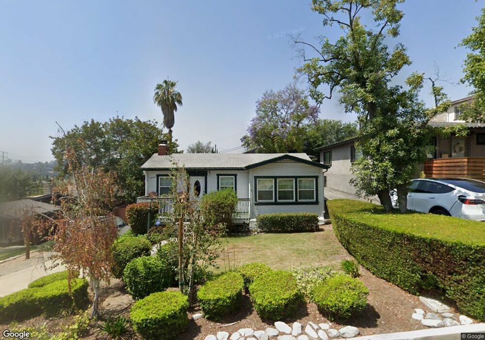
1218 Kipling Ave Los Angeles, CA 90041
Eagle Rock NeighborhoodEstimated Value: $1,106,383 - $1,294,000
1
Bed
1
Bath
1,100
Sq Ft
$1,066/Sq Ft
Est. Value
About This Home
This home is located at 1218 Kipling Ave, Los Angeles, CA 90041 and is currently estimated at $1,172,096, approximately $1,065 per square foot. 1218 Kipling Ave is a home located in Los Angeles County with nearby schools including Dahlia Heights Elementary, Eagle Rock High School, and PUC CALS Middle School and Early College High.
Ownership History
Date
Name
Owned For
Owner Type
Purchase Details
Closed on
Jul 24, 2021
Sold by
Spear Paul Robert
Bought by
Spear Paul Robert
Current Estimated Value
Home Financials for this Owner
Home Financials are based on the most recent Mortgage that was taken out on this home.
Original Mortgage
$776,000
Outstanding Balance
$705,171
Interest Rate
3%
Mortgage Type
New Conventional
Estimated Equity
$466,925
Purchase Details
Closed on
Jun 27, 2018
Sold by
Spear Paul Robert
Bought by
Spear Paul Robert
Home Financials for this Owner
Home Financials are based on the most recent Mortgage that was taken out on this home.
Original Mortgage
$453,100
Interest Rate
4.6%
Mortgage Type
New Conventional
Create a Home Valuation Report for This Property
The Home Valuation Report is an in-depth analysis detailing your home's value as well as a comparison with similar homes in the area
Home Values in the Area
Average Home Value in this Area
Purchase History
| Date | Buyer | Sale Price | Title Company |
|---|---|---|---|
| Spear Paul Robert | -- | Pacific Coast Title | |
| Spear Paul Robert | -- | Old Republic Title Company |
Source: Public Records
Mortgage History
| Date | Status | Borrower | Loan Amount |
|---|---|---|---|
| Open | Spear Paul Robert | $776,000 | |
| Previous Owner | Spear Paul Robert | $453,100 |
Source: Public Records
Tax History Compared to Growth
Tax History
| Year | Tax Paid | Tax Assessment Tax Assessment Total Assessment is a certain percentage of the fair market value that is determined by local assessors to be the total taxable value of land and additions on the property. | Land | Improvement |
|---|---|---|---|---|
| 2025 | $3,514 | $288,941 | $187,820 | $101,121 |
| 2024 | $3,514 | $283,277 | $184,138 | $99,139 |
| 2023 | $3,447 | $277,724 | $180,528 | $97,196 |
| 2022 | $3,286 | $272,280 | $176,989 | $95,291 |
| 2021 | $3,241 | $266,942 | $173,519 | $93,423 |
| 2020 | $3,270 | $264,206 | $171,740 | $92,466 |
| 2019 | $3,143 | $259,026 | $168,373 | $90,653 |
| 2018 | $3,107 | $253,948 | $165,072 | $88,876 |
| 2016 | $2,959 | $244,089 | $158,663 | $85,426 |
| 2015 | $2,916 | $240,423 | $156,280 | $84,143 |
| 2014 | $2,932 | $235,714 | $153,219 | $82,495 |
Source: Public Records
Map
Nearby Homes
- 1440 Holbrook St
- 5219 Lunsford Dr
- 1325 Linda Rosa Ave
- 1200 Saginaw St
- 5130 Loleta Ave
- 1515 Colorado Blvd
- 4879 Hartwick St
- 1300 Blue Hill Rd
- 4764 Wiota St
- 4841 Minden Place
- 972 Rockdale Ave
- 1026 Oak Grove Dr
- 0 Wildwood Dr Unit PF25124260
- 1059 Glen Arbor Ave
- 5031 Townsend Ave
- 1869 Kaweah Dr
- 4984 Vincent Ave
- 1480 Glengarry Rd
- 424 Elmwood Dr
- 4989 Vincent Ave
- 1212 Kipling Ave
- 1222 Kipling Ave
- 1224 Kipling Ave
- 5121 Wiota St
- 1202 Kipling Ave
- 1231 Colorado Blvd
- 1234 Kipling Ave
- 1225 Colorado Blvd
- 1225 Colorado Blvd
- 1227 Colorado Blvd
- 1211 Kipling Ave
- 1223 Kipling Ave
- 1315 Colorado Blvd
- 5111 Wiota St
- 1207 Kipling Ave
- 1227 Kipling Ave
- 1203 Kipling Ave
- 5120 Wiota St
- 1319 Colorado Blvd
- 1240 Kipling Ave