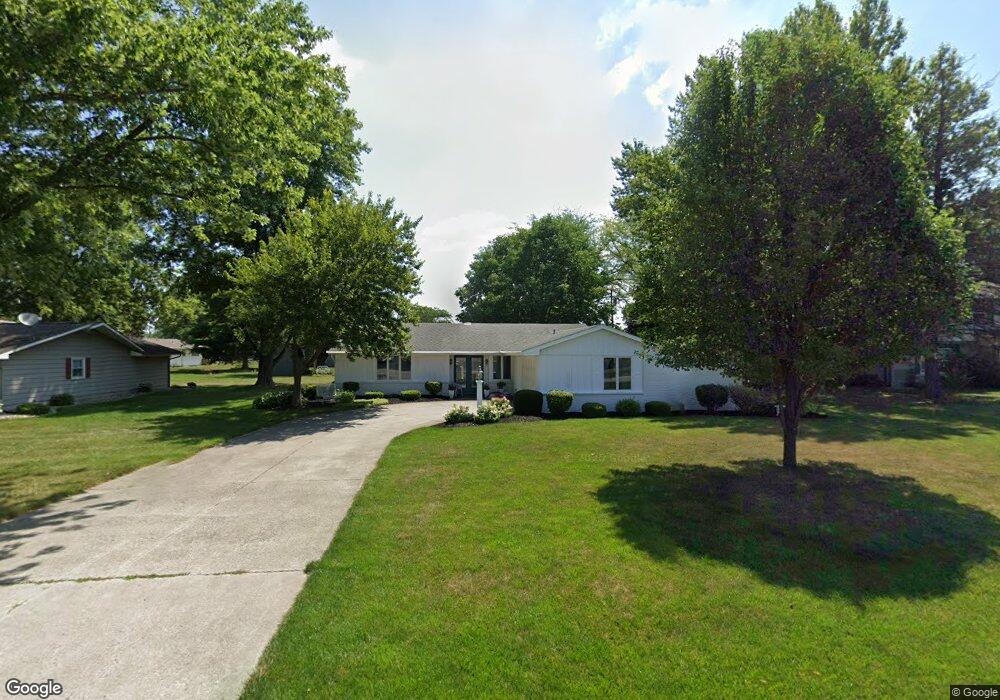
1241 Stogdill Rd Bluffton, IN 46714
Estimated Value: $225,219 - $248,000
2
Beds
2
Baths
1,530
Sq Ft
$155/Sq Ft
Est. Value
About This Home
This home is located at 1241 Stogdill Rd, Bluffton, IN 46714 and is currently estimated at $237,305, approximately $155 per square foot. 1241 Stogdill Rd is a home located in Wells County with nearby schools including Bluffton-Harrison Elementary School, Bluffton-Harrison Middle School, and Bluffton High School.
Ownership History
Date
Name
Owned For
Owner Type
Purchase Details
Closed on
Jun 20, 2022
Sold by
Hay Carolyn Jean
Bought by
Hay Caroyln Jean
Current Estimated Value
Purchase Details
Closed on
Apr 24, 2002
Sold by
Hay Donald E and Hay Carolyn J
Bought by
Hay Carolyn J
Create a Home Valuation Report for This Property
The Home Valuation Report is an in-depth analysis detailing your home's value as well as a comparison with similar homes in the area
Home Values in the Area
Average Home Value in this Area
Purchase History
| Date | Buyer | Sale Price | Title Company |
|---|---|---|---|
| Hay Caroyln Jean | -- | Huffman Keith P | |
| Hay Carolyn J | -- | -- |
Source: Public Records
Tax History
| Year | Tax Paid | Tax Assessment Tax Assessment Total Assessment is a certain percentage of the fair market value that is determined by local assessors to be the total taxable value of land and additions on the property. | Land | Improvement |
|---|---|---|---|---|
| 2025 | $1,424 | $186,700 | $43,600 | $143,100 |
| 2024 | $1,424 | $185,400 | $43,600 | $141,800 |
| 2023 | $1,254 | $170,400 | $37,900 | $132,500 |
| 2022 | $1,018 | $149,900 | $29,700 | $120,200 |
| 2021 | $949 | $141,500 | $29,700 | $111,800 |
| 2020 | $660 | $133,200 | $13,000 | $120,200 |
| 2019 | $721 | $127,800 | $13,000 | $114,800 |
| 2018 | $609 | $117,700 | $11,800 | $105,900 |
| 2017 | $456 | $116,500 | $11,800 | $104,700 |
| 2016 | $486 | $114,400 | $11,700 | $102,700 |
| 2014 | $436 | $102,400 | $11,200 | $91,200 |
| 2013 | $381 | $103,400 | $11,200 | $92,200 |
Source: Public Records
Map
Nearby Homes
- 1100 Echo Ln
- 200 S 350 E
- 4011 Indiana 116
- 515 E Arnold St
- 427 E Central Ave
- 929 S Main St
- 515 S Bennett St
- 127 E Wiley Ave
- 1803 S 300 E Unit 7
- 1795 S 300 E Unit 3
- 1799 S 300 E Unit 5
- 1805 S 300 E Unit 8
- 1797 S 300 E Unit 4
- 1801 S 300 E Unit 6
- 1791 S 300 E Unit 1
- 3286 E State Road 124
- 128 W South St
- 4162 Indiana 124
- 1339 Clark Ave
- 1435 Mcconnell Dr
- 1249 Stogdill Rd
- 1233 Stogdill Rd
- 1232 Kenwood Dr
- 1240 Kenwood Dr
- 1225 Stogdill Rd
- 1305 Stogdill Rd
- 1224 Kenwood Dr
- 1311 Windsor Ln
- 1310 Stogdill Rd
- 1217 Stogdill Rd
- 1218 Kenwood Dr
- 1313 Stogdill Rd
- 1217 Honeysuckle Ln
- 1237 Kenwood Dr
- 1312 Kenwood Dr
- 1245 Kenwood Dr
- 1229 Kenwood Dr
- 1211 Honeysuckle Ln
- 1214 Kenwood Dr
- 1321 Stogdill Rd
Your Personal Tour Guide
Ask me questions while you tour the home.