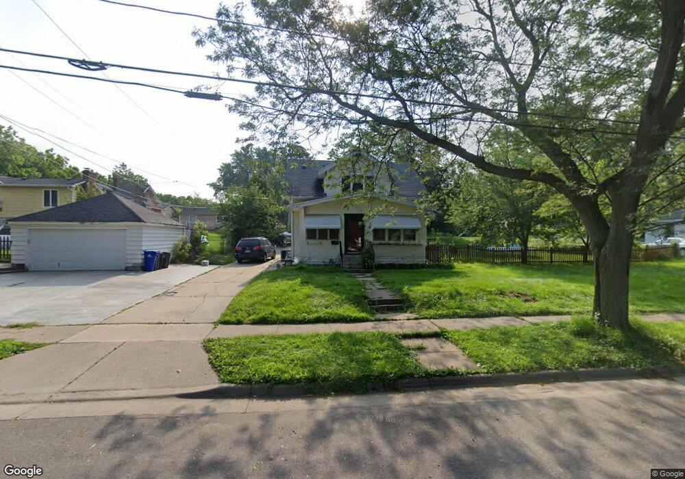
1246 Kennard St Saint Paul, MN 55106
Prosperity Heights NeighborhoodEstimated Value: $280,000 - $323,473
4
Beds
2
Baths
1,350
Sq Ft
$222/Sq Ft
Est. Value
About This Home
This home is located at 1246 Kennard St, Saint Paul, MN 55106 and is currently estimated at $299,118, approximately $221 per square foot. 1246 Kennard St is a home located in Ramsey County with nearby schools including The Heights Community School, Txuj Ci HMong Language and Culture Upper Campus, and Johnson Senior High School.
Ownership History
Date
Name
Owned For
Owner Type
Purchase Details
Closed on
Jul 24, 2015
Sold by
Gabriel James B and Gabriel Melissa A
Bought by
Yang Kue
Current Estimated Value
Home Financials for this Owner
Home Financials are based on the most recent Mortgage that was taken out on this home.
Original Mortgage
$137,464
Outstanding Balance
$106,772
Interest Rate
3.75%
Mortgage Type
FHA
Estimated Equity
$192,346
Purchase Details
Closed on
Sep 28, 1998
Sold by
Buche Ralph J
Bought by
Gabriel Melissa A and Gabriel James B
Create a Home Valuation Report for This Property
The Home Valuation Report is an in-depth analysis detailing your home's value as well as a comparison with similar homes in the area
Home Values in the Area
Average Home Value in this Area
Purchase History
| Date | Buyer | Sale Price | Title Company |
|---|---|---|---|
| Yang Kue | $144,242 | Ancona Title & Escrow | |
| Gabriel Melissa A | $102,000 | -- |
Source: Public Records
Mortgage History
| Date | Status | Borrower | Loan Amount |
|---|---|---|---|
| Open | Yang Kue | $137,464 |
Source: Public Records
Tax History Compared to Growth
Tax History
| Year | Tax Paid | Tax Assessment Tax Assessment Total Assessment is a certain percentage of the fair market value that is determined by local assessors to be the total taxable value of land and additions on the property. | Land | Improvement |
|---|---|---|---|---|
| 2025 | $3,732 | $271,300 | $60,000 | $211,300 |
| 2023 | $3,732 | $249,900 | $50,000 | $199,900 |
| 2022 | $3,086 | $249,100 | $50,000 | $199,100 |
| 2021 | $3,138 | $204,200 | $50,000 | $154,200 |
| 2020 | $2,756 | $213,700 | $51,200 | $162,500 |
| 2019 | $2,612 | $179,600 | $51,200 | $128,400 |
| 2018 | $2,142 | $169,100 | $51,200 | $117,900 |
| 2017 | $2,114 | $147,300 | $51,200 | $96,100 |
| 2016 | $2,834 | $0 | $0 | $0 |
| 2015 | $2,726 | $154,600 | $51,200 | $103,400 |
| 2014 | $2,030 | $0 | $0 | $0 |
Source: Public Records
Map
Nearby Homes
- 1664 Orange Ave E
- 1675 Maryland Ave E
- 1711 Maryland Ave E
- 1181 Herbert St
- 1732 Maryland Ave E
- 1755 Maryland Ave E
- 1562 Ivy Ave E
- 1734 Cottage Ave E
- 1126 Breen St
- 1111 Breen St
- 866 Clear Ave E
- 1729 Sherwood Ave
- 1698 Arlington Ave E
- 1685 Arlington Ave E
- 1806 Sherwood Ave
- 1868 Ivy Ave E
- 1891 Maryland Ave E
- 1828 Arlington Ave E
- 1583 Nevada Ave E
- 1931 Hawthorne Ave E
- 1662 Orange Ave E
- 1234 Kennard St
- 1245 Kennard St
- 1239 Kennard St
- 1674 Orange Ave E
- 1251 Kennard St
- 1235 Kennard St
- 1224 Kennard St
- 1255 Kennard St
- 1680 Orange Ave E
- 1245 1245 Kennard-Street-
- 1231 Kennard St
- 1686 Orange Ave E
- 1263 Kennard St
- 1661 Orange Ave E
- 1225 Kennard St
- 1220 Kennard St
- 1669 Orange Ave E
- 1673 1673 Orange-Avenue-e
- 1673 Orange Ave E