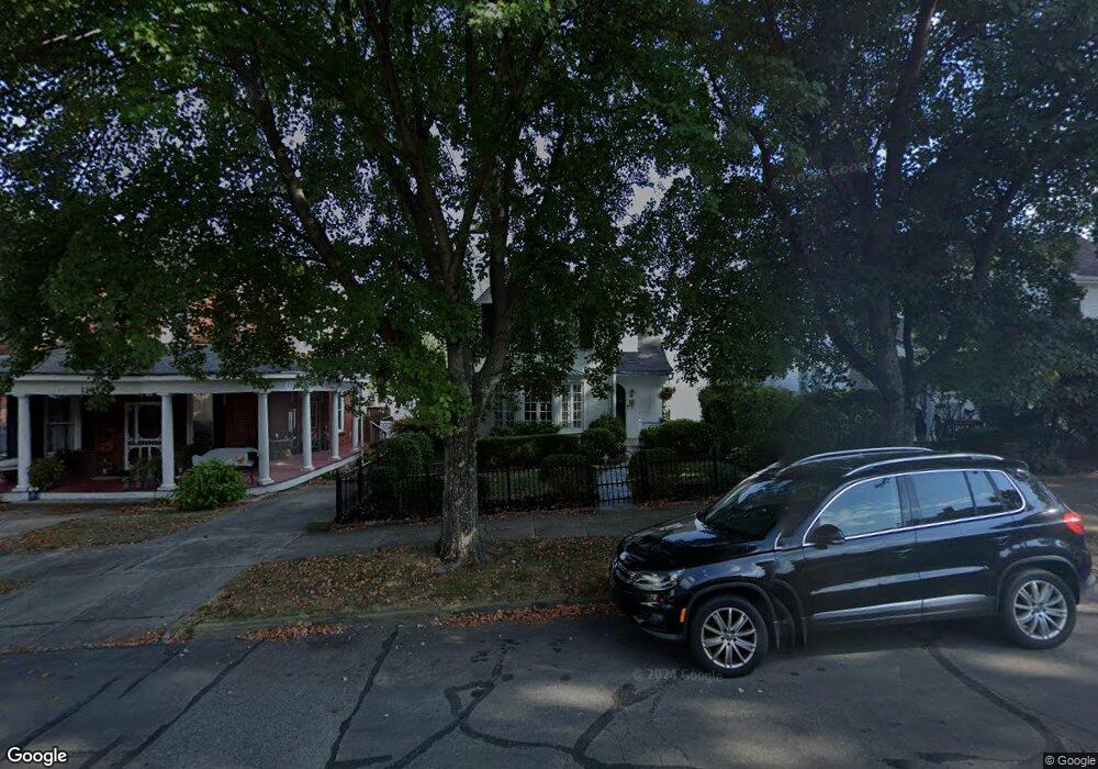
127 E Mulberry St Lancaster, OH 43130
Estimated Value: $338,000 - $426,000
3
Beds
3
Baths
2,490
Sq Ft
$150/Sq Ft
Est. Value
About This Home
This home is located at 127 E Mulberry St, Lancaster, OH 43130 and is currently estimated at $374,251, approximately $150 per square foot. 127 E Mulberry St is a home located in Fairfield County with nearby schools including Thomas Ewing Junior High School, Lancaster High School, and St Mary Elementary School.
Ownership History
Date
Name
Owned For
Owner Type
Purchase Details
Closed on
Sep 11, 2000
Sold by
Likes Creighton E
Bought by
Custer Geoffrey A and Custer Judith B
Current Estimated Value
Home Financials for this Owner
Home Financials are based on the most recent Mortgage that was taken out on this home.
Original Mortgage
$110,000
Interest Rate
8.15%
Mortgage Type
New Conventional
Purchase Details
Closed on
Sep 16, 1997
Sold by
Kuehn Thomas W
Bought by
Likes Creighton E and Likes Constance Y
Home Financials for this Owner
Home Financials are based on the most recent Mortgage that was taken out on this home.
Original Mortgage
$215,000
Interest Rate
7.44%
Mortgage Type
New Conventional
Create a Home Valuation Report for This Property
The Home Valuation Report is an in-depth analysis detailing your home's value as well as a comparison with similar homes in the area
Home Values in the Area
Average Home Value in this Area
Purchase History
| Date | Buyer | Sale Price | Title Company |
|---|---|---|---|
| Custer Geoffrey A | $301,000 | -- | |
| Likes Creighton E | $140,000 | -- |
Source: Public Records
Mortgage History
| Date | Status | Borrower | Loan Amount |
|---|---|---|---|
| Closed | Custer Geoffrey A | $110,000 | |
| Previous Owner | Likes Creighton E | $215,000 |
Source: Public Records
Tax History
| Year | Tax Paid | Tax Assessment Tax Assessment Total Assessment is a certain percentage of the fair market value that is determined by local assessors to be the total taxable value of land and additions on the property. | Land | Improvement |
|---|---|---|---|---|
| 2025 | $8,793 | $106,720 | $25,900 | $80,820 |
| 2024 | $8,793 | $97,810 | $15,070 | $82,740 |
| 2023 | $3,224 | $97,810 | $15,070 | $82,740 |
| 2022 | $3,252 | $97,810 | $15,070 | $82,740 |
| 2021 | $2,629 | $76,190 | $12,550 | $63,640 |
| 2020 | $2,519 | $76,190 | $12,550 | $63,640 |
| 2019 | $2,395 | $76,190 | $12,550 | $63,640 |
| 2018 | $2,634 | $68,860 | $17,260 | $51,600 |
| 2017 | $2,635 | $79,200 | $18,830 | $60,370 |
| 2016 | $2,566 | $79,200 | $18,830 | $60,370 |
| 2015 | $2,546 | $76,580 | $18,830 | $57,750 |
| 2014 | $2,425 | $76,580 | $18,830 | $57,750 |
| 2013 | $2,425 | $76,580 | $18,830 | $57,750 |
Source: Public Records
Map
Nearby Homes
- 526 N Columbus St
- 515 N Columbus St
- 233 Union St
- 249 N Pearl Ave
- 600 N High St
- 154 E Main St
- 233 E 6th Ave
- 0 Slocum Ave
- 0 N Columbus St
- 123 Arnold Ave
- 820 N Broad St
- 311 E Allen St
- 165 Lake St
- 517 N Maple St
- 130 W Fair Ave
- 342 E Chestnut St
- 547 E Mulberry St
- 534 E Wheeling St
- 925 N Columbus St
- 414 E Walnut St
- 123 E Mulberry St
- 131 E Mulberry St
- 119 E Mulberry St
- 137 E Mulberry St
- 141 E Mulberry St
- 145 E Mulberry St
- 130 King St
- 122 King St
- 122 E Mulberry St
- 136 King St
- 149 E Mulberry St
- 128 E Mulberry St
- 144 King St
- 136 E Mulberry St
- 140 E Mulberry St
- 114 King St
- 151 E Mulberry St
- 150 King St
- 144 E Mulberry St
- 00 Union St
Your Personal Tour Guide
Ask me questions while you tour the home.