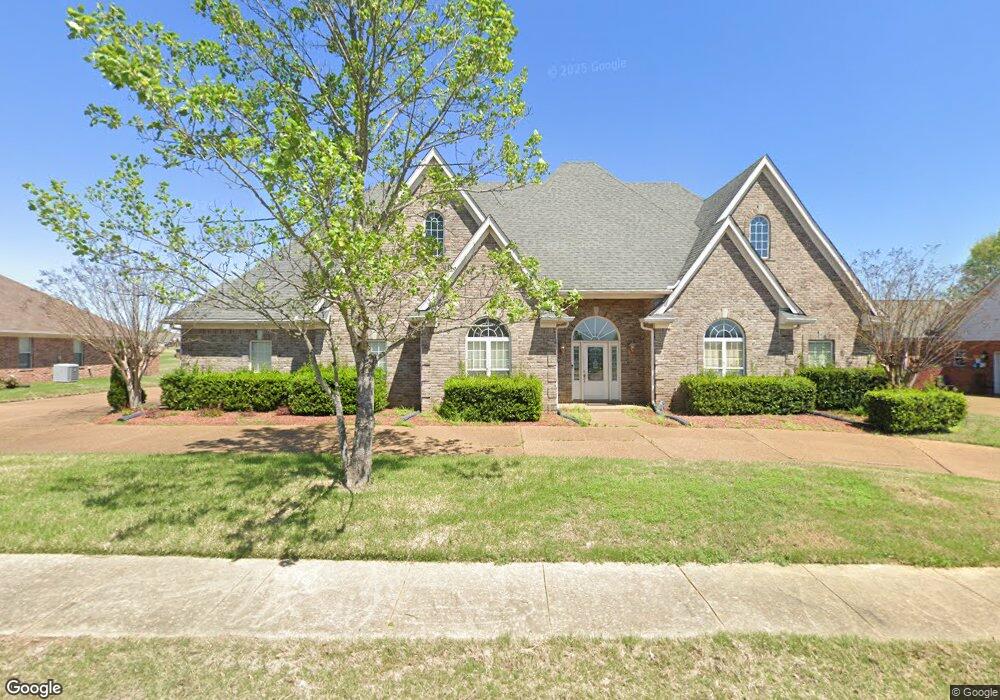
12928 Arbor Dr Olive Branch, MS 38654
Center Hill NeighborhoodEstimated Value: $413,969 - $470,000
4
Beds
2
Baths
3,500
Sq Ft
$128/Sq Ft
Est. Value
About This Home
This home is located at 12928 Arbor Dr, Olive Branch, MS 38654 and is currently estimated at $449,492, approximately $128 per square foot. 12928 Arbor Dr is a home located in DeSoto County with nearby schools including Center Hill Elementary School and Center Hill High School.
Ownership History
Date
Name
Owned For
Owner Type
Purchase Details
Closed on
Nov 20, 2008
Sold by
Marr Kevin L and Marr Jill S
Bought by
Bradshaw Dale W
Current Estimated Value
Home Financials for this Owner
Home Financials are based on the most recent Mortgage that was taken out on this home.
Original Mortgage
$162,885
Outstanding Balance
$105,661
Interest Rate
6.01%
Mortgage Type
Purchase Money Mortgage
Estimated Equity
$343,831
Create a Home Valuation Report for This Property
The Home Valuation Report is an in-depth analysis detailing your home's value as well as a comparison with similar homes in the area
Home Values in the Area
Average Home Value in this Area
Purchase History
| Date | Buyer | Sale Price | Title Company |
|---|---|---|---|
| Bradshaw Dale W | -- | Realty Title |
Source: Public Records
Mortgage History
| Date | Status | Borrower | Loan Amount |
|---|---|---|---|
| Open | Bradshaw Dale W | $162,885 |
Source: Public Records
Tax History Compared to Growth
Tax History
| Year | Tax Paid | Tax Assessment Tax Assessment Total Assessment is a certain percentage of the fair market value that is determined by local assessors to be the total taxable value of land and additions on the property. | Land | Improvement |
|---|---|---|---|---|
| 2025 | $1,304 | $23,302 | $3,500 | $19,802 |
| 2024 | $2,030 | $23,302 | $3,500 | $19,802 |
| 2023 | $2,030 | $23,302 | $0 | $0 |
| 2022 | $2,030 | $23,302 | $3,500 | $19,802 |
| 2021 | $2,030 | $23,302 | $3,500 | $19,802 |
| 2020 | $1,871 | $21,718 | $3,500 | $18,218 |
| 2019 | $1,871 | $21,718 | $3,500 | $18,218 |
| 2017 | $1,829 | $38,778 | $21,139 | $17,639 |
| 2016 | $1,927 | $22,119 | $3,500 | $18,619 |
| 2015 | $2,227 | $40,738 | $22,119 | $18,619 |
| 2014 | $1,927 | $22,119 | $0 | $0 |
| 2013 | $1,986 | $22,119 | $0 | $0 |
Source: Public Records
Map
Nearby Homes
- 12780 Myrtle Bend Loop
- 4253 Lakecrest Cove
- 4140 Three Hawks Dr
- 12632 River Bend Dr
- 13294 Old Locke Rd
- 13165 Coldwater Dr
- 4103 W Dearden Dr
- 13377 Berkstone Loop
- 13518 Broadmore Ln
- 13532 Broadmore Ln
- 13624 Broadmore Ln
- 13634 Broadmore Ln
- 12860 Pine Crest Dr
- 13648 Highlands Crest Dr
- Nelson Plan at Forest Hill - Highlands of
- Carver Plan at Forest Hill - Highlands of
- Bentley Plan at Forest Hill - Highlands of
- Chestnut Plan at Forest Hill - Highlands of
- Scottsdale Plan at Forest Hill - Highlands of
- Worthington Plan at Forest Hill - Highlands of
- 12916 Arbor Dr
- 12944 Arbor Dr
- 219 Arbor Dr
- 12918 Myrtle Bend Loop
- 12902 Arbor Dr
- 12960 Arbor Dr
- 12949 Arbor Dr
- 12911 Arbor Dr
- 12902 Myrtle Bend Loop
- 12890 Arbor Dr
- 12980 Arbor Dr
- 12887 Arbor Dr
- 12967 Arbor Dr
- 12905 Myrtle Bend Loop
- 12890 Myrtle Bend Loop
- 12868 Arbor Dr
- 4050 Upper Valley Cove
- 3995 Windemere Cove
- 12998 Arbor Dr
- 12857 Arbor Dr