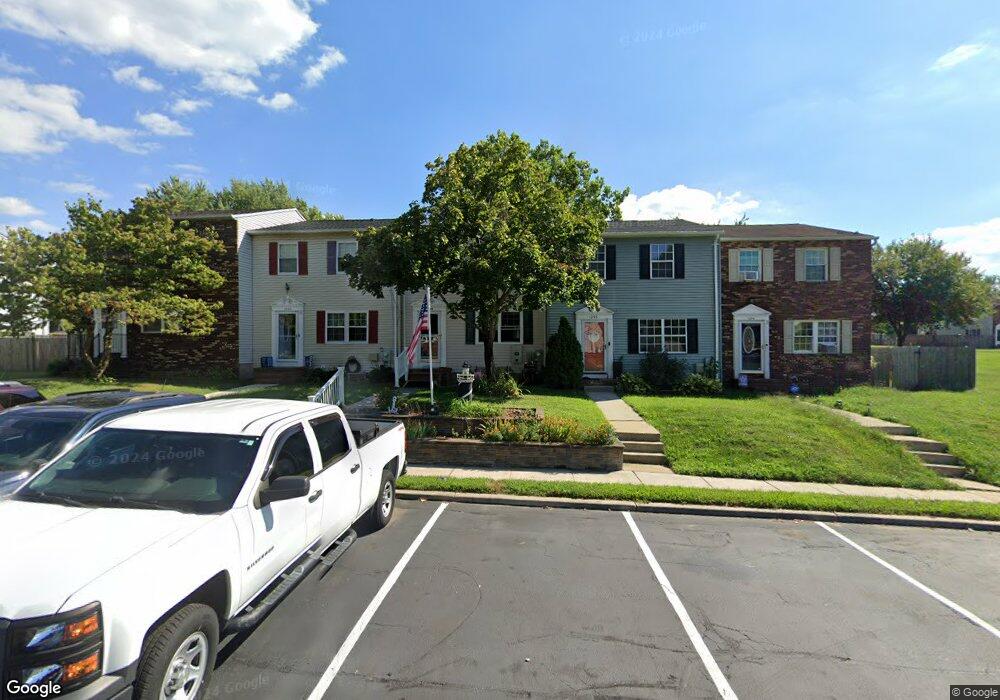
1294 Holmespun Dr Pasadena, MD 21122
Estimated Value: $349,000 - $370,637
--
Bed
2
Baths
1,338
Sq Ft
$266/Sq Ft
Est. Value
About This Home
This home is located at 1294 Holmespun Dr, Pasadena, MD 21122 and is currently estimated at $355,659, approximately $265 per square foot. 1294 Holmespun Dr is a home located in Anne Arundel County with nearby schools including High Point Elementary School, Northeast Middle School, and Northeast High School.
Ownership History
Date
Name
Owned For
Owner Type
Purchase Details
Closed on
Dec 30, 1999
Sold by
Webb Myralon S
Bought by
Shelley I Charles I and Shelley Sheiley
Current Estimated Value
Purchase Details
Closed on
Apr 29, 1991
Sold by
Head George R
Bought by
Webb Myralon S
Home Financials for this Owner
Home Financials are based on the most recent Mortgage that was taken out on this home.
Original Mortgage
$630,000
Interest Rate
9.53%
Create a Home Valuation Report for This Property
The Home Valuation Report is an in-depth analysis detailing your home's value as well as a comparison with similar homes in the area
Home Values in the Area
Average Home Value in this Area
Purchase History
| Date | Buyer | Sale Price | Title Company |
|---|---|---|---|
| Shelley I Charles I | $94,000 | -- | |
| Webb Myralon S | $11,000 | -- |
Source: Public Records
Mortgage History
| Date | Status | Borrower | Loan Amount |
|---|---|---|---|
| Previous Owner | Webb Myralon S | $630,000 | |
| Closed | Shelley I Charles I | -- |
Source: Public Records
Tax History Compared to Growth
Tax History
| Year | Tax Paid | Tax Assessment Tax Assessment Total Assessment is a certain percentage of the fair market value that is determined by local assessors to be the total taxable value of land and additions on the property. | Land | Improvement |
|---|---|---|---|---|
| 2025 | $3,011 | $244,033 | -- | -- |
| 2024 | $3,011 | $234,500 | $115,000 | $119,500 |
| 2023 | $2,885 | $226,000 | $0 | $0 |
| 2022 | $2,650 | $217,500 | $0 | $0 |
| 2021 | $5,122 | $209,000 | $95,000 | $114,000 |
| 2020 | $2,514 | $208,400 | $0 | $0 |
| 2019 | $2,509 | $207,800 | $0 | $0 |
| 2018 | $2,101 | $207,200 | $95,000 | $112,200 |
| 2017 | $2,320 | $195,100 | $0 | $0 |
| 2016 | -- | $183,000 | $0 | $0 |
| 2015 | -- | $170,900 | $0 | $0 |
| 2014 | -- | $170,900 | $0 | $0 |
Source: Public Records
Map
Nearby Homes
- 8639 Cobscook Harbour
- 1197 Hillside Rd
- 1201 Rock Hill Rd
- 7635 Stoney Creek Dr
- 1216 Farmview Rd
- 7693 Oak Ln
- 1248 Rock Hill Rd
- 7740 Notley Rd
- 1202 Hillcreek Rd
- 1208 Castine Ct
- 1219 Hillcreek Rd
- 1220 Hillcreek Rd
- 7824 Acorn Bank
- 124 Club Rd
- 131 Jackpine Dr
- 7818 Renshaw Rd
- 808 De Franceaux Way
- 889 New London Harbour
- 4 Silver Cir
- 969 Tidewater Rd
- 1296 Holmespun Dr
- 1292 Holmespun Dr
- 1290 Holmespun Dr
- 1298 Holmespun Dr
- 1288 Holmespun Dr
- 1286 Holmespun Dr
- 1284 Holmespun Dr
- 1282 Holmespun Dr
- 1252 Holmespun Dr
- 1254 Holmespun Dr
- 1256 Holmespun Dr
- 1250 Holmespun Dr
- 1280 Holmespun Dr
- 1260 Holmespun Dr
- 1262 Holmespun Dr
- 7742 Moonfall Ct
- 1264 Holmespun Dr
- 1266 Holmespun Dr
- 7700 Moonfall Ct
- 1248 Holmespun Dr