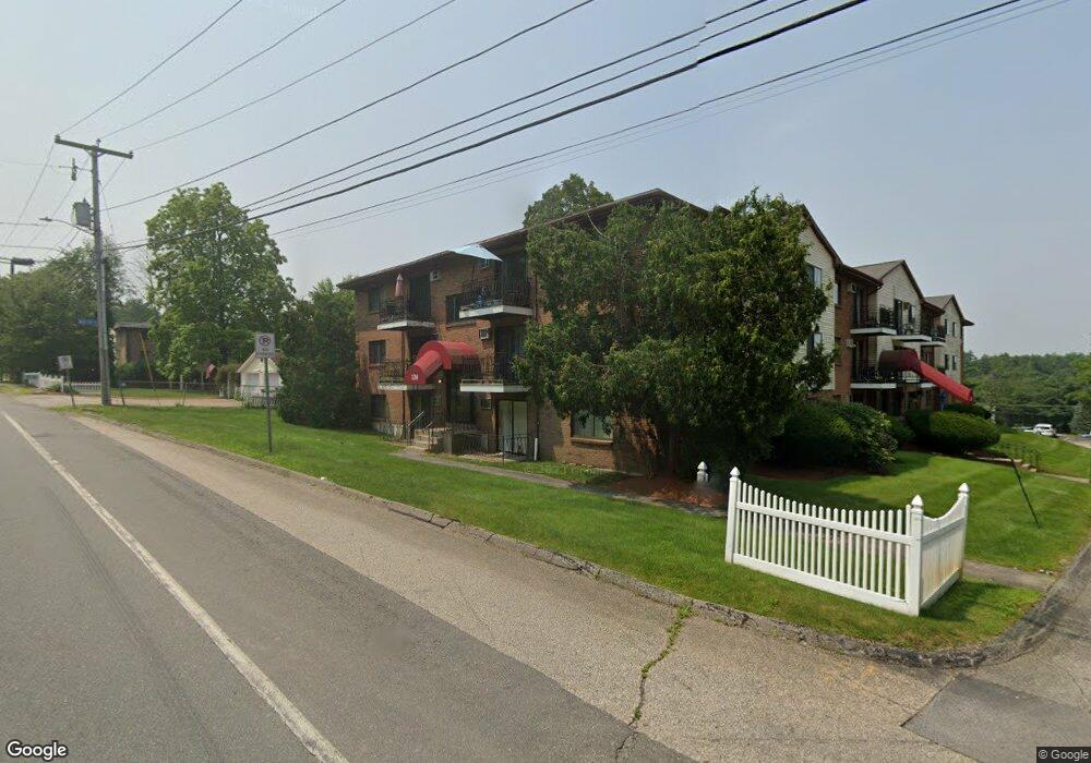
134 Mammoth Rd Unit 515 Hooksett, NH 03106
Estimated Value: $194,000 - $206,000
1
Bed
1
Bath
831
Sq Ft
$242/Sq Ft
Est. Value
About This Home
This home is located at 134 Mammoth Rd Unit 515, Hooksett, NH 03106 and is currently estimated at $201,034, approximately $241 per square foot. 134 Mammoth Rd Unit 515 is a home located in Merrimack County with nearby schools including Fred C. Underhill School, Hooksett Memorial School, and David R. Cawley Middle School.
Ownership History
Date
Name
Owned For
Owner Type
Purchase Details
Closed on
Mar 11, 2021
Sold by
Hrustic Hadzira and Hrustic Sahbaz
Bought by
Isabelle Ft 2015
Current Estimated Value
Purchase Details
Closed on
Oct 31, 2003
Sold by
Triple R Rt
Bought by
Hrustic Sabbaz and Hrustic Hadzira
Home Financials for this Owner
Home Financials are based on the most recent Mortgage that was taken out on this home.
Original Mortgage
$72,750
Interest Rate
6.05%
Create a Home Valuation Report for This Property
The Home Valuation Report is an in-depth analysis detailing your home's value as well as a comparison with similar homes in the area
Home Values in the Area
Average Home Value in this Area
Purchase History
| Date | Buyer | Sale Price | Title Company |
|---|---|---|---|
| Isabelle Ft 2015 | $130,000 | None Available | |
| Hrustic Sabbaz | $75,000 | -- |
Source: Public Records
Mortgage History
| Date | Status | Borrower | Loan Amount |
|---|---|---|---|
| Previous Owner | Hrustic Sabbaz | $72,750 |
Source: Public Records
Tax History Compared to Growth
Tax History
| Year | Tax Paid | Tax Assessment Tax Assessment Total Assessment is a certain percentage of the fair market value that is determined by local assessors to be the total taxable value of land and additions on the property. | Land | Improvement |
|---|---|---|---|---|
| 2024 | $2,483 | $146,400 | $0 | $146,400 |
| 2023 | $2,339 | $146,400 | $0 | $146,400 |
| 2022 | $1,679 | $69,800 | $0 | $69,800 |
| 2021 | $1,551 | $69,800 | $0 | $69,800 |
| 2020 | $1,571 | $69,800 | $0 | $69,800 |
| 2019 | $1,504 | $69,800 | $0 | $69,800 |
| 2018 | $1,544 | $69,800 | $0 | $69,800 |
| 2017 | $947 | $35,400 | $0 | $35,400 |
| 2016 | $934 | $35,400 | $0 | $35,400 |
| 2015 | $875 | $35,400 | $0 | $35,400 |
| 2014 | $879 | $35,400 | $0 | $35,400 |
| 2013 | $831 | $35,400 | $0 | $35,400 |
Source: Public Records
Map
Nearby Homes
- 136 Mammoth Rd Unit 628
- 126 Mammoth Rd Unit 1
- 128 Mammoth Rd Unit 122
- 45 Leonard Ave
- 286 Londonderry Turnpike Unit A
- 286B Londonderry Turnpike Unit A
- 27 Martins Ferry Rd
- 13 Johns Dr
- 22 Harmony Ln
- 15 Johns Dr
- 29 Golden Gate Dr
- 6 Deerhead St
- 190 Chase Way
- 7 Mulberry Ln
- 212 Kearney St
- 541 Pickering St
- 534 Fox Hollow Way
- 18 Cindy Dr
- 6 Gailor Ln
- 755 Straw Hill Rd
- 134 Mammoth Rd Unit 26
- 134 Mammoth Rd Unit 5
- 134 Mammoth Rd Unit 29
- 134 Mammoth Rd Unit 10
- 134 Mammoth Rd Unit 530
- 134 Mammoth Rd Unit 529
- 134 Mammoth Rd Unit 528
- 134 Mammoth Rd Unit 527
- 134 Mammoth Rd Unit 526
- 134 Mammoth Rd Unit 524
- 134 Mammoth Rd Unit 523
- 134 Mammoth Rd Unit 522
- 134 Mammoth Rd Unit 521
- 134 Mammoth Rd Unit 520
- 134 Mammoth Rd Unit 519
- 134 Mammoth Rd Unit 518
- 134 Mammoth Rd Unit 517
- 134 Mammoth Rd Unit 516
- 134 Mammoth Rd Unit 514
- 134 Mammoth Rd Unit 513