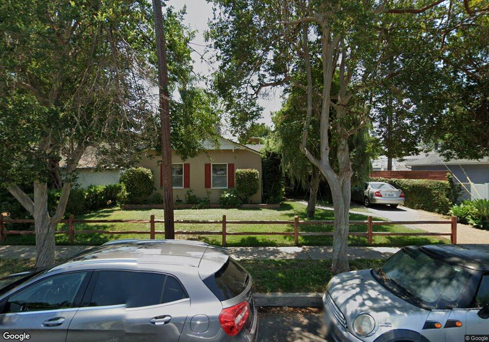
13612 Califa St van Nuys, CA 91401
Estimated Value: $1,195,000 - $1,300,000
4
Beds
2
Baths
1,813
Sq Ft
$690/Sq Ft
Est. Value
About This Home
This home is located at 13612 Califa St, van Nuys, CA 91401 and is currently estimated at $1,251,037, approximately $690 per square foot. 13612 Califa St is a home located in Los Angeles County with nearby schools including Erwin Street Elementary School, Ulysses S. Grant Senior High School, and Louis D. Armstrong Middle School.
Ownership History
Date
Name
Owned For
Owner Type
Purchase Details
Closed on
Aug 27, 2019
Sold by
Blandon Arthur B and Blandon Mardi Lind
Bought by
Archer Hanh N and The Arthur And Mardi Blandon 2019 Trust
Current Estimated Value
Purchase Details
Closed on
Mar 29, 1994
Sold by
Clark Jerald A and Abberger Roger A
Bought by
Blandon Arthur B
Home Financials for this Owner
Home Financials are based on the most recent Mortgage that was taken out on this home.
Original Mortgage
$202,500
Interest Rate
7.15%
Create a Home Valuation Report for This Property
The Home Valuation Report is an in-depth analysis detailing your home's value as well as a comparison with similar homes in the area
Home Values in the Area
Average Home Value in this Area
Purchase History
| Date | Buyer | Sale Price | Title Company |
|---|---|---|---|
| Archer Hanh N | -- | None Available | |
| Blandon Arthur B | $225,000 | American Title Insurance Co |
Source: Public Records
Mortgage History
| Date | Status | Borrower | Loan Amount |
|---|---|---|---|
| Previous Owner | Blandon Arthur B | $202,500 |
Source: Public Records
Tax History
| Year | Tax Paid | Tax Assessment Tax Assessment Total Assessment is a certain percentage of the fair market value that is determined by local assessors to be the total taxable value of land and additions on the property. | Land | Improvement |
|---|---|---|---|---|
| 2025 | $4,726 | $382,396 | $231,479 | $150,917 |
| 2024 | $4,726 | $374,899 | $226,941 | $147,958 |
| 2023 | $4,637 | $367,549 | $222,492 | $145,057 |
| 2022 | $4,424 | $360,343 | $218,130 | $142,213 |
| 2021 | $4,362 | $353,278 | $213,853 | $139,425 |
| 2020 | $4,401 | $349,657 | $211,661 | $137,996 |
| 2019 | $4,232 | $342,802 | $207,511 | $135,291 |
| 2018 | $4,136 | $336,082 | $203,443 | $132,639 |
| 2016 | $3,936 | $323,034 | $195,544 | $127,490 |
| 2015 | $3,879 | $318,182 | $192,607 | $125,575 |
| 2014 | $3,898 | $311,951 | $188,835 | $123,116 |
Source: Public Records
Map
Nearby Homes
- 5811 Woodman Ave Unit 22
- 13430 Oxnard St
- 13422 Oxnard St
- 5728 Mammoth Ave
- 6038 Allott Ave
- 6044 Woodman Ave
- 13822 Oxnard St
- 6121 Woodman Ave
- 13559 Burbank Blvd
- 13633 Delano St
- 5636 Matilija Ave
- 13816 Bessemer St
- 5906 Colbath Ave
- 13942 Oxnard St
- 6221 Mammoth Ave
- 6255 Woodman Ave Unit 203
- 13600 Sylvan St
- 14024 Califa St
- 6104 Costello Ave
- 6043 Mary Ellen Ave
- 13606 Califa St
- 5856 Buffalo Ave
- 5860 Buffalo Ave
- 13600 Califa St
- 5850 Buffalo Ave
- 13623 Califa St
- 13617 Emelita St
- 13613 Emelita St
- 5846 Buffalo Ave
- 13621 Emelita St
- 5871 Allott Ave
- 5900 Buffalo Ave
- 13609 Emelita St
- 13607 Califa St
- 13625 Califa St
- 5840 Buffalo Ave
- 5865 Allott Ave
- 13601 Califa St
- 5834 Buffalo Ave
- 13605 Emelita St
Your Personal Tour Guide
Ask me questions while you tour the home.