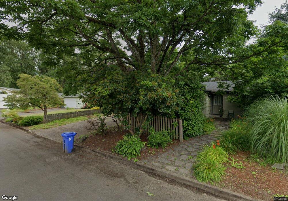
1365 Lanson Ln Eugene, OR 97404
River Road NeighborhoodEstimated Value: $331,000 - $508,000
6
Beds
2
Baths
1,920
Sq Ft
$235/Sq Ft
Est. Value
About This Home
This home is located at 1365 Lanson Ln, Eugene, OR 97404 and is currently estimated at $451,024, approximately $234 per square foot. 1365 Lanson Ln is a home located in Lane County with nearby schools including River Road/El Camino del Río Elementary School, Kelly Middle School, and North Eugene High School.
Ownership History
Date
Name
Owned For
Owner Type
Purchase Details
Closed on
Apr 19, 2021
Sold by
Blaser Floyd A and Blaser Sharon K
Bought by
Tuski Brian J
Current Estimated Value
Home Financials for this Owner
Home Financials are based on the most recent Mortgage that was taken out on this home.
Original Mortgage
$227,500
Outstanding Balance
$204,959
Interest Rate
3%
Mortgage Type
New Conventional
Estimated Equity
$246,065
Purchase Details
Closed on
Apr 9, 2001
Sold by
Esgate Colette K
Bought by
Blaser Floyd A and Blaser Sharon K
Home Financials for this Owner
Home Financials are based on the most recent Mortgage that was taken out on this home.
Original Mortgage
$212,000
Interest Rate
7.19%
Purchase Details
Closed on
Sep 16, 1997
Sold by
Esgate Albert D and Esgate Colette K
Bought by
Esgate Colette K
Create a Home Valuation Report for This Property
The Home Valuation Report is an in-depth analysis detailing your home's value as well as a comparison with similar homes in the area
Home Values in the Area
Average Home Value in this Area
Purchase History
| Date | Buyer | Sale Price | Title Company |
|---|---|---|---|
| Tuski Brian J | $250,000 | Ticor Title | |
| Blaser Floyd A | $265,000 | Western Title & Escrow Compa | |
| Esgate Colette K | -- | Western Pioneer Title Co |
Source: Public Records
Mortgage History
| Date | Status | Borrower | Loan Amount |
|---|---|---|---|
| Open | Tuski Brian J | $227,500 | |
| Previous Owner | Blaser Floyd A | $212,000 |
Source: Public Records
Tax History
| Year | Tax Paid | Tax Assessment Tax Assessment Total Assessment is a certain percentage of the fair market value that is determined by local assessors to be the total taxable value of land and additions on the property. | Land | Improvement |
|---|---|---|---|---|
| 2025 | $4,546 | $270,577 | -- | -- |
| 2024 | $4,496 | $262,697 | -- | -- |
| 2023 | $4,496 | $255,046 | $0 | $0 |
| 2022 | $4,229 | $247,618 | $0 | $0 |
| 2021 | $3,933 | $240,406 | $0 | $0 |
| 2020 | $3,826 | $233,404 | $0 | $0 |
| 2019 | $3,617 | $226,606 | $0 | $0 |
| 2018 | $3,345 | $213,598 | $0 | $0 |
| 2017 | $3,129 | $213,598 | $0 | $0 |
| 2016 | $3,068 | $207,377 | $0 | $0 |
| 2015 | $2,982 | $201,337 | $0 | $0 |
| 2014 | $2,947 | $195,473 | $0 | $0 |
Source: Public Records
Map
Nearby Homes
- 172 Norman Ave
- 260 Greenleaf Ave
- 154 Norman Ave
- 1420 Evergreen Dr
- 1685 Evergreen Dr
- 1483 Barton St
- 1487 Barton St
- 2874 Riverwalk Loop
- 1360 Andersen Ln
- 2709 Riverwalk Loop
- 1927 Lake Isle Dr
- 574 Wimbledon Ct
- 606 Wimbledon Ct
- 32 Marion Ln
- 2628 Edgewater Dr
- 2808 Edgewater Dr
- 172 Oakleigh Ln Unit 513
- 172 Oakleigh Ln Unit 221
- 389 Maxwell Rd
- 1555 Escalante St
- 168 E Hatton Ave
- 184 E Hatton Ave
- 117 Merry Ln
- 152 E Hatton Ave
- 119 Merry Ln
- 115 Merry Ln
- 1361 Lanson Ln
- 136 E Hatton Ave
- 1361/1363 Lanson Ln
- 113 Merry Ln
- 195 E Hatton Ave
- 173 E Hatton Ave
- 157 E Hatton Ave
- 120 E Hatton Ave
- 143 E Hatton Ave
- 95 Merry Ln
- 116 Merry Ln
- 118 Merry Ln
- 129 E Hatton Ave
- 114 Merry Ln
Your Personal Tour Guide
Ask me questions while you tour the home.