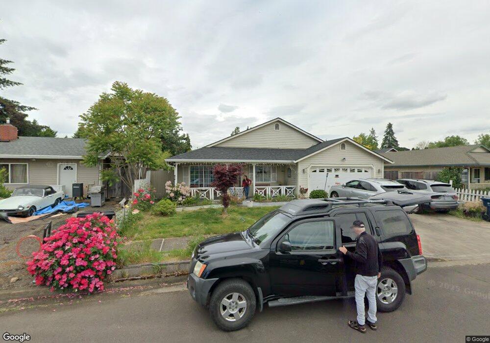
1367 David Ave Eugene, OR 97404
River Road NeighborhoodEstimated Value: $384,029 - $414,000
3
Beds
2
Baths
1,248
Sq Ft
$322/Sq Ft
Est. Value
About This Home
This home is located at 1367 David Ave, Eugene, OR 97404 and is currently estimated at $402,257, approximately $322 per square foot. 1367 David Ave is a home located in Lane County with nearby schools including Irving Elementary School, Shasta Middle School, and Willamette High School.
Ownership History
Date
Name
Owned For
Owner Type
Purchase Details
Closed on
Oct 15, 2021
Sold by
Lewis Charles D
Bought by
Lewis Charles Doug and Charles D Lewis Trust
Current Estimated Value
Purchase Details
Closed on
Oct 16, 1998
Sold by
Masada Development Inc
Bought by
Lewis Charles D
Home Financials for this Owner
Home Financials are based on the most recent Mortgage that was taken out on this home.
Original Mortgage
$36,900
Outstanding Balance
$7,016
Interest Rate
6.79%
Estimated Equity
$395,241
Create a Home Valuation Report for This Property
The Home Valuation Report is an in-depth analysis detailing your home's value as well as a comparison with similar homes in the area
Home Values in the Area
Average Home Value in this Area
Purchase History
| Date | Buyer | Sale Price | Title Company |
|---|---|---|---|
| Lewis Charles Doug | -- | None Available | |
| Lewis Charles D | $121,900 | Oregon Title Insurance Co |
Source: Public Records
Mortgage History
| Date | Status | Borrower | Loan Amount |
|---|---|---|---|
| Open | Lewis Charles D | $36,900 |
Source: Public Records
Tax History
| Year | Tax Paid | Tax Assessment Tax Assessment Total Assessment is a certain percentage of the fair market value that is determined by local assessors to be the total taxable value of land and additions on the property. | Land | Improvement |
|---|---|---|---|---|
| 2025 | $3,743 | $215,180 | -- | -- |
| 2024 | $3,649 | $208,913 | -- | -- |
| 2023 | $3,649 | $202,829 | -- | -- |
| 2022 | $3,396 | $196,922 | $0 | $0 |
| 2021 | $3,325 | $191,187 | $0 | $0 |
| 2020 | $3,228 | $185,619 | $0 | $0 |
| 2019 | $3,069 | $180,213 | $0 | $0 |
| 2018 | $2,983 | $169,869 | $0 | $0 |
| 2017 | $2,851 | $169,869 | $0 | $0 |
| 2016 | $2,778 | $164,921 | $0 | $0 |
| 2015 | $2,724 | $160,117 | $0 | $0 |
| 2014 | $2,682 | $155,453 | $0 | $0 |
Source: Public Records
Map
Nearby Homes
- 1307 Bramblewood Ln
- 2418 Kalmia St
- 2488 Northampton
- 1755 Brentwood Ave
- 1682 Hemlock St
- 3906 Century Dr
- 3717 Riviera
- 3886 Aerial Way
- 1566 Maywood Ave
- 805 Impala Ave
- 541 Durham Ave
- 2580 Crowther Dr
- 2563 York St
- 2610 Crowther Dr
- 4114 Jessen Dr
- 2002 Kintyre St
- 2931 Shelby Way
- 2721 La Darrah St
- 3820 Dove Ln
- 2965 Teal Place
- 1385 David Ave
- 1363 David Ave
- 1365 David Ave
- 1361 David Ave
- 1380 David Ave
- 1376 David Ave
- 1919 Smithoak St
- 1975 Smithoak St
- 1370 David Ave
- 1944 Anthony Way
- 1930 Anthony Way
- 1970 Anthony Way
- 650 Bushnell Ln
- 1362 David Ave
- 1943 Smithoak St
- 1325 Bramblewood Ln
- 2026 Anthony Way
- 1319 Bramblewood Ln
- 2010 Anthony Way
- 1995 Smithoak St
Your Personal Tour Guide
Ask me questions while you tour the home.