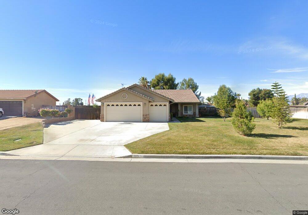
139 Carlin Ln Riverside, CA 92507
Highgrove NeighborhoodEstimated Value: $705,000 - $731,000
4
Beds
3
Baths
1,830
Sq Ft
$391/Sq Ft
Est. Value
About This Home
This home is located at 139 Carlin Ln, Riverside, CA 92507 and is currently estimated at $715,154, approximately $390 per square foot. 139 Carlin Ln is a home located in Riverside County with nearby schools including Highgrove Elementary School, University Heights Middle School, and John W. North High School.
Ownership History
Date
Name
Owned For
Owner Type
Purchase Details
Closed on
Feb 26, 2014
Sold by
Farley Donald V and Farley Beverly F
Bought by
The Farley Trust
Current Estimated Value
Purchase Details
Closed on
Apr 3, 2008
Sold by
Weesner Timothy A
Bought by
Farley Donald and Farley Beverly F
Home Financials for this Owner
Home Financials are based on the most recent Mortgage that was taken out on this home.
Original Mortgage
$200,000
Interest Rate
6.04%
Mortgage Type
Purchase Money Mortgage
Purchase Details
Closed on
Nov 14, 2005
Sold by
Tract 29168 Highgrove Llc
Bought by
Weesner Timothy A
Home Financials for this Owner
Home Financials are based on the most recent Mortgage that was taken out on this home.
Original Mortgage
$220,000
Interest Rate
8.76%
Mortgage Type
Fannie Mae Freddie Mac
Create a Home Valuation Report for This Property
The Home Valuation Report is an in-depth analysis detailing your home's value as well as a comparison with similar homes in the area
Home Values in the Area
Average Home Value in this Area
Purchase History
| Date | Buyer | Sale Price | Title Company |
|---|---|---|---|
| The Farley Trust | -- | None Available | |
| Farley Donald | $350,000 | Landwood Title | |
| Weesner Timothy A | $275,000 | Stewart Title Mad Anaheim |
Source: Public Records
Mortgage History
| Date | Status | Borrower | Loan Amount |
|---|---|---|---|
| Previous Owner | Farley Donald | $200,000 | |
| Previous Owner | Weesner Timothy A | $220,000 |
Source: Public Records
Tax History
| Year | Tax Paid | Tax Assessment Tax Assessment Total Assessment is a certain percentage of the fair market value that is determined by local assessors to be the total taxable value of land and additions on the property. | Land | Improvement |
|---|---|---|---|---|
| 2025 | $5,158 | $471,103 | $197,017 | $274,086 |
| 2023 | $5,158 | $452,811 | $189,367 | $263,444 |
| 2022 | $5,015 | $443,933 | $185,654 | $258,279 |
| 2021 | $4,927 | $435,229 | $182,014 | $253,215 |
| 2020 | $4,889 | $430,767 | $180,148 | $250,619 |
| 2019 | $4,797 | $422,321 | $176,616 | $245,705 |
| 2018 | $4,703 | $414,041 | $173,154 | $240,887 |
| 2017 | $4,029 | $353,000 | $148,000 | $205,000 |
| 2016 | $3,848 | $353,000 | $148,000 | $205,000 |
| 2015 | $3,778 | $346,000 | $145,000 | $201,000 |
| 2014 | $3,321 | $300,000 | $125,000 | $175,000 |
Source: Public Records
Map
Nearby Homes
- 7133 Flourish St
- 7145 Flourish St
- 22586 Main St
- 7210 Bliss St
- 7222 Bliss St
- 22544 Main St
- 7221 Bliss St
- 22400 Ladera St
- 22795 Raven Way
- 12738 Wilmac Ave
- 7387 Silverspot Rd
- 20065 Curaco Ct
- 7608 Citrusmoon Ct
- 7672 Kuvera Bend St
- 7635 Sweet Ranch Cir
- 22170 Raven Way
- 7664 Steamboat St
- 470 Conners Ln
- 7561 Baerss Rd
- 438 Tanner Cir
Your Personal Tour Guide
Ask me questions while you tour the home.