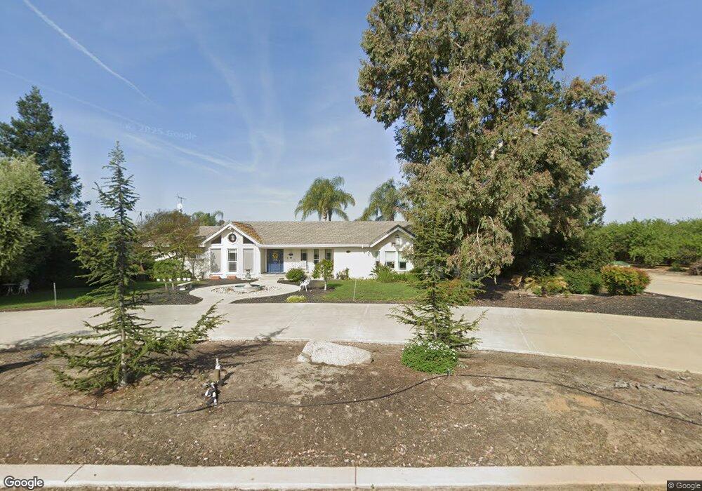
1401 Hull Rd Atwater, CA 95301
Estimated Value: $985,000 - $1,570,870
3
Beds
2
Baths
2,200
Sq Ft
$581/Sq Ft
Est. Value
About This Home
This home is located at 1401 Hull Rd, Atwater, CA 95301 and is currently estimated at $1,277,957, approximately $580 per square foot. 1401 Hull Rd is a home located in Merced County with nearby schools including McSwain Elementary School, Buhach Colony High School, and Landmark Christian School.
Ownership History
Date
Name
Owned For
Owner Type
Purchase Details
Closed on
Oct 31, 2024
Sold by
Silveira Joe B and Silveira Paulette A
Bought by
Silveira
Current Estimated Value
Purchase Details
Closed on
Jul 6, 1998
Sold by
United Companies Lending Corp
Bought by
Silveira Joe B and Silveira Paulette A
Home Financials for this Owner
Home Financials are based on the most recent Mortgage that was taken out on this home.
Original Mortgage
$201,800
Interest Rate
7.03%
Purchase Details
Closed on
Mar 20, 1998
Sold by
Wade David W and Wade Pamela M
Bought by
United Companies Lending Corp
Create a Home Valuation Report for This Property
The Home Valuation Report is an in-depth analysis detailing your home's value as well as a comparison with similar homes in the area
Purchase History
| Date | Buyer | Sale Price | Title Company |
|---|---|---|---|
| Silveira | -- | None Listed On Document | |
| Silveira | -- | None Listed On Document | |
| Silveira Joe B | $212,500 | Fidelity National Title Co | |
| United Companies Lending Corp | $220,674 | Fidelity National Title Ins |
Source: Public Records
Mortgage History
| Date | Status | Borrower | Loan Amount |
|---|---|---|---|
| Previous Owner | Silveira Joe B | $201,800 |
Source: Public Records
Tax History
| Year | Tax Paid | Tax Assessment Tax Assessment Total Assessment is a certain percentage of the fair market value that is determined by local assessors to be the total taxable value of land and additions on the property. | Land | Improvement |
|---|---|---|---|---|
| 2025 | $12,286 | $1,196,222 | $258,505 | $937,717 |
| 2024 | $12,286 | $1,147,890 | $226,469 | $921,421 |
| 2023 | $12,134 | $1,134,746 | $225,942 | $908,804 |
| 2022 | $11,983 | $1,112,820 | $216,906 | $895,914 |
| 2021 | $12,118 | $1,115,311 | $216,733 | $898,578 |
| 2020 | $12,113 | $1,116,027 | $205,116 | $910,911 |
| 2019 | $11,801 | $1,095,918 | $142,557 | $953,361 |
| 2018 | $11,306 | $1,048,987 | $114,011 | $934,976 |
| 2017 | $10,986 | $1,014,147 | $137,022 | $877,125 |
| 2016 | $10,836 | $994,263 | $134,336 | $859,927 |
| 2015 | $10,169 | $929,330 | $132,319 | $797,011 |
| 2014 | $8,847 | $796,552 | $189,333 | $607,219 |
Source: Public Records
Map
Nearby Homes
- 0 Green Sands Ave Unit MC22098863
- 9990 W 55th St
- 0 Aka W of 75th Unit CV25226384
- 8808 California 140
- 8808 State Highway 140
- 6410 Stockton Ave
- 1371 Shady Cove Ave
- 5704 W State Highway 140
- 2484 Sierra Springs Ct
- 5931 Presidio Ct
- 5561 Brighton Ct
- 1 White Crane Rd
- 0 Queen Elizabeth Dr
- 0 Moran Ave
- 3465 Giannini Rd
- 5135 W Lucille Ln
- 0 Noah Dr
- 2104 Redding Way
- 1883 Sycamore Ave
- 5420 Appaloosa Ct
- 1526 Hull Rd
- 1236 Hull Rd
- 1745 Hull Rd
- 1456 Bert Crane Rd
- 1760 Hull Rd
- 1850 Hull Rd
- 219 Derek Ave
- 9999 Santa fe
- 2370 Nebela Lot #44
- 0 Dogwood Ct Unit 80040941
- 0 W Hwy 140 Unit 80096101
- 0 W Hwy 140 Unit 90033626
- 3037 Bell St
- 0 Dogwood Ct-Lot #106 Unit 10033909
- 0 No Name Unit MC18162059
- 0 No Name Unit MC18050907
- 0 Alley Access Unit CC311179
- 0 Beluga Ct Unit CC319919
- 0 Beluga Ct Unit CC320129
- 1 Bell
Your Personal Tour Guide
Ask me questions while you tour the home.