Estimated Value: $882,000 - $1,076,342
5
Beds
3
Baths
1,752
Sq Ft
$566/Sq Ft
Est. Value
About This Home
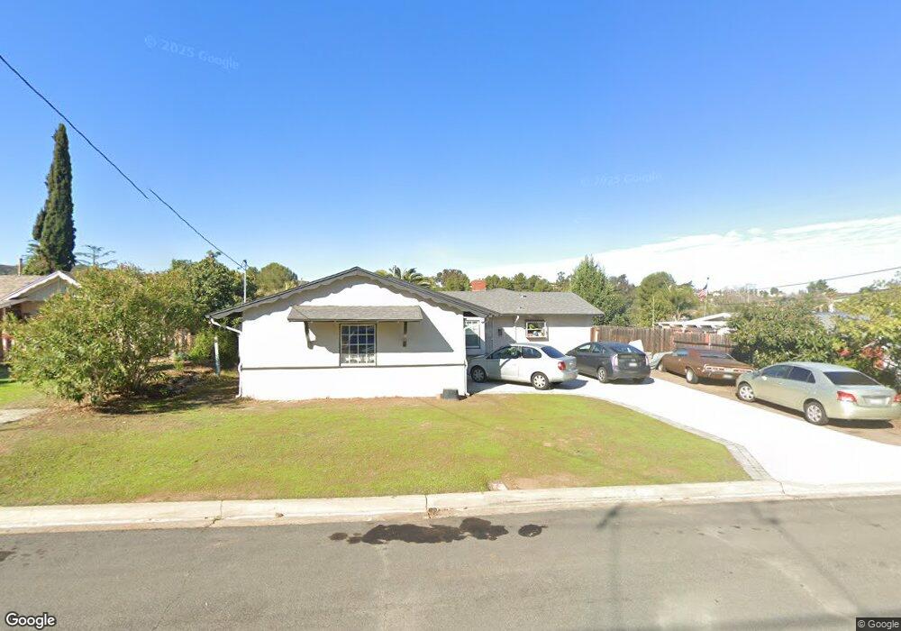
This home is located at 14132 Tobiasson Rd, Poway, CA 92064 and is currently estimated at $992,336, approximately $566 per square foot. 14132 Tobiasson Rd is a home located in San Diego County with nearby schools including Pomerado Elementary, Meadowbrook Middle, and Poway High.
Ownership History
Date
Name
Owned For
Owner Type
Purchase Details
Closed on
Sep 9, 2021
Sold by
Rizzo Ronald and Rizzo Mary
Bought by
Rizzo Ronald James and Rizzo Mary Elizabeth
Current Estimated Value
Purchase Details
Closed on
Aug 10, 1997
Sold by
Delhotal Brian K and Delhotal Carol A
Bought by
Rizzo Ronald and Rizzo Mary
Home Financials for this Owner
Home Financials are based on the most recent Mortgage that was taken out on this home.
Original Mortgage
$124,800
Outstanding Balance
$18,558
Interest Rate
7.45%
Estimated Equity
$973,778
Purchase Details
Closed on
Mar 28, 1990
Create a Home Valuation Report for This Property
The Home Valuation Report is an in-depth analysis detailing your home's value as well as a comparison with similar homes in the area
Home Values in the Area
Average Home Value in this Area
Purchase History
We collect this data history from publicly available records. To have your information removed, we recommend requesting removal directly through your county’s website.
| Date | Buyer | Sale Price | Title Company |
|---|---|---|---|
| Rizzo Ronald James | -- | None Available | |
| Rizzo Ronald | $156,000 | Commonwealth Land Title Co | |
| -- | $173,000 | -- |
Source: Public Records
Mortgage History
We collect this data history from publicly available records. To have your information removed, we recommend requesting removal directly through your county’s website.
| Date | Status | Borrower | Loan Amount |
|---|---|---|---|
| Open | Rizzo Ronald | $124,800 |
Source: Public Records
Tax History
| Year | Tax Paid | Tax Assessment Tax Assessment Total Assessment is a certain percentage of the fair market value that is determined by local assessors to be the total taxable value of land and additions on the property. | Land | Improvement |
|---|---|---|---|---|
| 2025 | $2,748 | $249,067 | $136,767 | $112,300 |
| 2024 | $2,748 | $244,185 | $134,086 | $110,099 |
| 2023 | $2,689 | $239,398 | $131,457 | $107,941 |
| 2022 | $2,644 | $234,705 | $128,880 | $105,825 |
| 2021 | $2,609 | $230,103 | $126,353 | $103,750 |
| 2020 | $2,574 | $227,745 | $125,058 | $102,687 |
| 2019 | $2,507 | $223,280 | $122,606 | $100,674 |
| 2018 | $2,437 | $218,902 | $120,202 | $98,700 |
| 2017 | $170 | $214,611 | $117,846 | $96,765 |
| 2016 | $2,322 | $210,404 | $115,536 | $94,868 |
| 2015 | $2,287 | $207,244 | $113,801 | $93,443 |
| 2014 | $2,234 | $203,185 | $111,572 | $91,613 |
Source: Public Records
Map
Nearby Homes
- 14212 Tobiasson Rd
- 14210 Frame Rd
- 14125 Halper Rd
- 13858 Esprit Ave
- 13824 Powers Rd
- 14054 Via Corsini Unit 14
- 13944 Arbolitos Dr
- 13757 Eisenhower Ave
- 12210 Riley Ln
- 12834 Rockwell Ct
- 13515 Essence Rd
- 13509 Tradition St
- 12166 Via Milano
- 12041 Tivoli Park Row Unit 1
- 12041 Tivoli Park Row
- 14110 Brent Wilsey Place Unit 1
- 12327 Cornwallis Square Unit 118
- 13641 Carriage Rd
- 12143 Stanwix Square
- 12144 Carrollton Square Unit 72
- 14144 Tobiasson Rd
- 14150 Tobiasson Rd
- 14138 Tobiasson Rd
- 14161 Frame Rd
- 14167 Frame Rd
- 14156 Tobiasson Rd
- 14145 Tobiasson Rd
- 14149 Frame Rd
- 14173 Frame Rd
- 14151 Tobiasson Rd
- 14139 Tobiasson Rd
- 14126 Tobiasson Rd
- 14206 Tobiasson Rd
- 14133 Tobiasson Rd
- 14157 Tobiasson Rd
- 14143 Frame Rd
- 14205 Frame Rd
- 14120 Tobiasson Rd
- 14160 Frame Rd
- 12509 Taunt Rd
Your Personal Tour Guide
Ask me questions while you tour the home.