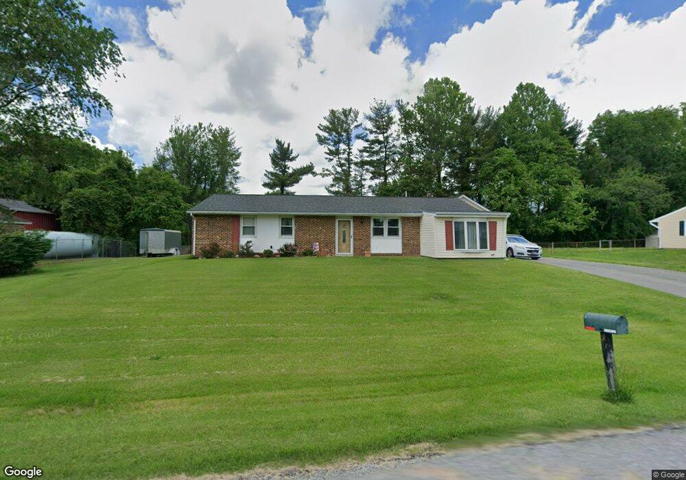
1433 Knight Ave Dunkirk, MD 20754
Estimated Value: $379,000 - $516,000
Studio
2
Baths
1,813
Sq Ft
$246/Sq Ft
Est. Value
About This Home
This home is located at 1433 Knight Ave, Dunkirk, MD 20754 and is currently estimated at $446,329, approximately $246 per square foot. 1433 Knight Ave is a home located in Calvert County with nearby schools including Windy Hill Elementary School, Northern Middle School, and Northern High School.
Ownership History
Date
Name
Owned For
Owner Type
Purchase Details
Closed on
Apr 24, 2025
Sold by
Jones Richard W and Jones Helena N
Bought by
Jones Family Revocable Trust and Jones
Current Estimated Value
Purchase Details
Closed on
Sep 6, 1990
Sold by
Knott Harry Conrad
Bought by
Jones Richard W and Jones Helena N
Home Financials for this Owner
Home Financials are based on the most recent Mortgage that was taken out on this home.
Original Mortgage
$129,550
Interest Rate
10.24%
Create a Home Valuation Report for This Property
The Home Valuation Report is an in-depth analysis detailing your home's value as well as a comparison with similar homes in the area
Home Values in the Area
Average Home Value in this Area
Purchase History
| Date | Buyer | Sale Price | Title Company |
|---|---|---|---|
| Jones Family Revocable Trust | -- | None Listed On Document | |
| Jones Family Revocable Trust | -- | None Listed On Document | |
| Jones Richard W | $127,000 | -- |
Source: Public Records
Mortgage History
| Date | Status | Borrower | Loan Amount |
|---|---|---|---|
| Previous Owner | Jones Richard W | $129,550 |
Source: Public Records
Tax History
| Year | Tax Paid | Tax Assessment Tax Assessment Total Assessment is a certain percentage of the fair market value that is determined by local assessors to be the total taxable value of land and additions on the property. | Land | Improvement |
|---|---|---|---|---|
| 2025 | $3,906 | $347,000 | $136,200 | $210,800 |
| 2024 | $3,737 | $331,767 | $0 | $0 |
| 2023 | $3,443 | $316,533 | $0 | $0 |
| 2022 | $3,131 | $301,300 | $136,200 | $165,100 |
| 2021 | $3,176 | $295,800 | $0 | $0 |
| 2020 | $3,176 | $290,300 | $0 | $0 |
| 2019 | $3,130 | $284,800 | $136,200 | $148,600 |
| 2018 | $3,115 | $284,667 | $0 | $0 |
| 2017 | $3,153 | $284,533 | $0 | $0 |
| 2016 | -- | $284,400 | $0 | $0 |
| 2015 | $3,061 | $284,400 | $0 | $0 |
| 2014 | $3,061 | $284,400 | $0 | $0 |
Source: Public Records
Map
Nearby Homes
- 461 Jewell Rd
- 11130 Dumbarton Dr
- 12761 Carronade Ct
- 6340 Mckendree Rd
- 276 Southdale Ct
- 11216 Lakeview Dr
- 2850 Dunleigh Dr
- 2950 Chaney Rd
- 411 W Mckendree Rd
- 99 Hummingbird Ct
- 11871 Lexington Dr
- 6159 Fishers Station Rd
- 6125 Fishers Station Rd
- 1921 Haven Ln
- 3402 King Dr
- 243 Jaguar Dr
- 6095 Solomons Island Rd
- 9254 Blue Sky Ct
- 1071 Lower Pindell Rd
- 56 Cross Point Dr
- 1435 Knight Ave
- 1431 Knight Ave
- 1430 Knight Ave
- 1432 Knight Ave
- 1429 Knight Ave
- 1428 Knight Ave
- 1434 Knight Ave
- 1462 Knight Ave
- 1427 Knight Ave
- 1460 Knight Ave
- 1437 Knight Ave
- 1420 Knight Ave
- 1436 Knight Ave
- 1458 Knight Ave
- 1425 Knight Ave
- 1471 Knight Ave
- 1370 Jewell Rd
- 1469 Knight Ave
- 1456 Knight Ave
- 1467 Knight Ave
Your Personal Tour Guide
Ask me questions while you tour the home.