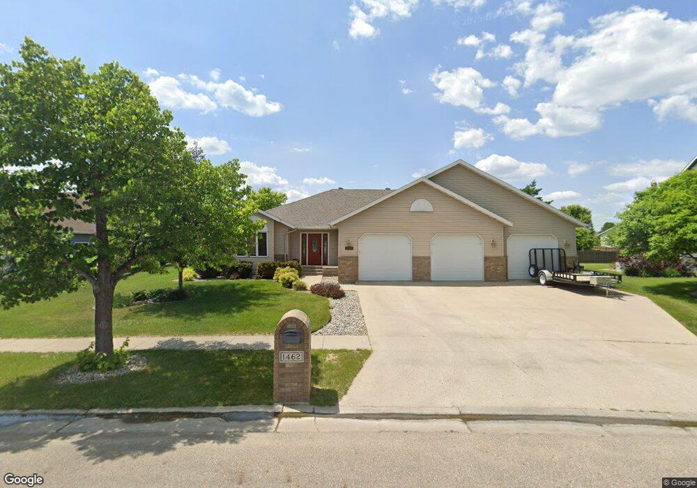
1462 7th St E West Fargo, ND 58078
Charleswood NeighborhoodEstimated Value: $460,000 - $535,481
4
Beds
3
Baths
2,241
Sq Ft
$222/Sq Ft
Est. Value
About This Home
This home is located at 1462 7th St E, West Fargo, ND 58078 and is currently estimated at $497,741, approximately $222 per square foot. 1462 7th St E is a home located in Cass County with nearby schools including South Elementary School, Cheney Middle School, and West Fargo High School.
Ownership History
Date
Name
Owned For
Owner Type
Purchase Details
Closed on
May 15, 2009
Sold by
Brooks Kristi
Bought by
Ranum Dena L and Ranum Chris M
Current Estimated Value
Home Financials for this Owner
Home Financials are based on the most recent Mortgage that was taken out on this home.
Original Mortgage
$215,900
Outstanding Balance
$136,264
Interest Rate
4.83%
Mortgage Type
New Conventional
Estimated Equity
$361,477
Purchase Details
Closed on
Oct 29, 2007
Sold by
Brooks Lee M
Bought by
Brooks Kristi
Create a Home Valuation Report for This Property
The Home Valuation Report is an in-depth analysis detailing your home's value as well as a comparison with similar homes in the area
Home Values in the Area
Average Home Value in this Area
Purchase History
| Date | Buyer | Sale Price | Title Company |
|---|---|---|---|
| Ranum Dena L | -- | -- | |
| Brooks Kristi | -- | -- |
Source: Public Records
Mortgage History
| Date | Status | Borrower | Loan Amount |
|---|---|---|---|
| Open | Ranum Dena L | $215,900 |
Source: Public Records
Tax History
| Year | Tax Paid | Tax Assessment Tax Assessment Total Assessment is a certain percentage of the fair market value that is determined by local assessors to be the total taxable value of land and additions on the property. | Land | Improvement |
|---|---|---|---|---|
| 2024 | $5,257 | $202,600 | $38,350 | $164,250 |
| 2023 | $5,523 | $192,550 | $38,350 | $154,200 |
| 2022 | $5,592 | $186,700 | $38,350 | $148,350 |
| 2021 | $5,254 | $168,450 | $31,600 | $136,850 |
| 2020 | $4,928 | $163,250 | $31,600 | $131,650 |
| 2019 | $4,681 | $161,000 | $31,600 | $129,400 |
| 2018 | $4,415 | $158,400 | $31,600 | $126,800 |
| 2017 | $4,309 | $158,450 | $31,600 | $126,850 |
| 2016 | $3,817 | $153,550 | $31,600 | $121,950 |
| 2015 | $3,660 | $136,050 | $24,550 | $111,500 |
| 2014 | $3,451 | $127,150 | $24,550 | $102,600 |
| 2013 | $3,374 | $122,250 | $24,550 | $97,700 |
Source: Public Records
Map
Nearby Homes
- 722 14 1 2 Ave E
- 783 14 1 2 Ave E
- 602 12 1 2 Ave E Unit 5
- 306 13th Ave E
- 1409 Heatherwood Ct
- 790 Lakeridge Dr
- 245 12th Ave E
- 715 Northridge Way
- 868 Lakeridge Place
- 622 12th Ave E
- 1811 7th St E
- 1827 7th St E
- 1929 Pentland St
- 1424 14th St E Unit 11
- 1755 Huntington Dr
- 1550 Sheyenne St
- 226 10 1/2 Ave W
- 801 9th St E
- 1829 13th St E
- 1423 10th Ave E Unit 206
- 1470 7th St E
- 1454 7th St E
- 1453 6th St E
- 1447 6th St E
- 1459 6th St E
- 1478 7th St E
- 1441 6th St E
- 711 14 1/2 Ave E
- 711 14 1 2 Ave E
- 710 14 1/2 Ave E
- 1465 6th St E
- 708 15th Ave E
- 1435 6th St E
- 717 14 1 2 Ave E
- 717 14 1/2 Ave E
- 716 14 1/2 Ave E
- 714 15th Ave E
- 619 14th Ave E
- 617 14th Ave E
- 623 14th Ave E
Your Personal Tour Guide
Ask me questions while you tour the home.