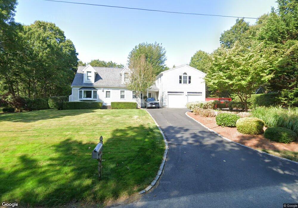
148 Sampsons Mill Rd Mashpee, MA 02649
Estimated Value: $622,000 - $1,080,000
4
Beds
3
Baths
2,052
Sq Ft
$391/Sq Ft
Est. Value
About This Home
This home is located at 148 Sampsons Mill Rd, Mashpee, MA 02649 and is currently estimated at $801,439, approximately $390 per square foot. 148 Sampsons Mill Rd is a home located in Barnstable County with nearby schools including Kenneth C. Coombs School, Quashnet School, and Mashpee Middle School.
Ownership History
Date
Name
Owned For
Owner Type
Purchase Details
Closed on
Nov 4, 1996
Sold by
Knutson Mtg Corp
Bought by
Eldredge Patricia A
Current Estimated Value
Home Financials for this Owner
Home Financials are based on the most recent Mortgage that was taken out on this home.
Original Mortgage
$84,000
Outstanding Balance
$8,264
Interest Rate
8.07%
Mortgage Type
Purchase Money Mortgage
Estimated Equity
$793,175
Purchase Details
Closed on
Oct 30, 1996
Sold by
Metayer Diane E
Bought by
Knutson Mortgage Corp
Home Financials for this Owner
Home Financials are based on the most recent Mortgage that was taken out on this home.
Original Mortgage
$84,000
Outstanding Balance
$8,264
Interest Rate
8.07%
Mortgage Type
Purchase Money Mortgage
Estimated Equity
$793,175
Create a Home Valuation Report for This Property
The Home Valuation Report is an in-depth analysis detailing your home's value as well as a comparison with similar homes in the area
Purchase History
| Date | Buyer | Sale Price | Title Company |
|---|---|---|---|
| Eldredge Patricia A | $84,000 | -- | |
| Knutson Mortgage Corp | $109,396 | -- |
Source: Public Records
Mortgage History
| Date | Status | Borrower | Loan Amount |
|---|---|---|---|
| Open | Eldredge Patricia A | $84,000 |
Source: Public Records
Tax History
| Year | Tax Paid | Tax Assessment Tax Assessment Total Assessment is a certain percentage of the fair market value that is determined by local assessors to be the total taxable value of land and additions on the property. | Land | Improvement |
|---|---|---|---|---|
| 2025 | $4,263 | $643,900 | $190,100 | $453,800 |
| 2024 | $3,893 | $605,400 | $172,900 | $432,500 |
| 2023 | $3,645 | $520,000 | $164,600 | $355,400 |
| 2022 | $3,470 | $424,700 | $133,800 | $290,900 |
| 2021 | $3,404 | $375,300 | $120,500 | $254,800 |
| 2020 | $3,311 | $364,200 | $115,900 | $248,300 |
| 2019 | $21,231 | $346,300 | $115,900 | $230,400 |
| 2018 | $2,599 | $330,100 | $115,900 | $214,200 |
| 2017 | $2,852 | $310,300 | $115,900 | $194,400 |
| 2016 | $2,742 | $296,700 | $115,900 | $180,800 |
| 2015 | $2,634 | $289,100 | $115,900 | $173,200 |
| 2014 | $2,699 | $287,400 | $114,500 | $172,900 |
Source: Public Records
Map
Nearby Homes
- 70 Simons Rd Unit E
- 70 Simons Rd
- 70 Cape Dr Unit 14D
- 70 Cape Dr Unit 11D
- 70 Cape Dr Unit 11D
- 226 Dunrobin Rd
- 16 Spring Brook Ln
- 195 Falmouth Rd Unit 10E
- 195 Falmouth Rd Unit 19F
- 195 Falmouth Rd Unit 10E
- 195 Falmouth Rd Unit 9D
- 195 Falmouth Rd Unit 19F
- 114 Orchard Rd
- 6 Willow Cir
- 4 Bishops Park
- 239 Oxford Dr
- 16 Cedar St
- 34 Rainbow Ln
- 39 Papnomett Rd
- 75 Bob White Run
- 117 Sampsons Old Mill
- 154 Sampsons Mill Rd
- 142 Sampsons Mill Rd
- 145 Sampsons Mill Rd
- 160 Sampsons Mill Rd
- 151 Sampsons Mill Rd
- 106 Cape Dr
- 137 Sampsons Mill Rd
- 98 Cape Dr
- 137 Sampson's Mill Rd
- 101 Quippish Rd
- 90 Cape Dr
- 131 Sampsons Mill Rd
- 135 Sampsons Mill Rd
- 0 Sampsons Mill Rd
- 126 Sampsons Mill Rd
- 99 Cape Dr
- 127 Sampsons Mill Rd
- 93 Cape Dr
- 46 Cranberry Ridge Rd
Your Personal Tour Guide
Ask me questions while you tour the home.