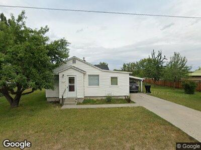
1505 5th Ave W Kalispell, MT 59901
Estimated Value: $303,000 - $372,000
3
Beds
1
Bath
1,083
Sq Ft
$323/Sq Ft
Est. Value
About This Home
This home is located at 1505 5th Ave W, Kalispell, MT 59901 and is currently estimated at $350,152, approximately $323 per square foot. 1505 5th Ave W is a home located in Flathead County with nearby schools including Elrod School, Kalispell Middle School, and Flathead High School.
Ownership History
Date
Name
Owned For
Owner Type
Purchase Details
Closed on
Mar 9, 2021
Sold by
Patton Kacy
Bought by
Patton Daniel
Current Estimated Value
Purchase Details
Closed on
Sep 24, 2016
Sold by
Patton Daniel J and Patton Kacy
Bought by
Patton Daniel J and Patton Kacy
Home Financials for this Owner
Home Financials are based on the most recent Mortgage that was taken out on this home.
Original Mortgage
$124,100
Interest Rate
3.43%
Mortgage Type
New Conventional
Create a Home Valuation Report for This Property
The Home Valuation Report is an in-depth analysis detailing your home's value as well as a comparison with similar homes in the area
Home Values in the Area
Average Home Value in this Area
Purchase History
| Date | Buyer | Sale Price | Title Company |
|---|---|---|---|
| Patton Daniel | -- | None Available | |
| Patton Daniel J | -- | None Available |
Source: Public Records
Mortgage History
| Date | Status | Borrower | Loan Amount |
|---|---|---|---|
| Closed | Patton Daniel J | $109,900 | |
| Closed | Patton Daniel J | $124,100 | |
| Closed | Patton Daniel J | $120,000 | |
| Closed | Patton Daniel J | $30,000 |
Source: Public Records
Tax History Compared to Growth
Tax History
| Year | Tax Paid | Tax Assessment Tax Assessment Total Assessment is a certain percentage of the fair market value that is determined by local assessors to be the total taxable value of land and additions on the property. | Land | Improvement |
|---|---|---|---|---|
| 2024 | $2,149 | $276,000 | $0 | $0 |
| 2023 | $2,648 | $276,000 | $0 | $0 |
| 2022 | $1,913 | $190,400 | $0 | $0 |
| 2021 | $2,050 | $190,400 | $0 | $0 |
| 2020 | $2,142 | $151,900 | $0 | $0 |
| 2019 | $2,142 | $151,900 | $0 | $0 |
| 2018 | $1,972 | $131,000 | $0 | $0 |
| 2017 | $1,974 | $131,000 | $0 | $0 |
| 2016 | $1,567 | $108,800 | $0 | $0 |
| 2015 | $1,561 | $108,800 | $0 | $0 |
| 2014 | $1,711 | $74,942 | $0 | $0 |
Source: Public Records
Map
Nearby Homes
- 1543 7th Ave W
- 1401 6th Ave W
- 1302 5th Ave W
- 1202 6th Ave W
- 1129 6th Ave W
- 1888 N Belmar Dr
- 1922 Bluestone Dr
- 1905 Darlington Dr
- 7 and 9 Stratford Dr
- 1814 Bluestone Dr
- 1934 Belmar Dr
- 1735 Bluestone Dr
- 861 9th St W
- 1030 1st Ave W
- 706 Ashley Dr
- 804 5th Ave W
- 1215 Sunnyside Dr
- 824 8th St W
- 819 3rd Ave W
- 1996/1998 Greatview