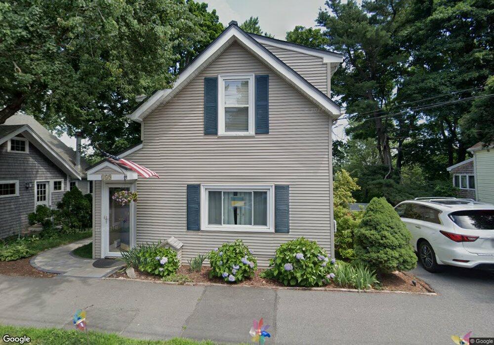
159 Riverside Dr Dedham, MA 02026
Riverdale NeighborhoodEstimated Value: $665,690 - $771,000
4
Beds
2
Baths
1,322
Sq Ft
$529/Sq Ft
Est. Value
About This Home
This home is located at 159 Riverside Dr, Dedham, MA 02026 and is currently estimated at $698,923, approximately $528 per square foot. 159 Riverside Dr is a home located in Norfolk County with nearby schools including Riverdale Elementary School, Dedham Middle School, and Dedham High School.
Ownership History
Date
Name
Owned For
Owner Type
Purchase Details
Closed on
Aug 28, 2009
Sold by
Vaughan Richard J and Vaughan Michelle B
Bought by
Larose Michael L and Larose Sharon I
Current Estimated Value
Home Financials for this Owner
Home Financials are based on the most recent Mortgage that was taken out on this home.
Original Mortgage
$405,028
Outstanding Balance
$264,617
Interest Rate
5.17%
Mortgage Type
Purchase Money Mortgage
Estimated Equity
$434,306
Purchase Details
Closed on
Apr 29, 2004
Sold by
Mann Douglas P
Bought by
Vaughan Michelle B and Vaughan Richard J
Home Financials for this Owner
Home Financials are based on the most recent Mortgage that was taken out on this home.
Original Mortgage
$360,000
Interest Rate
5.36%
Mortgage Type
Purchase Money Mortgage
Create a Home Valuation Report for This Property
The Home Valuation Report is an in-depth analysis detailing your home's value as well as a comparison with similar homes in the area
Home Values in the Area
Average Home Value in this Area
Purchase History
| Date | Buyer | Sale Price | Title Company |
|---|---|---|---|
| Larose Michael L | $412,500 | -- | |
| Vaughan Michelle B | $450,000 | -- |
Source: Public Records
Mortgage History
| Date | Status | Borrower | Loan Amount |
|---|---|---|---|
| Open | Larose Michael L | $405,028 | |
| Previous Owner | Vaughan Michelle B | $360,000 |
Source: Public Records
Tax History
| Year | Tax Paid | Tax Assessment Tax Assessment Total Assessment is a certain percentage of the fair market value that is determined by local assessors to be the total taxable value of land and additions on the property. | Land | Improvement |
|---|---|---|---|---|
| 2025 | $7,645 | $605,800 | $327,100 | $278,700 |
| 2024 | $7,013 | $561,000 | $297,100 | $263,900 |
| 2023 | $6,325 | $492,600 | $269,500 | $223,100 |
| 2022 | $6,576 | $492,600 | $269,500 | $223,100 |
| 2021 | $6,335 | $463,400 | $248,800 | $214,600 |
| 2020 | $6,211 | $452,700 | $230,300 | $222,400 |
| 2019 | $6,052 | $427,700 | $210,300 | $217,400 |
| 2018 | $6,478 | $445,200 | $221,200 | $224,000 |
| 2017 | $6,241 | $422,800 | $207,300 | $215,500 |
| 2016 | $5,878 | $379,500 | $191,900 | $187,600 |
| 2015 | $5,350 | $337,100 | $147,700 | $189,400 |
| 2014 | $5,189 | $322,700 | $145,000 | $177,700 |
Source: Public Records
Map
Nearby Homes
- 50 Trimount St
- 17-31 Charles Park Rd Unit 196
- 1210 Vfw Pkwy Unit 11
- 1216 Vfw Pkwy Unit 40
- 63 Dixon Ave
- 18 Hemlock Rd
- 1515 Vfw Pkwy Unit M19
- 340 Baker St Unit 2
- 116 Spring St Unit D2
- 56 Riverview St
- 17 Cass St Unit 4
- 15 Cass St Unit 3
- 37 Cotuit St
- 9 Cass St Unit 2
- 45 Commonwealth Ave
- 990 Vfw Pkwy Unit 204
- 71 Joyce Kilmer Rd
- 342 Needham St
- 69 Keystone St Unit 1
- 33 Paragon Rd
- 155 Riverside Dr
- 163 Riverside Dr
- 153 Riverside Dr
- 41 E Riverside Dr
- 154 Riverside Dr
- 12 Bayard St
- 148 Riverside Dr
- 171 Riverside Dr
- 37 E Riverside Dr
- 2 Bayard St Unit 2
- 146 Riverside Dr
- 44 E Riverside Dr
- 16 Bayard St
- 175 Riverside Dr
- 30 E Riverside Dr
- 30 E Riverside Dr Unit 30
- 143 Riverside Unit 101
- 143 Riverside Dr
- 20 Bayard St
- 3 Bayard St
Your Personal Tour Guide
Ask me questions while you tour the home.