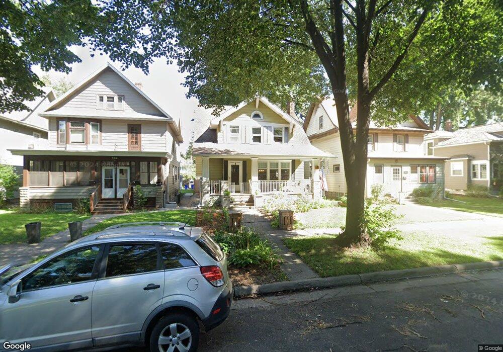
1617 Ashland Ave Saint Paul, MN 55104
Union Park NeighborhoodEstimated Value: $436,000 - $487,175
3
Beds
2
Baths
1,984
Sq Ft
$236/Sq Ft
Est. Value
About This Home
This home is located at 1617 Ashland Ave, Saint Paul, MN 55104 and is currently estimated at $469,044, approximately $236 per square foot. 1617 Ashland Ave is a home located in Ramsey County with nearby schools including Groveland Park Elementary School, Hidden River Middle School, and Central Senior High School.
Ownership History
Date
Name
Owned For
Owner Type
Purchase Details
Closed on
Mar 25, 2022
Sold by
Davidson Iii James P and Bloch Tamara
Bought by
Donoghue Nathaniel
Current Estimated Value
Home Financials for this Owner
Home Financials are based on the most recent Mortgage that was taken out on this home.
Original Mortgage
$399,000
Outstanding Balance
$374,833
Interest Rate
4.42%
Mortgage Type
New Conventional
Estimated Equity
$94,211
Purchase Details
Closed on
Mar 18, 2022
Sold by
Davidson James and Davidson Tamara
Bought by
Donoghue Nathaniel
Home Financials for this Owner
Home Financials are based on the most recent Mortgage that was taken out on this home.
Original Mortgage
$399,000
Outstanding Balance
$374,833
Interest Rate
4.42%
Mortgage Type
New Conventional
Estimated Equity
$94,211
Create a Home Valuation Report for This Property
The Home Valuation Report is an in-depth analysis detailing your home's value as well as a comparison with similar homes in the area
Home Values in the Area
Average Home Value in this Area
Purchase History
| Date | Buyer | Sale Price | Title Company |
|---|---|---|---|
| Donoghue Nathaniel | -- | Burnet Title | |
| Donoghue Nathaniel | $420,000 | -- |
Source: Public Records
Mortgage History
| Date | Status | Borrower | Loan Amount |
|---|---|---|---|
| Open | Donoghue Nathaniel | $399,000 | |
| Closed | Donoghue Nathaniel | $420,000 |
Source: Public Records
Tax History Compared to Growth
Tax History
| Year | Tax Paid | Tax Assessment Tax Assessment Total Assessment is a certain percentage of the fair market value that is determined by local assessors to be the total taxable value of land and additions on the property. | Land | Improvement |
|---|---|---|---|---|
| 2025 | $8,348 | $504,300 | $96,000 | $408,300 |
| 2023 | $8,348 | $467,000 | $96,000 | $371,000 |
| 2022 | $4,882 | $316,400 | $96,000 | $220,400 |
| 2021 | $5,052 | $285,900 | $96,000 | $189,900 |
| 2020 | $5,264 | $307,700 | $96,000 | $211,700 |
| 2019 | $4,898 | $298,200 | $96,000 | $202,200 |
| 2018 | $4,576 | $272,900 | $96,000 | $176,900 |
| 2017 | $4,612 | $262,500 | $96,000 | $166,500 |
| 2016 | $4,744 | $0 | $0 | $0 |
| 2015 | $4,510 | $262,500 | $96,000 | $166,500 |
| 2014 | $4,510 | $0 | $0 | $0 |
Source: Public Records
Map
Nearby Homes
- 1670 Ashland Ave
- 1540 Ashland Ave Unit 12
- 1510 Laurel Ave
- 184 Saratoga St N
- 750 Summit Ave
- 1671 Marshall Ave
- 266 Fry St
- 1447 Hague Ave
- 1821 Selby Ave
- 1611 Carroll Ave
- 1798 Marshall Ave
- 142 Cambridge St
- 1796 Iglehart Ave
- 1836 Marshall Ave
- 1354 Grand Ave
- 1826 Goodrich Ave
- 1787 Carroll Ave
- 382 Fry St
- 1920 Laurel Ave
- 1917 Summit Ave Unit 2
- 1615 Ashland Ave
- 1621 Ashland Ave
- 1625 Ashland Ave
- 1611 Ashland Ave
- 1603 Ashland Ave
- 1618 Laurel Ave
- 1620 Laurel Ave
- 1614 Laurel Ave
- 1633 Ashland Ave
- 1610 Laurel Ave
- 1610 1610 Laurel Ave
- 1626 Laurel Ave
- 1612 Ashland Ave
- 1595 Ashland Ave
- 1595 1595 Ashland Ave
- 1604 Laurel Ave
- 1618 Ashland Ave
- 1624 Ashland Ave
- 1635 1635 Ashland Ave
- 1635 Ashland Ave