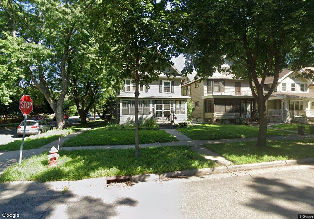
1625 Ashland Ave Saint Paul, MN 55104
Union Park NeighborhoodEstimated Value: $390,703 - $479,000
5
Beds
3
Baths
2,451
Sq Ft
$179/Sq Ft
Est. Value
About This Home
This home is located at 1625 Ashland Ave, Saint Paul, MN 55104 and is currently estimated at $438,176, approximately $178 per square foot. 1625 Ashland Ave is a home located in Ramsey County with nearby schools including Groveland Park Elementary School, Hidden River Middle School, and Central Senior High School.
Ownership History
Date
Name
Owned For
Owner Type
Purchase Details
Closed on
Sep 29, 2023
Sold by
Bjornberg Gary A and Bjornberg Kimberley A
Bought by
Kaniess Kab
Current Estimated Value
Purchase Details
Closed on
Jul 10, 2013
Sold by
The Bank Of New York Mellon
Bought by
Dph Investments Llc
Purchase Details
Closed on
Nov 17, 1997
Sold by
Prentice Thomas R and Berg Carrie L
Bought by
Prentice John S
Create a Home Valuation Report for This Property
The Home Valuation Report is an in-depth analysis detailing your home's value as well as a comparison with similar homes in the area
Home Values in the Area
Average Home Value in this Area
Purchase History
| Date | Buyer | Sale Price | Title Company |
|---|---|---|---|
| Kaniess Kab | $235,000 | Watermark Title | |
| Dph Investments Llc | $216,363 | Servicelink Hopewell Campus | |
| -- | $210,000 | -- | |
| Prentice John S | $120,000 | -- |
Source: Public Records
Tax History Compared to Growth
Tax History
| Year | Tax Paid | Tax Assessment Tax Assessment Total Assessment is a certain percentage of the fair market value that is determined by local assessors to be the total taxable value of land and additions on the property. | Land | Improvement |
|---|---|---|---|---|
| 2025 | $7,478 | $398,500 | $96,000 | $302,500 |
| 2023 | $7,478 | $381,500 | $96,000 | $285,500 |
| 2022 | $7,236 | $375,600 | $96,000 | $279,600 |
| 2021 | $6,638 | $342,000 | $96,000 | $246,000 |
| 2020 | $6,868 | $322,600 | $96,000 | $226,600 |
| 2019 | $6,406 | $309,800 | $96,000 | $213,800 |
| 2018 | $5,818 | $284,600 | $96,000 | $188,600 |
| 2017 | $5,380 | $263,500 | $96,000 | $167,500 |
| 2016 | $5,484 | $0 | $0 | $0 |
| 2015 | $5,612 | $240,600 | $96,000 | $144,600 |
| 2014 | $5,842 | $0 | $0 | $0 |
Source: Public Records
Map
Nearby Homes
- 1670 Ashland Ave
- 1540 Ashland Ave Unit 12
- 1510 Laurel Ave
- 184 Saratoga St N
- 750 Summit Ave
- 1671 Marshall Ave
- 266 Fry St
- 1447 Hague Ave
- 1821 Selby Ave
- 1611 Carroll Ave
- 1798 Marshall Ave
- 142 Cambridge St
- 1796 Iglehart Ave
- 1836 Marshall Ave
- 1354 Grand Ave
- 1826 Goodrich Ave
- 1787 Carroll Ave
- 382 Fry St
- 1920 Laurel Ave
- 1917 Summit Ave Unit 2
- 1621 Ashland Ave
- 1617 Ashland Ave
- 1633 Ashland Ave
- 1615 Ashland Ave
- 1635 1635 Ashland Ave
- 1635 Ashland Ave
- 1611 Ashland Ave
- 1626 Laurel Ave
- 1620 Laurel Ave
- 1618 Laurel Ave
- 1641 Ashland Ave
- 1630 Laurel Ave
- 1628 Laurel Ave
- 1630 Laurel Ave Unit 1
- 1630 1630 Laurel-Avenue-
- 1630 1630 Laurel Ave
- 1614 Laurel Ave
- 1624 Ashland Ave
- 1612 Ashland Ave
- 1634 Laurel Ave