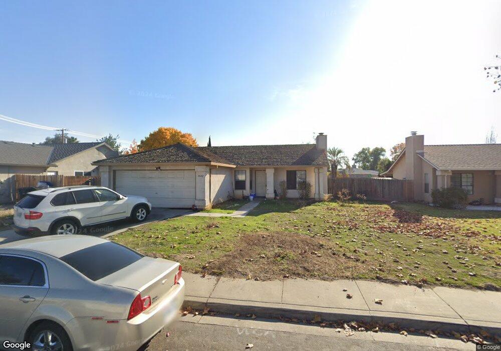
1642 Phil Way Modesto, CA 95351
Bystorm NeighborhoodEstimated Value: $321,000 - $382,000
3
Beds
2
Baths
1,086
Sq Ft
$320/Sq Ft
Est. Value
About This Home
This home is located at 1642 Phil Way, Modesto, CA 95351 and is currently estimated at $348,027, approximately $320 per square foot. 1642 Phil Way is a home located in Stanislaus County with nearby schools including M. Robert Adkison Elementary School, Mae Hensley Junior High School, and Ceres High School.
Ownership History
Date
Name
Owned For
Owner Type
Purchase Details
Closed on
Oct 6, 2010
Sold by
Lily Development Inc
Bought by
Samra Harjot S
Current Estimated Value
Home Financials for this Owner
Home Financials are based on the most recent Mortgage that was taken out on this home.
Original Mortgage
$84,000
Outstanding Balance
$55,101
Interest Rate
4.31%
Mortgage Type
New Conventional
Estimated Equity
$292,926
Purchase Details
Closed on
Feb 25, 2010
Sold by
Vargas Octavio and Guerrero Maria M
Bought by
Lily Development Inc
Purchase Details
Closed on
Mar 18, 2004
Sold by
Hirai Akira
Bought by
Vargas Octavio and Guerrero Maria M
Home Financials for this Owner
Home Financials are based on the most recent Mortgage that was taken out on this home.
Original Mortgage
$170,000
Interest Rate
5%
Mortgage Type
Purchase Money Mortgage
Create a Home Valuation Report for This Property
The Home Valuation Report is an in-depth analysis detailing your home's value as well as a comparison with similar homes in the area
Home Values in the Area
Average Home Value in this Area
Purchase History
| Date | Buyer | Sale Price | Title Company |
|---|---|---|---|
| Samra Harjot S | $105,000 | Old Republic Title Company | |
| Lily Development Inc | $81,940 | Old Republic | |
| Vargas Octavio | $212,500 | Alliance Title Company |
Source: Public Records
Mortgage History
| Date | Status | Borrower | Loan Amount |
|---|---|---|---|
| Open | Samra Harjot S | $84,000 | |
| Previous Owner | Vargas Octavio | $170,000 | |
| Closed | Vargas Octavio | $42,500 |
Source: Public Records
Tax History Compared to Growth
Tax History
| Year | Tax Paid | Tax Assessment Tax Assessment Total Assessment is a certain percentage of the fair market value that is determined by local assessors to be the total taxable value of land and additions on the property. | Land | Improvement |
|---|---|---|---|---|
| 2025 | $1,616 | $134,513 | $57,648 | $76,865 |
| 2024 | $1,517 | $131,876 | $56,518 | $75,358 |
| 2023 | $1,476 | $129,291 | $55,410 | $73,881 |
| 2022 | $1,462 | $126,757 | $54,324 | $72,433 |
| 2021 | $1,446 | $124,272 | $53,259 | $71,013 |
| 2020 | $1,402 | $122,998 | $52,713 | $70,285 |
| 2019 | $1,393 | $120,587 | $51,680 | $68,907 |
| 2018 | $1,364 | $118,223 | $50,667 | $67,556 |
| 2017 | $1,353 | $115,906 | $49,674 | $66,232 |
| 2016 | $1,325 | $113,634 | $48,700 | $64,934 |
| 2015 | $1,307 | $111,928 | $47,969 | $63,959 |
| 2014 | $1,281 | $109,737 | $47,030 | $62,707 |
Source: Public Records
Map
Nearby Homes
- 1637 Fantasy Ct
- 1516 Woodworth Ave
- 1625 River Rd
- 1009 Zinfandel Place
- 1301 Stonum Rd
- 1323 Holm Ave
- 1236 Vito Ave
- 1320 Aurora St
- 2120 River Rd
- 2217 Shadowbrook Way
- 811 Kerr Ave
- 740 Empire Ave
- 601 Avon St
- 0 5th St
- 739 Shallow Stream Way
- 634 Romeo Ave
- 1715 Lois Way
- 2320 Senimi Cir
- 1409 Villa Way
- 712 S Santa Cruz Ave