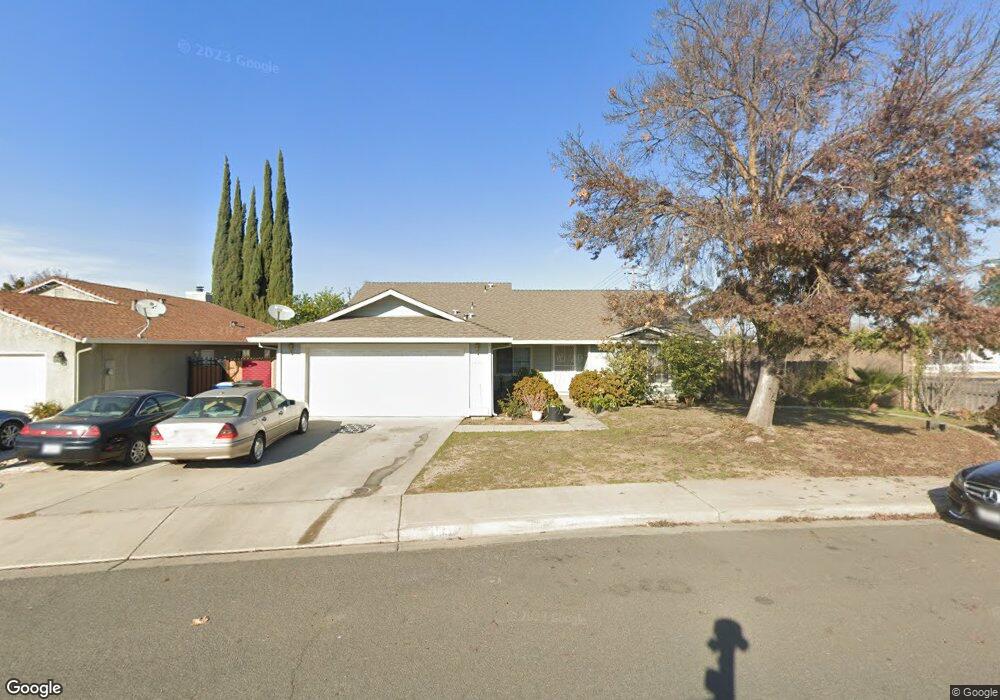
1647 Phil Way Modesto, CA 95351
Bystrom NeighborhoodEstimated Value: $395,000 - $556,000
4
Beds
2
Baths
1,872
Sq Ft
$252/Sq Ft
Est. Value
About This Home
This home is located at 1647 Phil Way, Modesto, CA 95351 and is currently estimated at $471,433, approximately $251 per square foot. 1647 Phil Way is a home located in Stanislaus County with nearby schools including M. Robert Adkison Elementary School, Mae Hensley Junior High School, and Ceres High School.
Ownership History
Date
Name
Owned For
Owner Type
Purchase Details
Closed on
Apr 28, 1995
Sold by
Evans Gilbert L and Evans Yvonne
Bought by
Inthavong Syphanh and Inthavong Souphaphone
Current Estimated Value
Home Financials for this Owner
Home Financials are based on the most recent Mortgage that was taken out on this home.
Original Mortgage
$102,400
Interest Rate
8.32%
Purchase Details
Closed on
Aug 17, 1994
Sold by
Evans Gilbert L and Evans Yvonne
Bought by
Evans Gilbert L and Evans Yvonne
Purchase Details
Closed on
Oct 21, 1993
Sold by
Evans Gilbert L and Evans Yvonne
Bought by
Scott Gary N and Scott Paris Chanel
Home Financials for this Owner
Home Financials are based on the most recent Mortgage that was taken out on this home.
Original Mortgage
$100,000
Interest Rate
6.95%
Create a Home Valuation Report for This Property
The Home Valuation Report is an in-depth analysis detailing your home's value as well as a comparison with similar homes in the area
Home Values in the Area
Average Home Value in this Area
Purchase History
| Date | Buyer | Sale Price | Title Company |
|---|---|---|---|
| Inthavong Syphanh | $128,000 | Chicago Title Company | |
| Evans Gilbert L | $60,508 | Chicago Title | |
| Scott Gary N | $130,000 | Chicago Title Company |
Source: Public Records
Mortgage History
| Date | Status | Borrower | Loan Amount |
|---|---|---|---|
| Closed | Inthavong Syphanh | $102,400 | |
| Previous Owner | Scott Gary N | $100,000 | |
| Closed | Scott Gary N | $43,849 |
Source: Public Records
Tax History
| Year | Tax Paid | Tax Assessment Tax Assessment Total Assessment is a certain percentage of the fair market value that is determined by local assessors to be the total taxable value of land and additions on the property. | Land | Improvement |
|---|---|---|---|---|
| 2025 | $2,475 | $214,984 | $53,742 | $161,242 |
| 2024 | $2,320 | $210,770 | $52,689 | $158,081 |
| 2023 | $2,256 | $206,638 | $51,656 | $154,982 |
| 2022 | $2,234 | $202,588 | $50,644 | $151,944 |
| 2021 | $2,210 | $198,616 | $49,651 | $148,965 |
| 2020 | $2,141 | $196,580 | $49,142 | $147,438 |
| 2019 | $2,125 | $192,727 | $48,179 | $144,548 |
| 2018 | $2,080 | $188,949 | $47,235 | $141,714 |
| 2017 | $2,062 | $185,245 | $46,309 | $138,936 |
| 2016 | $2,018 | $181,613 | $45,401 | $136,212 |
| 2015 | $1,990 | $178,886 | $44,720 | $134,166 |
| 2014 | $1,949 | $175,382 | $43,844 | $131,538 |
Source: Public Records
Map
Nearby Homes
- 1809 Blueridge Ct
- 1630 Holm Ave
- 1111 Richland Ave
- 1416 Pecos Ave
- 1001 Zinfandel Place
- 1916 Central Park Way
- 1404 Solar Ave
- 1821 River Rd
- 1829 River Rd
- 1409 Stonum Rd
- 1216 Vito Ave
- 1732 Connie Way
- 1707 Connie Way
- 2300 Park East Dr
- 1740 Darby Ln
- 708 Avon St
- 1833 Richard Way
- 0 5th St
- 509 Peerman Ct
- 921 Atlantic Dr
Your Personal Tour Guide
Ask me questions while you tour the home.