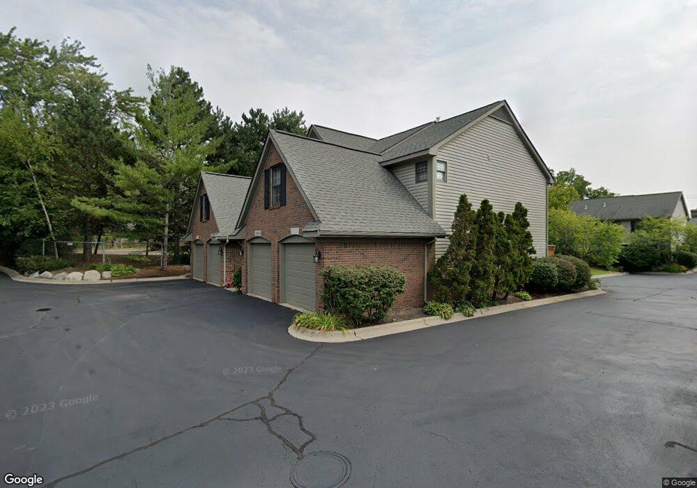
1664 Michael Ct Unit 11 Clawson, MI 48017
Estimated Value: $326,172 - $365,000
3
Beds
3
Baths
1,702
Sq Ft
$209/Sq Ft
Est. Value
About This Home
This home is located at 1664 Michael Ct Unit 11, Clawson, MI 48017 and is currently estimated at $355,293, approximately $208 per square foot. 1664 Michael Ct Unit 11 is a home located in Oakland County with nearby schools including Clawson Middle School, Clawson High School, and Japhet School.
Ownership History
Date
Name
Owned For
Owner Type
Purchase Details
Closed on
Jun 17, 2003
Sold by
Relocation Resources International Inc
Bought by
Ashman Lisa R
Current Estimated Value
Purchase Details
Closed on
Apr 4, 2003
Sold by
Camacci Steven J and Camacci Diana M
Bought by
Relocation Resources International Inc
Purchase Details
Closed on
Jan 13, 2003
Sold by
Camacci Steven and Camacci Diana M
Bought by
Camacci Steven and Camacci Diana
Purchase Details
Closed on
Feb 15, 2001
Sold by
Bridgestone Development
Bought by
Camacci Steven J
Home Financials for this Owner
Home Financials are based on the most recent Mortgage that was taken out on this home.
Original Mortgage
$275,000
Interest Rate
7.18%
Create a Home Valuation Report for This Property
The Home Valuation Report is an in-depth analysis detailing your home's value as well as a comparison with similar homes in the area
Home Values in the Area
Average Home Value in this Area
Purchase History
| Date | Buyer | Sale Price | Title Company |
|---|---|---|---|
| Ashman Lisa R | $275,000 | Colonial Title Co | |
| Relocation Resources International Inc | $275,000 | Colonial Title Co | |
| Camacci Steven | -- | -- | |
| Camacci Steven J | $293,900 | -- |
Source: Public Records
Mortgage History
| Date | Status | Borrower | Loan Amount |
|---|---|---|---|
| Previous Owner | Camacci Steven J | $275,000 |
Source: Public Records
Tax History
| Year | Tax Paid | Tax Assessment Tax Assessment Total Assessment is a certain percentage of the fair market value that is determined by local assessors to be the total taxable value of land and additions on the property. | Land | Improvement |
|---|---|---|---|---|
| 2025 | $3,052 | $158,980 | $0 | $0 |
| 2024 | $2,916 | $148,010 | $0 | $0 |
| 2023 | $2,796 | $147,440 | $0 | $0 |
| 2022 | $2,818 | $146,330 | $0 | $0 |
| 2021 | $2,760 | $129,330 | $0 | $0 |
| 2020 | $2,674 | $121,250 | $0 | $0 |
| 2019 | $2,764 | $114,970 | $0 | $0 |
| 2018 | $2,744 | $109,330 | $0 | $0 |
| 2017 | $2,728 | $109,270 | $0 | $0 |
| 2016 | $2,740 | $102,650 | $0 | $0 |
| 2015 | -- | $88,550 | $0 | $0 |
| 2014 | -- | $64,720 | $0 | $0 |
| 2011 | -- | $52,070 | $0 | $0 |
Source: Public Records
Map
Nearby Homes
- 1512 Normandy Rd Unit 105
- 4227 Crooks Rd
- 4345 Crooks Rd Unit 36
- 4101 Devon Rd
- 3915 Devon Rd
- 542 S Manitou Ave
- 4401 Crooks Rd
- 659 Gargantua Ave
- 2129 Normandy Rd
- 1935 Nakota Rd
- 3919 Woodland Ave
- 4510 Rosewold Ave
- 515 S Marias Ave
- 3403 Crooks Rd Unit 10
- 3535 Woodland Ave
- 3804 Elmhurst Ave
- 4201 Kent Rd
- 1212 W Windemere Ave
- 2419 Normandy Rd
- 1418 W 13 Mile Rd
- 1690 Alyssa Ln Unit 14
- 1700 Alyssa Ln
- 1670 Normandy Rd
- 1650 Normandy Rd Unit 8
- 1640 Normandy Rd
- 1630 Normandy Rd Unit 6
- 1620 Normandy Rd Unit 5
- 1610 Normandy Rd
- 1600 Normandy Rd
- 1670 Normandy Rd Unit 10
- 1700 Alyssa Ln Unit 15
- 1672 Michael Ct Unit 12
- 1604 Michael Ct
- 829 S Batchewana Ave
- 1680 Alyssa Ln Unit 13
- 811 S Batchewana Ave
- 744 S Batchewana Ave
- 745 S Batchewana Ave
- 806 S Webik Ave
- 738 S Batchewana Ave
Your Personal Tour Guide
Ask me questions while you tour the home.