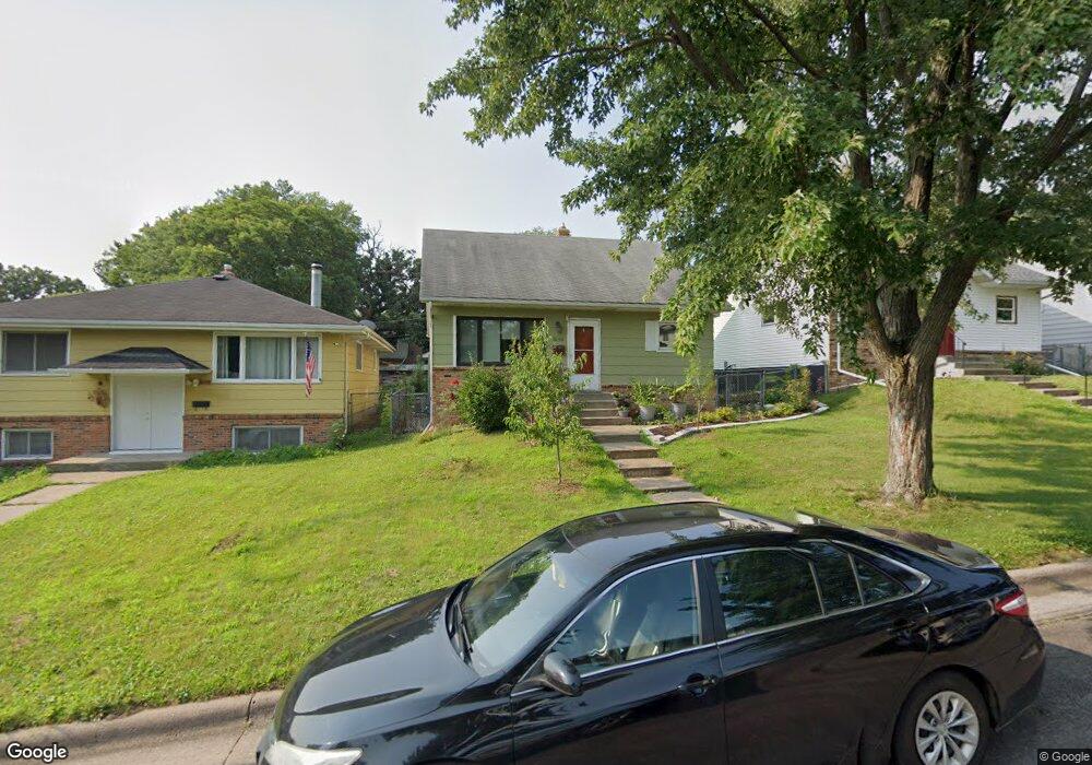
1694 Sims Ave Saint Paul, MN 55106
Hazel Park NeighborhoodEstimated Value: $267,000 - $291,000
4
Beds
2
Baths
752
Sq Ft
$373/Sq Ft
Est. Value
About This Home
This home is located at 1694 Sims Ave, Saint Paul, MN 55106 and is currently estimated at $280,673, approximately $373 per square foot. 1694 Sims Ave is a home located in Ramsey County with nearby schools including Hazel Park Preparatory Academy, Txuj Ci HMong Language and Culture Upper Campus, and Johnson Senior High School.
Ownership History
Date
Name
Owned For
Owner Type
Purchase Details
Closed on
Dec 22, 2015
Sold by
Christensen Chelsey M
Bought by
Htoo Daniel and Htoo Paw Lwei
Current Estimated Value
Home Financials for this Owner
Home Financials are based on the most recent Mortgage that was taken out on this home.
Original Mortgage
$158,110
Outstanding Balance
$125,412
Interest Rate
3.96%
Mortgage Type
New Conventional
Estimated Equity
$155,261
Create a Home Valuation Report for This Property
The Home Valuation Report is an in-depth analysis detailing your home's value as well as a comparison with similar homes in the area
Home Values in the Area
Average Home Value in this Area
Purchase History
| Date | Buyer | Sale Price | Title Company |
|---|---|---|---|
| Htoo Daniel | $163,000 | Titlesmart Inc |
Source: Public Records
Mortgage History
| Date | Status | Borrower | Loan Amount |
|---|---|---|---|
| Open | Htoo Daniel | $158,110 |
Source: Public Records
Tax History Compared to Growth
Tax History
| Year | Tax Paid | Tax Assessment Tax Assessment Total Assessment is a certain percentage of the fair market value that is determined by local assessors to be the total taxable value of land and additions on the property. | Land | Improvement |
|---|---|---|---|---|
| 2025 | $3,948 | $268,600 | $25,000 | $243,600 |
| 2023 | $3,948 | $263,300 | $20,000 | $243,300 |
| 2022 | $3,464 | $273,600 | $20,000 | $253,600 |
| 2021 | $3,144 | $226,100 | $20,000 | $206,100 |
| 2020 | $3,172 | $205,000 | $10,800 | $194,200 |
| 2019 | $2,712 | $202,800 | $10,800 | $192,000 |
| 2018 | $2,626 | $174,500 | $10,800 | $163,700 |
| 2017 | $2,406 | $174,500 | $10,800 | $163,700 |
| 2016 | $1,436 | $0 | $0 | $0 |
| 2015 | $1,526 | $108,100 | $10,800 | $97,300 |
| 2014 | $1,266 | $0 | $0 | $0 |
Source: Public Records
Map
Nearby Homes
- 935 Kennard St
- 1747 York Ave
- 1769 York Ave
- 1752 Stillwater Ave
- 1784 Sims Ave
- 1631 Ross Ave
- 1560 Case Ave
- 1736 Ross Ave
- 1824 Sims Ave
- 1685 Bush Ave
- 1661 Bush Ave
- 1766 Ross Ave
- 1764 Bush Ave
- 1803 Bush Ave E
- 1111 Breen St
- 1683 Minnehaha Ave E
- 1675 Minnehaha Ave E
- 1126 Breen St
- 1590 Minnehaha Ave E
- 1950 Case Ave E
- 1694 1694 Sims Ave
- 1698 Sims Ave
- 1690 Sims Ave
- 1704 Sims Ave
- 1686 Sims Ave
- 1706 Sims Ave
- 1697 York Ave
- 1684 1684 Sims Ave
- 1684 Sims Ave
- 1689 York Ave
- 1703 York Ave
- 1680 Sims Ave
- 1693 1693 Sims Ave
- 1693 Sims Ave
- 1697 Sims Ave
- 1689 Sims Ave
- 1679 York Ave
- 1679 1679 York-Avenue-
- 1685 Sims Ave
- 1699 Sims Ave