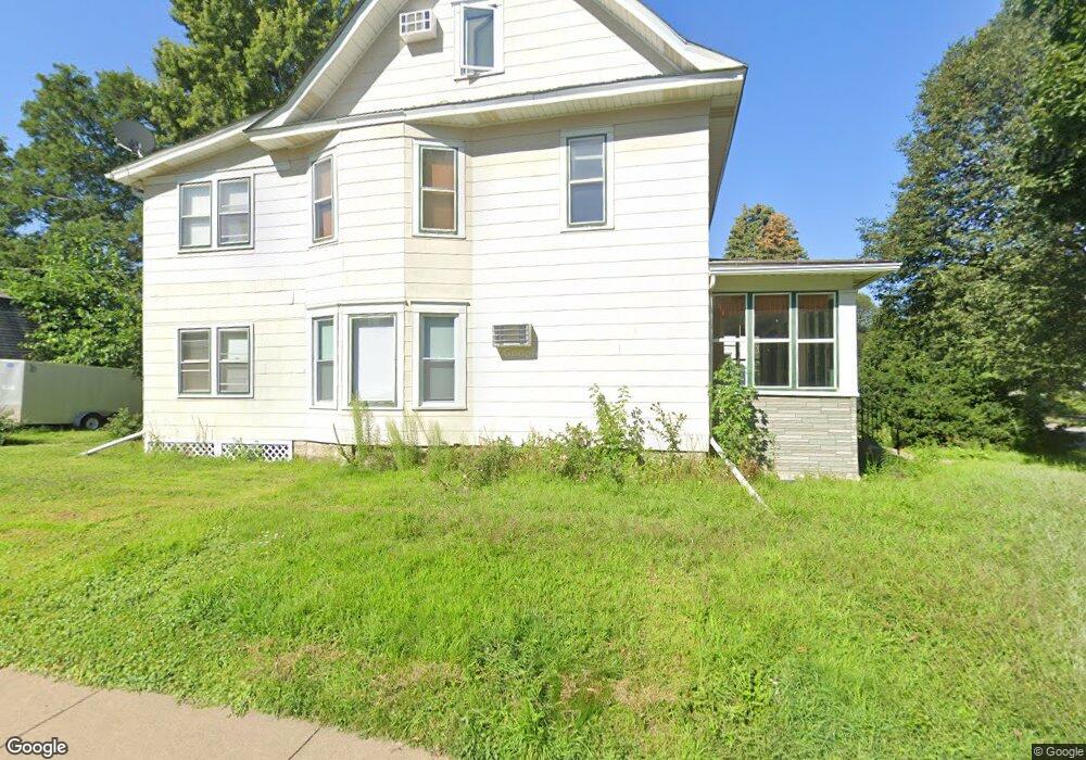
1704 Ashland Ave Saint Paul, MN 55104
Union Park NeighborhoodEstimated Value: $397,305 - $566,000
4
Beds
1
Bath
1,948
Sq Ft
$245/Sq Ft
Est. Value
About This Home
This home is located at 1704 Ashland Ave, Saint Paul, MN 55104 and is currently estimated at $476,576, approximately $244 per square foot. 1704 Ashland Ave is a home located in Ramsey County with nearby schools including Groveland Park Elementary School, Hidden River Middle School, and Central Senior High School.
Ownership History
Date
Name
Owned For
Owner Type
Purchase Details
Closed on
Aug 16, 2022
Sold by
Lillemoe Brett C and Lillemoe Deanna M
Bought by
1704 Ashland Avenue Llc
Current Estimated Value
Purchase Details
Closed on
Jul 17, 2015
Sold by
Ferber Margaret M
Bought by
Lillemoe Brett C
Purchase Details
Closed on
Feb 25, 2013
Sold by
Ferber Donald E and Ferber Margaret
Bought by
The Margaret M Ferber Living Trust
Create a Home Valuation Report for This Property
The Home Valuation Report is an in-depth analysis detailing your home's value as well as a comparison with similar homes in the area
Home Values in the Area
Average Home Value in this Area
Purchase History
| Date | Buyer | Sale Price | Title Company |
|---|---|---|---|
| 1704 Ashland Avenue Llc | $350,000 | Stewart Title | |
| Lillemoe Brett C | $288,484 | Bridge Title Llc | |
| The Margaret M Ferber Living Trust | -- | None Available |
Source: Public Records
Tax History Compared to Growth
Tax History
| Year | Tax Paid | Tax Assessment Tax Assessment Total Assessment is a certain percentage of the fair market value that is determined by local assessors to be the total taxable value of land and additions on the property. | Land | Improvement |
|---|---|---|---|---|
| 2025 | $5,552 | $385,200 | $110,600 | $274,600 |
| 2023 | $5,552 | $349,800 | $110,600 | $239,200 |
| 2022 | $6,126 | $402,400 | $110,600 | $291,800 |
| 2021 | $5,130 | $364,300 | $110,600 | $253,700 |
| 2020 | $5,560 | $324,100 | $110,600 | $213,500 |
| 2019 | $4,924 | $330,000 | $110,600 | $219,400 |
| 2018 | $4,786 | $288,000 | $110,600 | $177,400 |
| 2017 | $4,756 | $288,000 | $110,600 | $177,400 |
| 2016 | $4,968 | $0 | $0 | $0 |
| 2015 | $4,658 | $288,000 | $110,600 | $177,400 |
| 2014 | $4,248 | $0 | $0 | $0 |
Source: Public Records
Map
Nearby Homes
- 1670 Ashland Ave
- 1540 Ashland Ave Unit 12
- 1821 Selby Ave
- 1671 Marshall Ave
- 1798 Marshall Ave
- 1510 Laurel Ave
- 266 Fry St
- 1836 Marshall Ave
- 184 Saratoga St N
- 1796 Iglehart Ave
- 142 Cambridge St
- 1920 Laurel Ave
- 1917 Summit Ave Unit 2
- 750 Summit Ave
- 1611 Carroll Ave
- 1826 Goodrich Ave
- 1787 Carroll Ave
- 1447 Hague Ave
- 1926 Lincoln Ave
- 382 Fry St
- 1710 Ashland Ave
- 1712 Ashland Ave
- 1714 Ashland Ave
- 1692 Ashland Ave
- 1688 Ashland Ave
- 1688 1688 Ashland Ave
- 1705 Portland Ave
- 1720 Ashland Ave Unit 10
- 1709 Portland Ave
- 1699 Portland Ave
- 1684 Ashland Ave
- 1715 Portland Ave
- 1693 Portland Ave
- 1709 Ashland Ave
- 1699 Ashland Ave
- 1711 Ashland Ave
- 1726 Ashland Ave
- 1721 Portland Ave
- 1680 Ashland Ave
- 1689 Portland Ave